california

...now browsing by category


Quarantine year in review

Tuesday, March 16th, 2021

We simply need that wild country available to us, even if we never do more than drive to its edge and look in. For it can be a means of reassuring ourselves of our sanity as creatures, a part of the geography of hope.” – Wallace Stegner

One year ago, our lives were changed forever when the COVID-19 pandemic made heavy landfall in the United States. As quarantine started, businesses closed, work and school went virtual, and toilet paper disappeared from store shelves (I still can’t figure that one out).

One year later, we are still working from home, and our now-feral kids are slowly beginning their release back into the wild. My wife and I have both been vaccinated fully against COVID-19, and we talk often about what the “new normal,” as it were, may look like.

The New Normal

The phrase, “the new normal,” often implies the negative and hints at things we will have to give up moving forward. Personally, I hope it’s a force for things that are more positive. For instance, I’ve really enjoyed Zoom happy hours with friends who I may not otherwise think to connect with.

If the past year has been filled with anything, it’s been a wide range of emotions. I always been too busy to be bored during quarantine. I’ve felt overwhelmed, sad, angry, as well as extraordinary happiness and contentment. There’s been a wonderful joy I’ve felt in the little things. If nothing else, the pandemic has reminded me how to feel authentic emotion. I hope that remains a part of the new normal.

The outdoors as an outlet

Raw emotion can be very overwhelming; finding a way to deal with it is key. For me that often means being outdoors; this appeared to not be unique as parks and local trails were packed with people in the early days of the pandemic. Yet, early in quarantine lockdown, many national or state parks closed. Other wilderness areas also either banned entry or asked people to stay away. The rationale was clear: a backcountry injury puts undue stress on rural healthcare systems and is not worth the risk.

My personal escape was to resurrect images from previous wilderness trips, either processing with new skills, or using them to express my emotions in the moment. This proved to be an enjoyable and happy way to take a virtual drive to the edge of wilderness, as Wallace Stegner wrote about. This blog post has several images from previous years that I’ve processed during my time in quarantine.

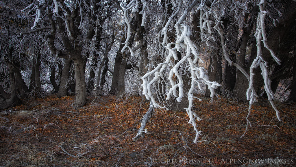
Hoarfrost on trees with fallen leaves underneath in the san Gabriel mountains near Wrightwood, California

As restriction started to and continue to ease, I’ve certainly enjoyed being out in the wilderness again. I’ve spent some very enjoyable days in the field working on my Wilderness Project (see posts here and here). It’s always better to be outdoors than to dream about it.

Whatever the “new normal” ends up looking like, I hope that we can remember to choose kindness, and find solace in wild places, regardless of how we visit. How have you handled the last year? How are you doing?

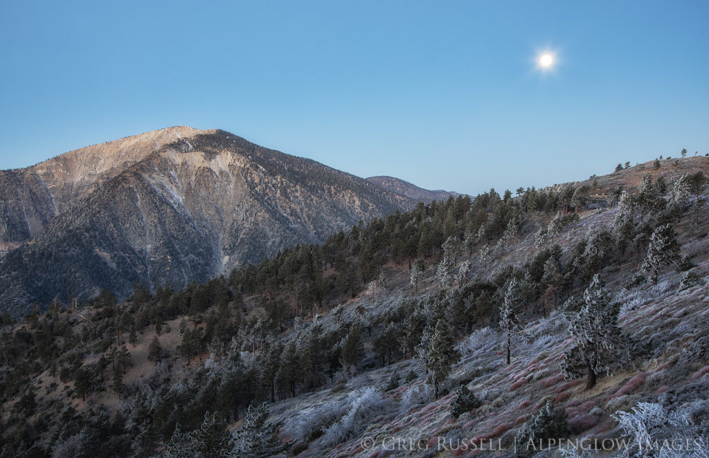
Mt. Baden-Powell, in the San Gabriel Mountains, glows in predawn light, with the setting moon overhead.
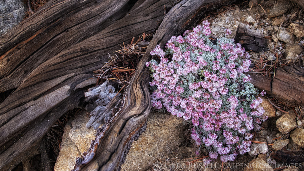
Buckwheat grows on the ground near the summit of San Gorgonio Mountain in Southern California.
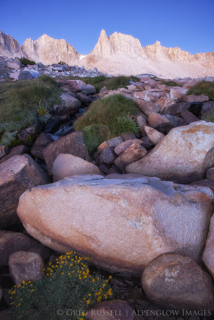
Wildflowers and a small stream below mountain peaks in the Sierra Nevada Mountains of California. The peaks are illuminated in predawn light.

The fight to save California’s deserts

Monday, February 22nd, 2021

“Now, here, you see, it takes all the running you can do, to keep in the same place.” – Lewis Carroll, Alice in Wonderland


**UPDATE: This plan has officially been scrapped by the Biden administration. Read more here. THANK YOU for all you do to protect our wild places!!**

California’s deserts in the Pleistocene were much different than they are today. Sabertooth cats, camels, bears, and sloths once roamed the Elysian plains between ancient lakes, like Owens, Manly, and Manix. Today it is not green or wet and the notion of an ecologically rich Mojave Desert hardly registers with most travelers intent on arriving at their Las Vegas hotel in time for check-in.

California’s deserts have been leveraged to the point of breaking


This lack of connection to place makes it especially difficult to lobby for protection of a place like California’s desert region, which includes not only the Mojave but also the Colorado. Indeed, conservationists must surely feel like the Red Queen. An old adage in conservation is that only the losses are permanent, meaning that any “wins” will immediately be challenged. Those fighting to protect our wild places are constantly running; forward progress is measured in inches.

Almost exactly three years ago, I wrote a blog post about plans to revise the then newly-minted Desert Renewable Energy Conservation Plan (DRECP). This legislation clearly delineated what parts of California’s desert would be used for energy development and what would be conserved. Today, those plans have come to fruition. The DRECP–as it was adopted in 2016–is on the chopping block.

In mid-January, the Bureau of Land Management (BLM) released a draft plan to roll back part of the original DRECP. This opens more land for renewable energy development. Specifically, the plan proposes to reduce or eliminate areas within Areas of Critical Environmental Concern, or ACECs. For instance, the Cadiz Valley ACEC would be reduced from 191,200 to 67,600 acres under the proposed changes. The Cadiz Valley is critically important habitat for its aquifer and springs. It is one of the last pristine desert watersheds in California.

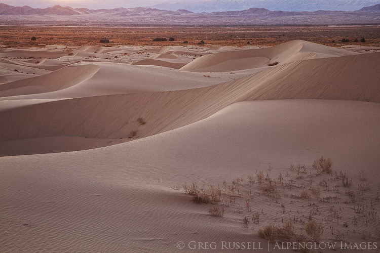
photograph of the rolling Cadiz sand dunes, one of many rich ecosystems in California’s deserts
Cadiz Dunes Wilderness

The California Energy Commission has said that they have more than enough land set aside through the original DRECP to meet current energy demands. The proposed rollbacks would remove an additional ~2 million acres from federal protection.

Proactive conservation requires connected ecosystems

Moving forward, the notion of conservation requires a significant paradigm shift. The DRECP was created with bipartisan support and with the long view in mind. It was a proactive response to decades of reactive environmental legislation.

As we shift from fossil fuels, renewable energy development is an unavoidable compromise. The DRECP allows us to plan for the future instead of trying to slow a runaway train. It takes into account the need for mandatory rooftop solar and the refurbishment of unused urban spaces for solar and wind energy.

Deserts are bellwethers of a changing climate. The DRECP was a first step towards the long-term preservation of several interconnected ecosystems. Connectivity is critical to allow wildlife the ability migrate, to search for mates, and to expand home ranges. Wildlife would once again be able to travel their ancestors’ paths. Desert tortoises, burro deer, and coyotes deserve freedom to roam. Bird populations are already collapsing in the Mojave, a sign of what’s yet to come.

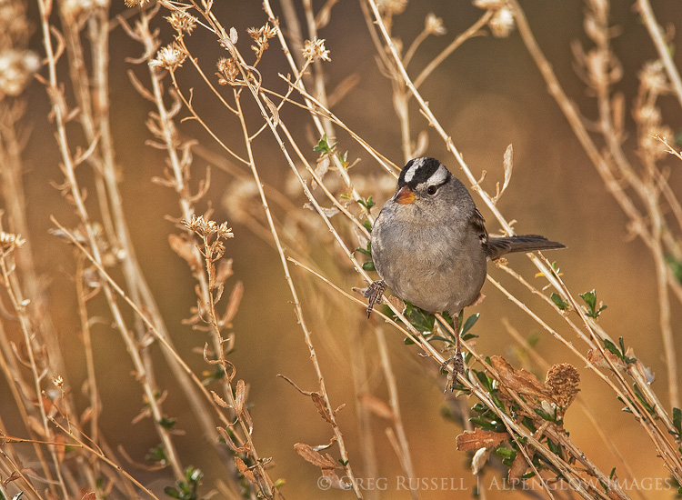
A white-crowned sparrow perches on a branch in California’s desert.
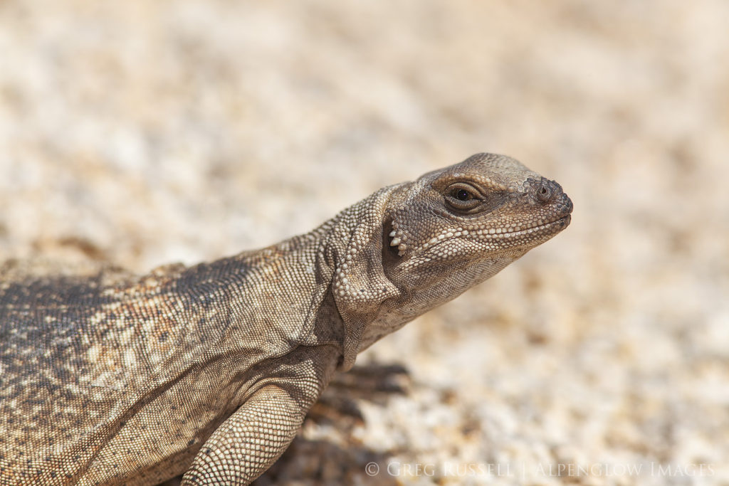
A small chuckwalla basks on a sunny rock in Joshua Tree National Park, California

I look forward to someday living in a post-environmentalist world. Until then, protection of California’s deserts requires our stewardship and advocacy. There is no acceptable alternative to the DRECP as it is currently written. The Mojave Desert has been leveraged enough. I encourage you to join me in saying “no” to any changes to this landmark legislation.

Click this link and submit your comments before April 15, 2021.

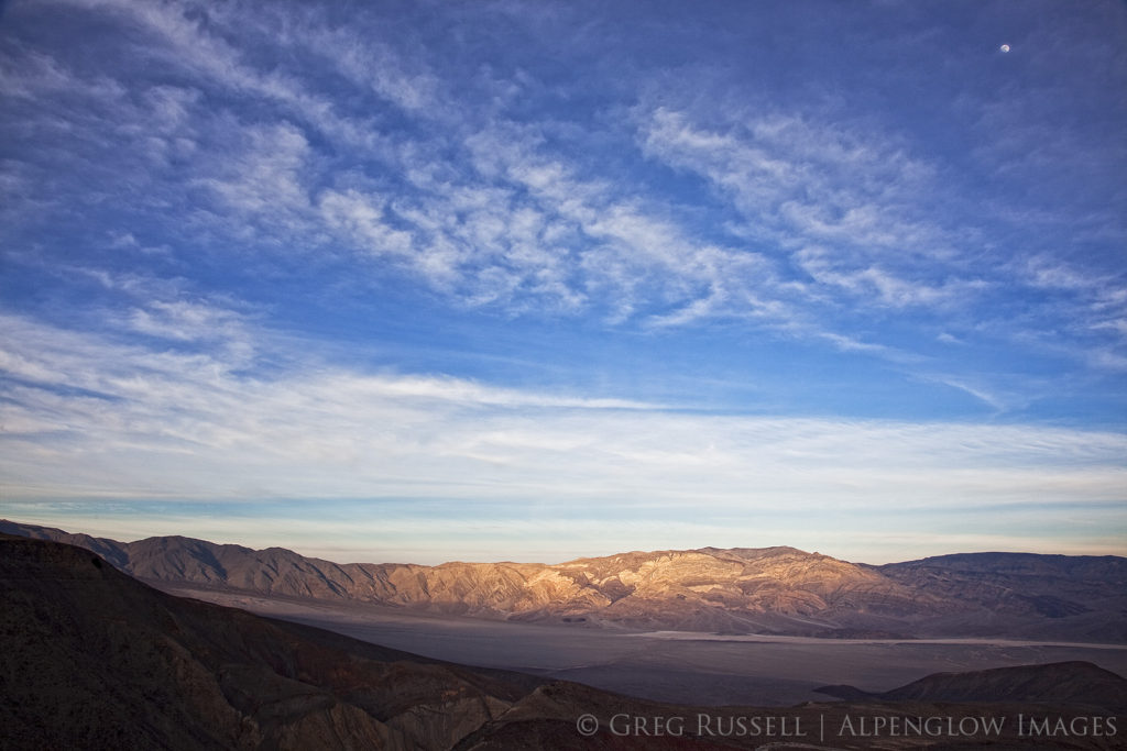
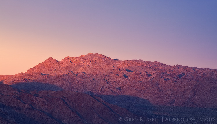
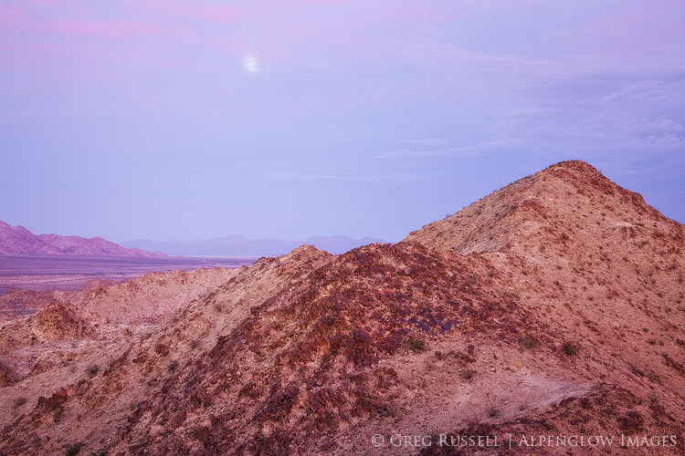
Moonrise over the Inyo Mountains in Inyo County California. This is near Conglomerate Mesa, the site of a proposed energy development.

2018 Year in Review

Monday, December 31st, 2018

My traditional 2018 year in review is arriving a little later than usual. I’m writing this on a snowy day in northern New Mexico reflecting on a year that was unusually light in terms of photography. If you follow my blog, you’ll have noticed that I haven’t made many images since February.

In 2018, my favorite images came from little-known landscapes. At the beginning of the year, I focused heavily on my Wilderness Project, and was able to discover some pockets of wilderness in southern California that I did not know existed. In addition to it being a year light in photography, the majority of my photographic efforts were close to home–this is the first year I haven’t traveled much to make images.

One unexpected result of my Wilderness Project has been the opportunity to confine myself to a particular area on the map, and get to know the personality of places that may be geographically close to one another, but in reality are quite unique. Bringing that out photographically has been challenging and satisfying.

One of the photographic highlights of the year was to be invited onto Matt Payne’s popular podcast F-Stop Collaborate and Listen. It was nice to be able to chat about ethics in landscape photography, the impact (both good and bad) photographers have on public lands, and my goals for the Wilderness Project. The episode should air in early 2019. Thanks, Matt!

The BIG highlight of the year, however was my engagement, and upcoming wedding January 4. As such, the lack of photography was backfilled with several other equally happy endeavors and adventures, and I’m looking forward to new adventures (including photography) in 2019!

In no particular order, here is my 2018 year in review. Enjoy!

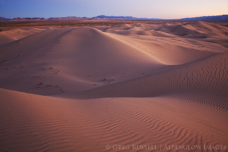
photo of Cadiz Sand Dune complex at sunset; the rolling sand dunes have a slight purple color, and the southern horizon displays sunset colors
Cadiz Dunes Wilderness, January 2018
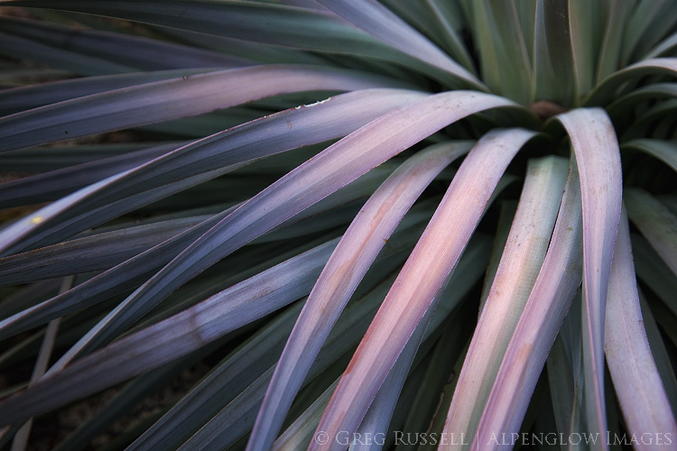
Yucca, San Jacinto Mountains, January 2018
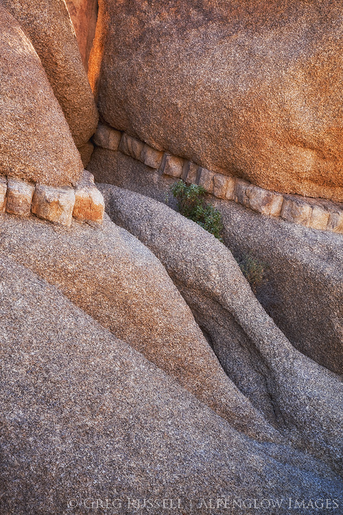
Small scene, Joshua Tree National Park, January 2018
Photo of Joshua Trees at sunrise with a boulder pile in the background. Joshua Trees are a characteristic species in the Mojave Desert, which covers approximately 28% of California's landmass.
Sunrise in Joshua Tree National Park, January 2018
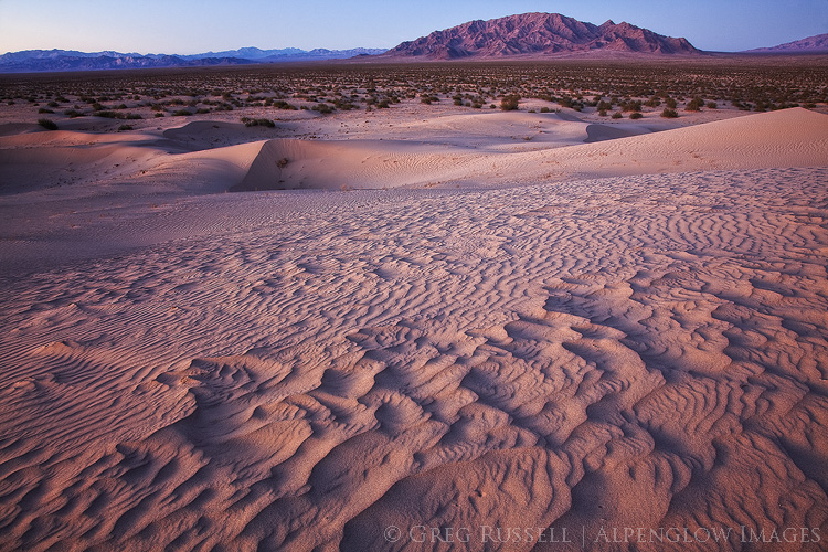
Cadiz Dunes Wilderness, January 2018 (Rarely do two images from the same place make my year in review, but this evening was simply magical.)
Sunset, Mojave Desert, California, December 2018
Sunset, Orocopia Mountains Wilderness, December 2018

Past images of the year:

2010 | 2011 | 2012 | 2013 | 2014 | 2015 | 2016 | 2017

Nowhere Land

Monday, February 26th, 2018

“And here we are,” said Dr. Ford.

The boy replied, “Nowhere Land.”

“That seems hardly a fitting name for a place so full. Can’t you see it? Perhaps you’re not looking hard enough.”

– HBO’s Westworld


It’s been over 15 years since I moved to southern California, and the sheer scale & emptiness of its massive deserts are still coming into perspective. The Mojave Desert alone sprawls over 7 counties, covering 28% of California’s landmass; to truly get to know this place would take a lifetime of exploration.

To many, California’s deserts range from something that has to be tolerated on the drive from Los Angeles to Vegas to simply “the ugliest landscape I’ve ever seen.” Although many people love and cherish this landscape, it lacks intrinsic value to others. Despite (or because of?) the lack of intrinsic value, the desert is often seen as a place with only extrinsic monetary value. Because of this, it is under threat from several different directions. What are those threats, and why should we value the desert?
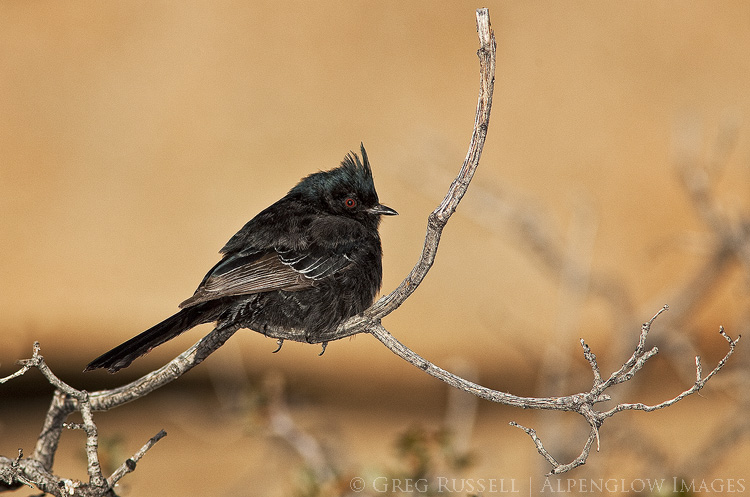
Photo of a phainopepla on a branch in Joshua Tree National park, California. Early morning light makes the blurred background golden, and the bird's characteristic red eye is apparent. The phainopepla is just one species of bird native to California's deserts.

Solar development

If California has an abundance of anything, it’s sunshine. It shouldn’t be surprising, then, that the Mojave Desert has been identified more than once for large-scale solar development. Most solar development involves “scraping” the desert floor of its native vegetation to install large arrays of solar arrays. Depending on the type of solar development, the arrays are either solar panels, or large mirrors which direct focused sunlight upwards towards a series of solar panels at the top of a tall tower.

In an effort to curtail chaotic and unplanned solar development in the California desert, the Obama administration passed the Desert Renewable Energy Conservation Plan (DRECP) in 2016. The idea behind the DRECP is simple: allow renewable energy development in certain areas of California’s deserts, while permanently protecting others.

Much of the focus of the DRECP was on prime habitat for some of the southwest’s most sensitive species, including desert tortoises. For instance, the massive Chuckwalla Bench (read more about the Chuckwalla Bench and Little Chuckwalla Mountains here), which extends from eastern Joshua Tree to the Colorado River in eastern Riverside County, is one of the best and most continuous desert tortoise habitats in the state.

At the beginning of February, the Trump Administration announced plans to revisit the DRECP with the intent of rolling back some of its original protections in order to open more of California’s deserts to renewable energy development. So far they have not offered a good reason for this.

It has been questioned whether large-scale solar development really benefits the environment or not.  What’s more, the Mojave Desert’s plants have been shown to be an incredibly good carbon sink, although their ability to reduce atmospheric carbon is heavily dependent on the occurrence of a wet winter. Thus, “scraping” away the plants on a large scale, or even covering them up, prevents the plants here from doing what they are best at. In solar arrays that focus light upward using mirrors, thousands of birds each year are accidentally incinerated (the Ivanpah solar array near the California-Nevada state line on Interstate 15 kills an estimated 6,000 birds/year).

Many solar projects have taken 3-4 years to build. From 2005-2016, all of the large-scale solar projects in California generated 1,470MW (megawatts) of energy. In 2015 alone, rooftop solar generated 1,050MW in California (source: Basin & Range Watch). I have said for years that rooftop solar should be mandatory on all new builds in the Southwest. Also, it is worth looking at other places for solar arrays, such as fields that are no longer farmed (as the city of Lancaster, California did). The bottom line is that there are alternatives to large-scale scrapes of critical desert habitat for solar.
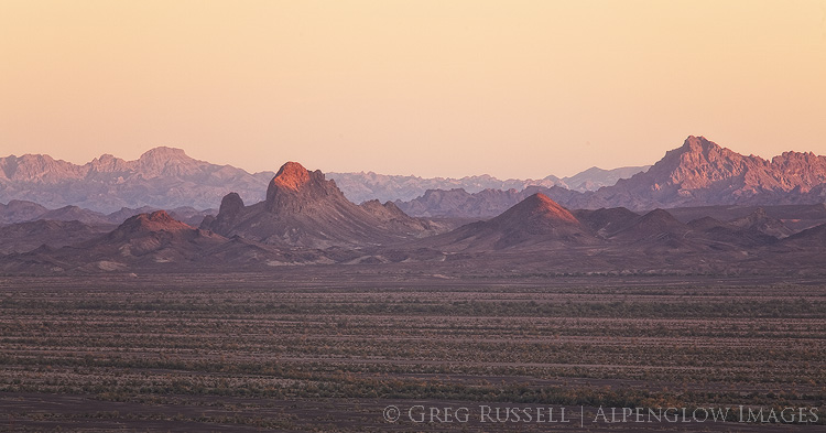
Photo of the Chuckwalla Bench at sunset, Imperial County, California. The Chuckwalla Bench is one of the areas of high conservation importance in California's deserts.

Mining

As part of the DRECP rollback, the BLM has cancelled its withdrawal of conservation lands from mining claims. In other words, conservation areas that were previously protected from new mining claims now are not. The logic is that there is such little mining occurring in the Mojave Desert that any new claims would be practically imperceptible. However, that may not be the case.

Last week, two mining companies signed MOUs (Memoranda of Understanding) expressing lithium mining interests in the Mojave Desert. Standard Lithium is exploring possible lithium deposits in the area of Bristol Dry Lake, in Cadiz Valley and Pacific Imperial Mines is developing a lithium mining operation near Death Valley Junction. With the increased demand for batteries, lithium mines are becoming more and more common in the Mojave and Great Basin Deserts.

In both mining operations–and in most in the West–lithium is extracted from brine via the use of massive evaporation ponds. As water evaporates, the minerals can be extracted. It’s no wonder why these mines would be so common in this part of the world, given high mineral content of dry lake valleys.

According to Basin & Range Watch, new claims are still subject to environmental assessment. Disturbance caps (limits on the mining in a particular region) are still enforceable, but the withdrawal of these lands from the conservation plan certainly opens up the possibility that those caps could be changed in a revised DRECP.

Water

I discussed the threat of water extraction in the Cadiz Valley previously (see this blog post). It is ironic that much of the water extracted from the Cadiz Valley would likely be used in lithium mining operations, and would never actually make it to the Colorado River aqueduct.
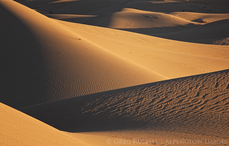
Photo of golden sand dunes at sunset in California's Cadiz Valley. Multiple hills are visible creating alternating dark and light layers, with ripples in the sand from wind.

Finding intrinsic value in a barren landscape

The science behind the desert’s importance in combating global climate change is relatively easy. Describing why the desert is beautiful to a “nonbeliever” is slightly more difficult. For me, watching a monsoon storm gather over an already imposing desert mountain range is one of the prettiest things I’ve ever seen. I also think about the first time I showed my parents a desert tortoise. Even my mom, who I wouldn’t call a desert lover, was enthralled. This past weekend, I saw my first desert pupfish in Death Valley National Park and felt a familiar and fleeting sense of joy. My son saw his first rattlesnake on a hike with me in Joshua Tree. He didn’t stop running for a solid half mile once he realized what he had just walked by, but he hasn’t forgotten about it either.
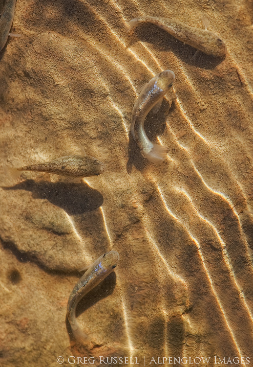
Photo of pupfish in Salt Creek, Death Valley National Park California. Desert pupfish are a critically endangered species, and are capable of living in extremely saline environments.

The point is that there are a million reasons to value and make memories in the desert. I can’t tell you what to value, just as I can’t tell you who to fall in love with. But, I can say that familiarity breeds intimacy, and California’s deserts need as many allies as possible right now.

While you’re developing your own relationship with the desert, there are some things you can do right now:

  1. Sign the online petition telling the BLM you would like to keep the DRECP intact. The BLM is accepting comments until March 22.
  2. Attend a public meeting to tell BLM representatives in person to keep the DRECP intact. I’ll be at the March 7 meeting in Palm Desert.
  3. Call or email your county supervisor. Because counties have a big role in developing the DRECP, your county supervisor will want to receive input from both residents and visitors.

California’s deserts may be barren, but they’re far from empty.
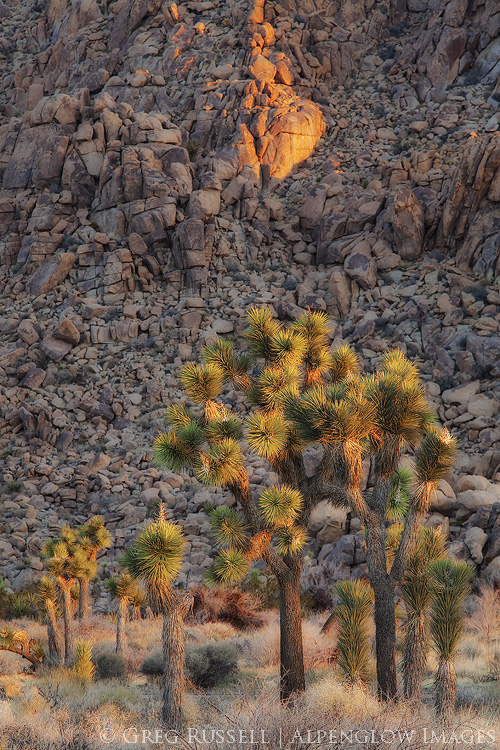
Photo of Joshua Trees at sunrise with a boulder pile in the background. Joshua Trees are a characteristic species in the Mojave Desert, which covers approximately 28% of California's landmass.


Happy birthday to the California Desert National Monuments

Monday, February 12th, 2018

All told, I have had little travel in my life which has yielded so much profit on the exertion as the old Mojave stage. I understand that the road is well furnished now with gas stations and hot dog stands, and the trip can be made in a few hours without incident. Which seems on the whole a pity.” – Mary Hunter Austin, Earth Horizon, 1932

Happiest of birthdays to California’s Desert National Monuments: Sand to Snow, Mojave Trails (which includes the Cadiz Dunes, the subject of my last blog post), and Castle Mountains. They were all designated two years ago today, on February 12, 2016. Together, their creation represents one of the largest acts in history towards the preservation of California’s deserts for future generations. May we celebrate many more birthdays for these diverse and unique monuments.

layers of sand dunes at sunset at the cadiz dunes complex within Mojave Trails National Monument

Sand dunes in Mojave Trails National Monument

photo of backlit cottonwood trees with golden light shining through in the Sand to Snow National Monument

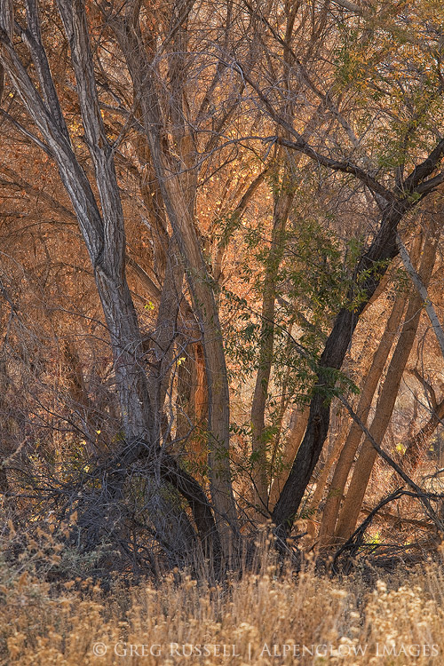
Cottonwood trees at Big Morongo Preserve, part of Sand to Snow National Monument

Water, sand, and the edge of wilderness

Friday, January 26th, 2018

“He said, “Americans look upon water as an inexhaustible resource. It’s not, if you’re mining it.” – John McPhee, Assembling California


If you live in southern California and read the news, you’ve probably heard about the Cadiz Water Project. The basic premise behind the project is to pump groundwater out of the Cadiz Valley in the Mojave Desert and pump it into the Colorado River aqueduct, thus delivering it to the Los Angeles Basin. For thirsty Angelenos, this seems like a great solution, and to paraphrase the old adage, if the source of the water is out of sight, it’s also out of mind.

The Cadiz Valley is also home to the Cadiz Dunes Wilderness, which is primarily made up of the Cadiz Dunes complex and portions surrounding valley.  A large part of the Cadiz Valley–including the Wilderness–are part of the Mojave Trails National Monument, which was designated in 2016. Because of increased news coverage, two friends and I recently went to the Cadiz Valley to photograph the dunes and experience the place first-hand.

The Cadiz Valley is a typical Basin and Range valley. It is surrounded by the Sheephole Mountains to the west, the Ship Mountains to the north, and the Old Woman Mountains to the east. A lake, which has long since dried up, once occupied the entire valley; blowing sand has created the Cadiz Dunes complex. Because of the minerals the lake left behind, several salt mines have popped up in the southern end of the valley. A railroad right-of-way also runs through the valley, connecting historic Route 66 with Parker, Arizona. When we visited, we drove for over 60 miles on unpaved roads and didn’t see another vehicle. As Mark said, “in southern California, that’s a pretty good indicator that you’re way out there.” Indeed, I bet it’s highly unlikely that many desert travelers give the Cadiz Valley much thought.

The Ship Mountains as seen from the Cadiz Dunes after sunset. Alpenglow covers the landscape.

The Cadiz Water Project

An interesting thing about the valley, and the reason it’s front-and-center in Los Angeles’ water politics, is the large aquifer that lies beneath it. Cadiz Inc., which owns several thousand acres in the valley, has proposed to pump water from the aquifer, and through a 43-mile-long pipeline, move it to the Colorado River aqueduct so it can be transported to the Los Angeles Basin.  The Cadiz Valley Water Conservation, Recovery and Storage Project–or Cadiz Water Project–has met with poor investor interest, court battles, and seemingly endless hurdles.

Last fall, however, the project got a new head of steam. David Bernhardt, a former partner at the law firm representing Cadiz, was confirmed as the Deputy Secretary of the Department of the Interior (in unrelated news, the Department of Interior also rolled back legislation limiting the use of railroad right-of-ways so the pipeline could be built) and a bill in the California state senate that would have shut down Cadiz was voted down by senate Democrats. There are still legal battles taking place, but this plan has a real possibility of happening.

Silly, and dangerously antiquated

Cadiz Inc. owns the rights to 50,000 acre-feet of water per year for the next 50 years; that’s 50,000 acre feet being pumped out of the ground each year and into the aqueduct. The aquifer is only replenishing itself at a rate of 32,000 acre feet per year. Cadiz also estimates the cost of their water between $775-$960/acre foot; the current price the Los Angeles Municipal Water District charges is $670/acre foot. Thus, water coming from this project would cost the consumer more.  Finally, the water Cadiz plans on pumping out of the aquifer contains the carcinogen hexavalent chromium. They argue that by diluting it in Colorado River water, levels of hexavalent chromium would be safe for human consumption. Finally, in seismically active southern California, any pipeline is going to require expensive maintenance.

Although the Colorado River aqueduct is an engineering achievement, it is admittedly antiquated and unsustainable. So is the Los Angeles aqueduct that brings water from the Owens Valley. For a truly sustainable solution to water woes, we need to be looking closer to the point of use: desalination plants, and water recycling make much more sense than piping water from hundreds of miles away.

photo of Cadiz Sand Dune complex at sunset; the rolling sand dunes have a slight purple color, and the southern horizon displays sunset colors

Thinking past the wilderness boundaries

A federally designated Wilderness is by definition a place of compromise. Its boundaries have been drawn as lines on a map based on public comments, input from all interested parties, and after a vote on its designation by people who will likely never see the place, or think about it again. Nevertheless, this is one of my favorite levels of protection for a place because it ensures that the land will remain as pristine as possible for generations to come. But tonight my mind is concerned with what lies beyond the edge of Wilderness boundaries. What of that landscape?

An edge, as defined by ecologists, is a place of transition between habitats: forest and meadow, for example. Deer and other herbivores can often be found along edges; they stay close to the cover of the forest, while enjoying the ability to graze in a meadow. For a hungry predator, this can be a place of incredible opportunity, but for distracted prey edges can be a great danger. Indeed, the future of the Cadiz Valley is not really all that different from a deer grazing at the edge of a meadow.

photo of expansive rolling sand dunes at sunset with the sheephole mountains in the distance

Standing on the Cadiz Dunes at sunset, looking east across a creosote sea towards the Old Woman Mountains, I was reminded why we visit these places. The road we drove in on was somewhere in front of me, but was rendered invisible due–if nothing else–to the vastness of the landscape. I found myself caught in one of those moments when the silence was deafening. In this big landscape, I was reminded of just how small I am, re-instilling my sense of humility. Looking out across the arbitrary lines protecting the Wilderness, my eyes try to imagine the dust from pipeline construction or the shimmer on the horizon from a body of evaporating water–the result of a pipeline spill. My ears try to hear the sound of pumps in the distance, sending groundwater on their long journey to Los Angeles.

The Cadiz Water Project would provide additional water to Los Angeles for 50 more years. Fifty more years to ruin a beautiful desert valley and search for another aquifer we can mine water from.

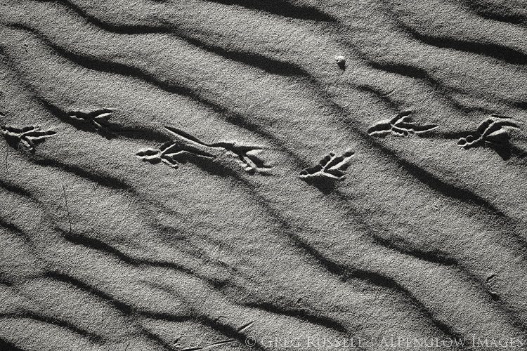
black and white photograph of roadrunner tracks going across a sand dune in the cadiz valley of southern California

Closing of the Mountain Light Gallery

Sunday, October 1st, 2017

Last week, the Mountain Light Gallery in California’s eastern Sierra announced it is closing its doors. Showcasing the work of photographers Galen and Barbara Rowell, the Mountain Light had been a standard stop for many photographers, hikers, and tourists stopping through Bishop since they first opened their doors in 1983. To say I was taken aback by this announcement is an understatement. Gary Crabbe, a past employee of Galen’s, shared his views on the closing of Mountain Light in his blog. I can’t begin to replicate Gary’s sentiments, but I wanted to share a bit of my history with Mountain Light.

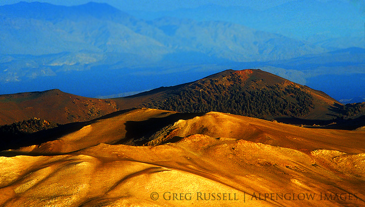
photo of a barren mountain landscape with late day sunlight with receding mountain ridges behind it

Galen Rowell was a San Francisco Bay Area photographer and climber whose images of the mountains are simply iconic. From his home range, the Sierra Nevada, to mountaineering expeditions in South America and Tibet, Galen’s work set the bar for adventure and backcountry landscape photography. In the days when I cared about such things, his were the images I compared mine against.

On August 11, 2002, on their way home from an expedition through northern Tibet, Galen and Barbara were flying into the Bishop airport when the plane they were in crashed, killing both of them. The same day as Galen and Barbara’s passing is the day I moved from California from Wyoming. I remember hearing the news that day on the radio as I unloaded boxes into my apartment. Not long after that I made my first trip to Bishop (I did graduate work at the White Mountain Research Station whose offices are in Bishop). The gallery was one of the first places we stopped. Galen’s images were always inspirational and moving, a grand welcome to the Golden State.

Perhaps most importantly, Galen’s was the first photography I became familiar with that had a “voice,” and I’ve often used his work as an example when trying to describe this somewhat abstract concept. Galen’s presence in his images was evident the moment you step foot in the gallery. His sense of adventure, eye for the subtleties of light, love of life, and even his devotion to his wife are all palpable when you walk through its doors. I have never gone to the eastern Sierra without stopping in at Mountain Light Gallery and I have never walked out of there without feeling a little choked up. Like the Rowells, their gallery will be truly missed.

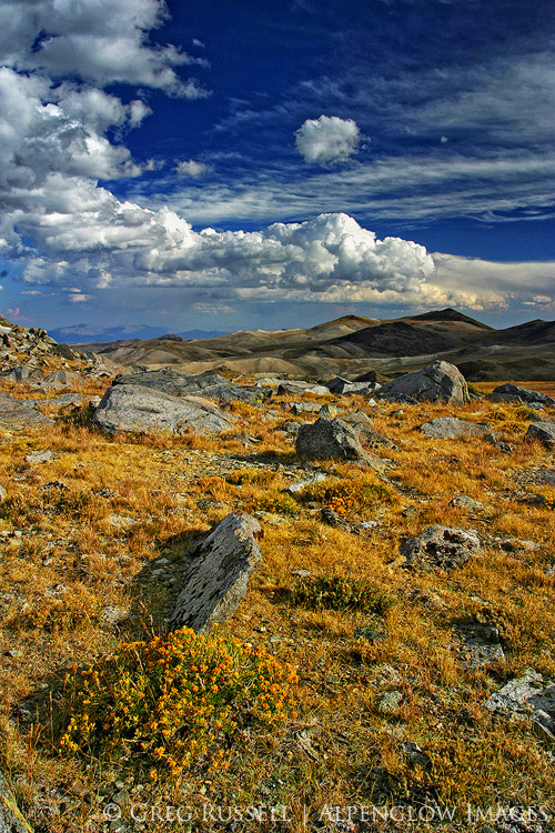
photo of yellow grasses on a high altitude plateau with peaks in the distance and white cumulus clouds in the blue sky above

The images in this blog post are throwbacks to my graduate school days (probably both are from 2003 or 2004). They are scanned Fuji Sensia slides from the Barcroft Plateau in the White Mountains not far from Bishop.

The Wilderness Project

Friday, September 15th, 2017

panoramic image with text and colorful mountains at sunset

The Wilderness Project is my current photographic project, launched earlier this month. Over the next several months, I will document the nineteen federally-designated wilderness areas in my backyard, Riverside County, California.

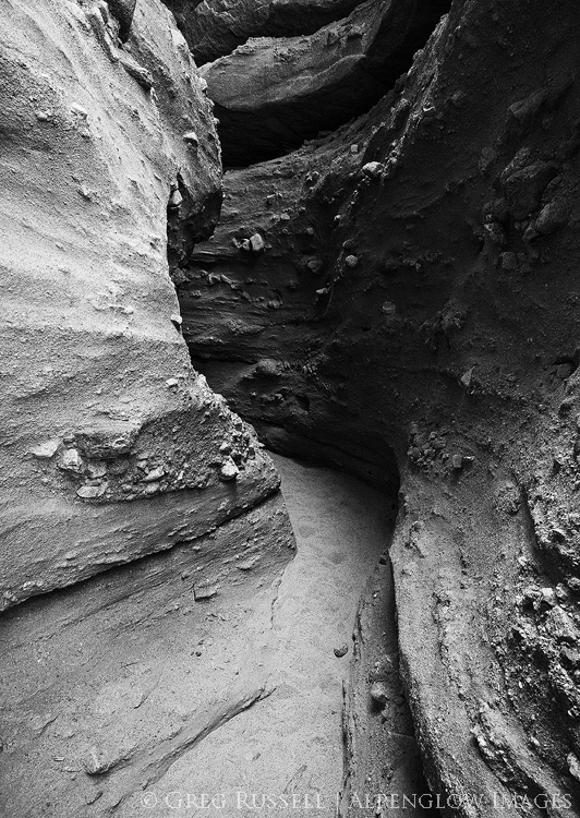
black and white photo of a slot canyon in the mecca hills wilderness of southern california

Mecca Hills Wilderness

Over the last year or so, I think we’ve become acutely aware of our public lands and what they have to offer. Our national monuments, especially, have garnered much attention, but there is still so much out there to see. The public lands-advocacy group Backcountry Hunters and Anglers has declared September Public Lands Month, and I thought it was apropos to launch this project in September. What’s more, many of the wildernesses in Riverside County were created with passage of the California Desert Protection Act, which turns 25 in 2019.

Finally, perhaps most importantly, I wanted to launch this project to know my own surroundings better. As Kenneth Brower (son of famed conservationist David Brower) writes, “There is a language for terrain, just as there is a language for art.” Understanding that language is crucial for the landscape photographer who wants to create personal, introspective images.

Some of the wilderness areas in Riverside County are ones you’ve been to. In fact, the most popular one–the Joshua Tree Wilderness–is one you have likely visited. The San Jacinto Wilderness is another popular hiking destination. However, there are others that you likely haven’t heard of. I recommend starting here as you orient yourself to my project, and consider subscribing to The Wilderness Project by email to get new blog posts as I visit the far-flung reaches of Riverside County.

Thanks for coming along on this journey! Hopefully it will inspire you to get into your own backyard to discover some of its hidden gems.

Kids & Photography

Wednesday, August 23rd, 2017

In my last post, I mentioned that Jackson Frishman and I managed to get our kids (two boys, ages 5 and 9) out for a short backpack in the Sierra last week. Backpacking with kids has its challenges and rewards, and I wrote about a few of them when my son was much younger. He’s 9 now, and can carry his own backpack (with a few small things in it), and asks often to go hiking, camping, or backpacking. Although I haven’t been able to get out with him as much as I’d like, this trip seemed fun and appropriately timed.

A couple of things I noticed on this trip were that it was great for him to have another kid to hike with. Having someone who hikes on your own level is motivating for anyone, especially little people. Additionally, having things to distract the boys was essential. Jackson had a deep pocket of jelly beans for them, and I packed a book in for my son so he could unwind after the hike, as well as a root beer for an after dinner treat. Finally, a good night’s sleep is essential. Although he was tired and–admittedly–a bit grouchy after our hike into our campsite, my son was a different kid after a solid rest.

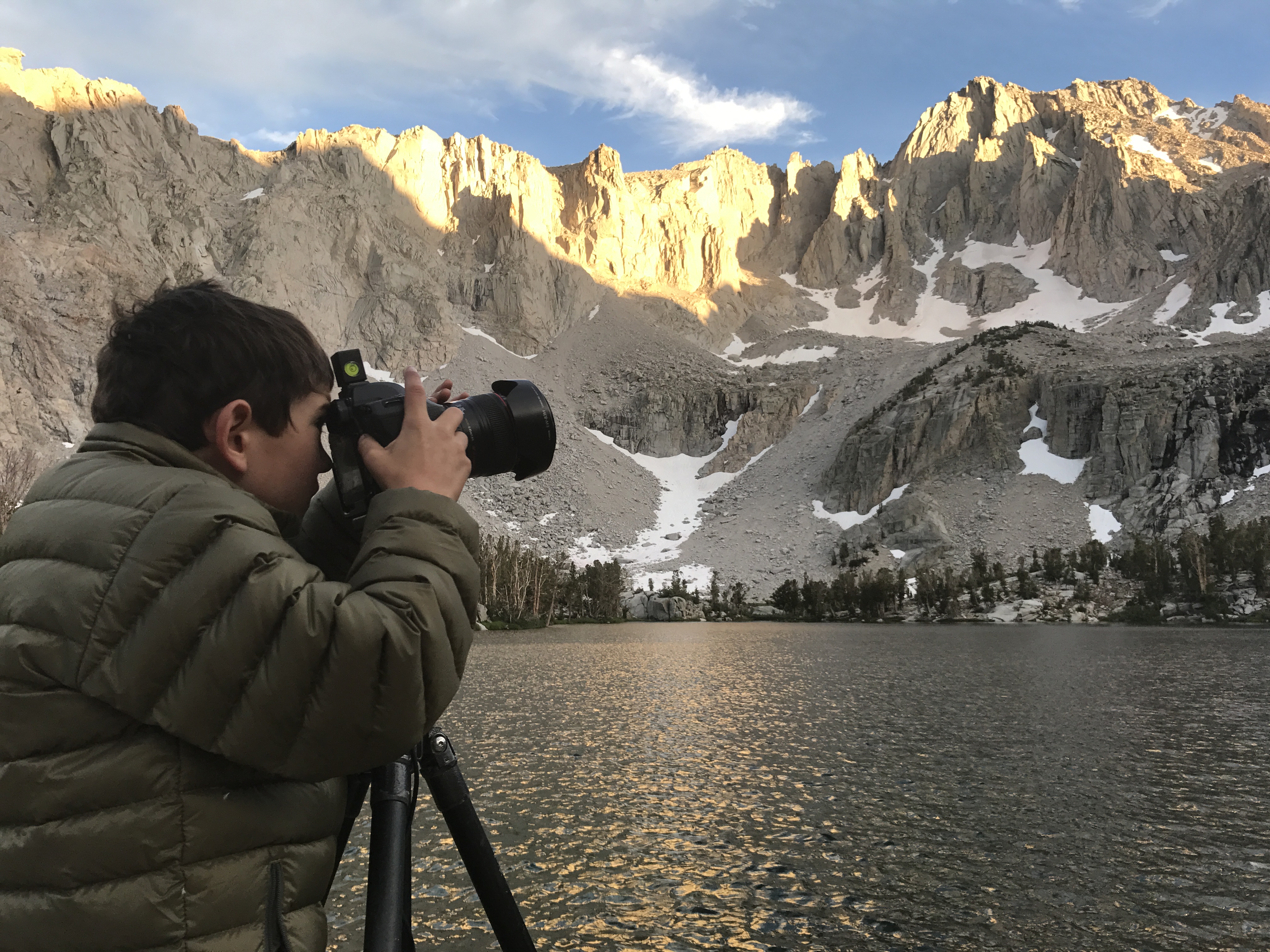
Perhaps more than anything, finding a way to share the experience is the most important part of engaging kids outdoors. On this trip, my son asked if he could take some photos with my camera. I was happy he wanted to try, so I metered for him, but let him compose and expose his own images. When we got home, I saw that one image was one I would have liked to claim for my own! I edited it, and posted it below. So, really I’m just bragging about my kiddo here, and am happy he’s taken an interest in a form of self-expression. Make sure to foster this in your own kids, no matter how it shows up.

photograph of snow, the flanks of University Peak, and matlock lake at sunset, in the john muir wilderness of california's sierra nevada mountains

a nine year old boy wearing a down jacket takes a photo with camera and tripod at a lake in the sierra nevada mountains of california

Fire in the sky

Friday, August 18th, 2017

“The agent by which fire was first brought down to earth and made available to mortal man was lightning. To this source every hearth owes its flames.” – Lucretius, De Rerum Natura


The sky has long been a source of wonder for humankind. Colorful sunrises and sets, stargazing, and of course events like eclipses are all things that evoke awe and inspiration. People in certain parts of the United States are gearing up for the upcoming solar eclipse on Monday, August 21. Personally, I’ll be driving across northern Arizona during the eclipse. I intend only to pull over and enjoy what will be about 75% occlusion as the moon passes between Earth and the sun.

While the solar eclipse will be the capstone of summer for many, the season–to me–is sadly becoming defined less by swimming pools and barbecues and more by wildland fires. Currently, there are 56 large fires burning in the United States; 55 of them are in the West. This is a particularly bad year for fires, but over the past few summers my own wilderness exploration has depended heavily on where smoke is not obscuring the views. Despite what Lucretius opined in his first century poem De Rerum Natura, most wildland fires today are human-caused. Only a small percentage are caused by lightning.

Earlier this week, Jackson Frishman and I managed to get our boys out for a short overnight backpack in the John Muir Wilderness. Smoke from several fires burning in the Sierra Nevada obscured views in the Owens Valley, but as we hiked up, the air seemed to clear. A few clouds in the sky made a colorful sunset seem promising.

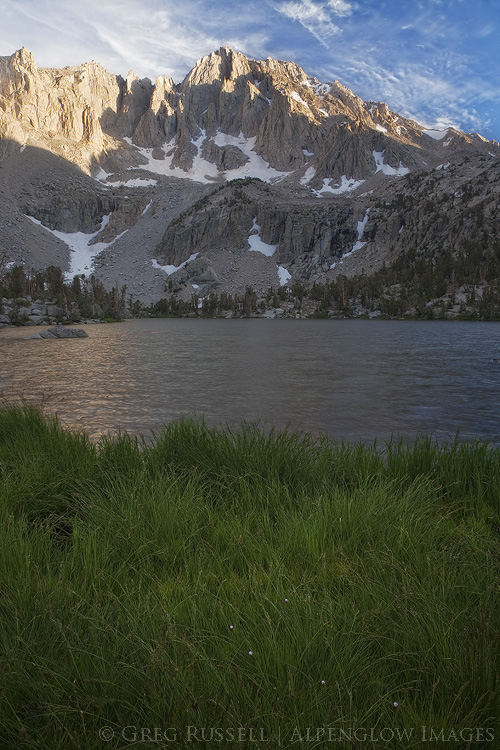
photo of grass along the edge of matlock lake and university peak with late day light in the john muir wilderness of california

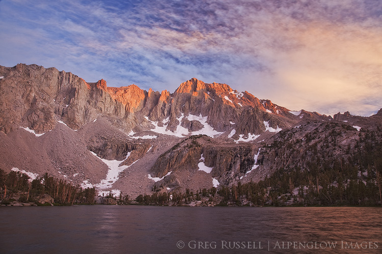
Indeed, as the sun went down, the sky started to light up. I was using a polarizing filter to help reduce glare on the lake we were camped by. As sunset got nearer, I noticed a very strange effect on the images I was making. What I can only conclude was “invisible” smoke in the upper atmosphere was showing up in my polarized images, intermingling with the pink clouds. The result, I think, is unique and pretty (despite its cause).

photo of a colorful sunset at Matlock Lake in the John Muir Wilderness, California

If you are going outdoors with family and friends next week to view the eclipse, I wish you luck. I also hope smoke does not obscure your view. Please make sure to not add to the smoke by being very careful with any fires you make.