Black rocks protruding up

Written by Alpenglow Images on July 5th, 2019

The Navajo or Diné Volcanic Field is a circle of volcanic formations lying roughly in the Four Corners region of the American Southwest. These peaks and ridges are striking in their own right, but are even more curious because of their juxtaposition with our image of what the Colorado Plateau should be.

The Colorado Plateau is synonymous with sandstone. We identify this region by massive cliffs, arches, hoodoos, and towers; people come from all over the world because there is nothing like these places anywhere else on Earth. It seems a bit incongruous, then, to drive through this region past numerous large volcanic towers, all of which stand in stark contrast to the surrounding sandstone formations.

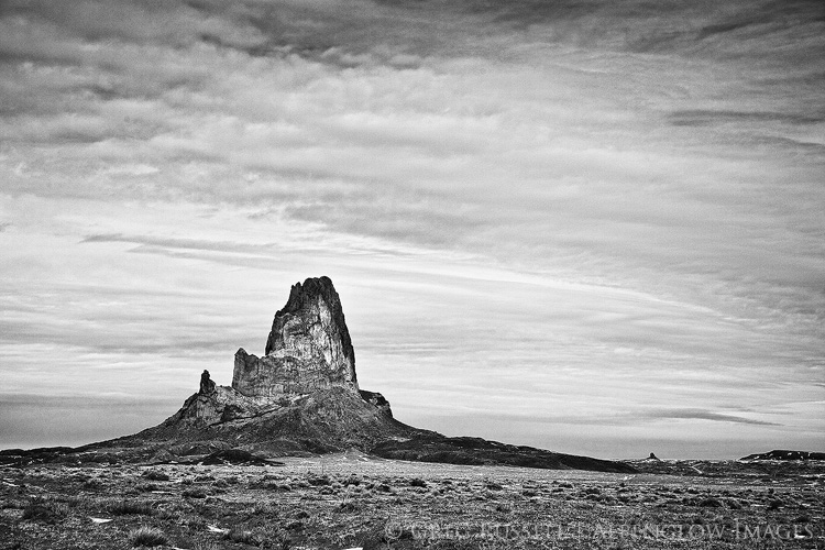
Agathla Peak, part of the Diné Volcanic field in northern Arizona
Agathla Peak–Aghaałą́–near Monument Valley in northern Arizona

Black rocks protruding up

About 30 million years ago, as the rest of the Colorado Plateau was rising, several volcanic explosions occurred in northern Arizona and New Mexico. They occurred from Kayenta and Comb Ridge eastward to the Lukachukai Mountains and northwest New Mexico. From there, the semicircle of violent volcanic eruptions turned southward towards Zuni Pueblo. The plugs and dikes were covered for millions of years, but erosion has uncovered and sculpted these features, leaving behind the desert towers we know today. The Navajo simply refer to these towers as ‘black rocks protruding up’–tsézhiin ‘íí ‘áhí.

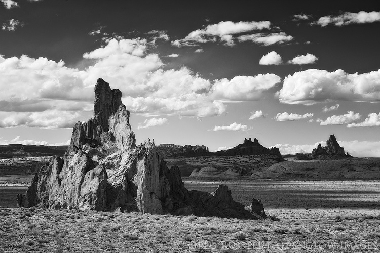
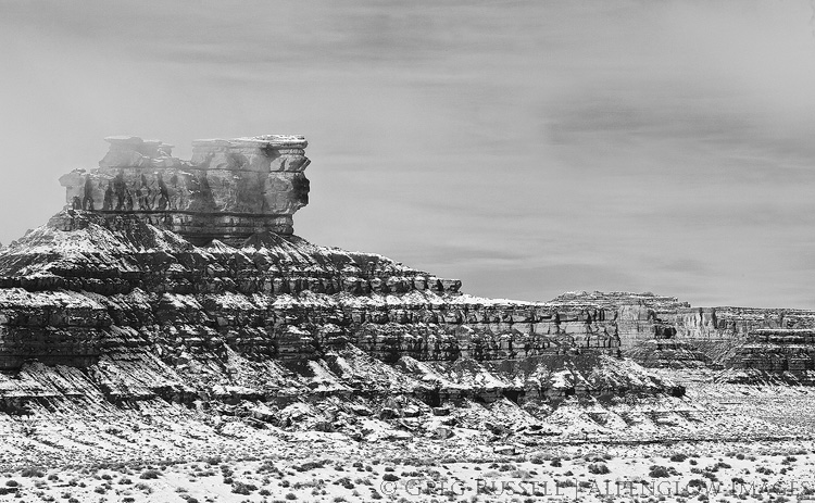
Black and white image of Church Rock, near Kayenta, Arizona
Church Rock with Agathla Peak in the background

Diné ethnogeology

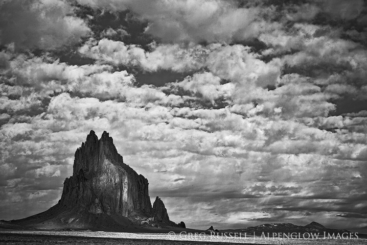
In spite of its obscurity in a sandstone world–or perhaps because of it–tsézhiin ‘íí ‘áhí has a strong presence in Diné mythology. Ship Rock–Tsé Bitʼaʼí–the landmark monolith in northwestern New Mexico, for instance, is told to have been home to a giant winged monster or bird, Tsé Nináhálééh. Tsé Nináhálééh was one of many monsters that followed the Diné to their current homeland–Dinétah–when they emerged to this world from the previous one. This bird was vicious, and would throw its prey into mountainsides and rocks, crushing them before eating them.

Monster Slayer (Nayé̆nĕzganĭ) was one of two sons of Changing Woman, Yoołgaii Nádleehé, who fought and battled these monsters. He had a magic feather that protected him from the giant winged monster’s attacks and was able to defeat it. Today, Ship Rock itself is thought to be the body of the winged monster; the volcanic ridges running out to its sides are thought to be the monster’s wings.

Black and white image of shiprock in northern New Mexico under a partly cloudy sky
Ship Rock–Tsé Bitʼaʼí–where Monster Slayer destroyed the winged monster

The Diné volcanic field is the perfect example of how geologic features and obscurities capture our attention and work their way into our cultural DNA. A region’s geology plays a huge role in its phenology, giving rise to many of the things we relate to in the places we love (trees, flowers, even animals), even if the geology itself goes unnoticed. Stories are told, and are passed down through generations. These stories are what root us in a place. This is another way we as photographers are very much storytellers.

This intersection between geology, folklore, and sense of place has really captured my attention lately and I hope to write more about it. In the meantime, how has geology influenced your sense of place?

*The Navajo Creation Story is one drawn from several stories, many of which can only be told respectfully during the winter months. There are several texts that have attempted to pull these stories into one cohesive book. An excellent summary can be found here.


Nature First | Earth Day

Written by Alpenglow Images on April 22nd, 2019

Since its first observance in 1970, Earth Day has been a celebration of clean, breathable air. Swimmable, drinkable, fishable water. Land that is fertile and free of litter. An appreciation of our planet–our only planet.

The truth is, this year I’m having a bit of a difficult time getting behind the notion of Earth Day. Of course I would like all the things I listed above, but where are we in our progress towards those things? Our production of carbon dioxide is outpacing Earth’s ability to convert it back to oxygen. As such our climate is changing and oceans are rising. Inuit hunters report their seal meat tastes “funny” in the last couple of years. Hard-fought for protections for our public lands in the United States are being removed in the name of progress.

In need of solace, I’ve turned back to Jack Turner, who for better or worse is always relatable when it all gets to feel a bit too heavy to bear:


Humans become foreigners to the wild, foreigners to an experience that once grounded their most scared beliefs and values. In short, wilderness as relic leads to tourism, and tourism in the wilderness becomes the primary mode of experiencing a diminished wild.


By Turner’s logic, we’re all depauperate of wilderness. Yet, I believe we all hunger for it. That’s why I’m particularly struck, on this Earth Day, at social media’s relationship with wild nature. Instagram and other social media channels have been flooded with photos of people abusing public lands for the sake of “influencing others.” Wilderness, to most, is a curated experience, and the notions of clean water and air, and a sustainable ecosystem, must certainly be the problems of others.

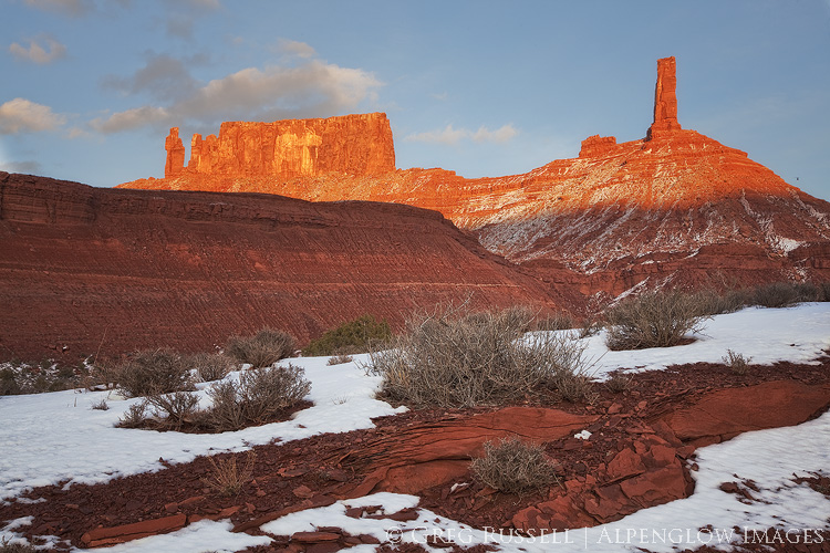
A redrock spire is illuminated by late day light in Monument Valley Tribal Park, Utah

Turner goes on:


From this we conclude that modern man’s knowledge and experience of wild nature is extensive. But it is not. Rather, what we have is extensive experience of a severely diminished wilderness animal or place–a charicature of its former self. Or we have extensive indirect experience of wild nature mediated via photographic images and the written word. But that is not experience of the wild, not gross contact.


Landscape photographers like me–by our very nature–make our living by observing the world around us. It’s a slow, almost meditative relationship with the Earth. We develop a way of seeing that I believe is much needed in the world today. Still, like others, we can fall victim to the seduction of getting “the shot.” While Turner doesn’t offer any solutions (perhaps there aren’t any real solutions), a few of my friends have. A group of landscape photographers that include my friends Matt Payne, Sarah Marino, and Ron Coscorrosa have started the Nature First–the alliance for responsible nature photography.

On their website they lay out many of what they believe to be the most important principles a landscape photographer can adhere to, but the list is not all inclusive. I encourage you to take a look, join, and take a reflective look at your own photography. Does it speak for the good of the Earth?

I’m thankful to be surrounded by like-minded, conscientious photographers. As the 16-year-old climate activist Greta Thunberg has pointed out, our house is literally burning down around us. It’s up to us to be the change, to be vocal, loud, and united against the destruction of the things we love. No photograph is worth that.

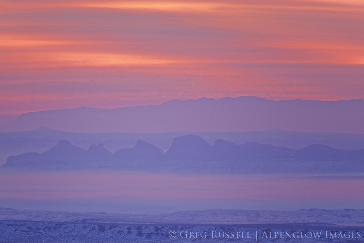
Pink and blue fill the sky at sunrise over a comb-shaped ridge on the Utah-Arizona border


Happy 100th birthday to Grand Canyon National Park

Written by Alpenglow Images on February 26th, 2019

“The wonders of the Grand Canyon cannot be adequately represented in symbols of speech, nor by speech itself. The resources of the graphic art are taxed beyond their powers in attempting to portray its features. Language and illustration combined must fail.” – John Wesley Powell


Aside from a few family vacations when I was young, I only have glimpses in my memory of our national parks. However, that changed when I was 13 and went to Grand Canyon National Park for the first time. I visited with my Boy Scout troop on spring break for my first backpacking trip. I’m not sure of my rank in Scouting at the time, but as far as backpacking went, I was truly a tenderfoot.

Our first night, spent on the South Rim, was as snowy and cold. As such, we hit the trail the next morning with wet tents and cold feet. Two days later, I would be bailing water out of my tent for an entire afternoon in a torrential downpour on the North Kaibab trail. After a rocky start, though, the clouds lifted and we got to experience the tranquil beauty of Grand Canyon. The immense canyon showed us all four seasons over just a few days. I came out filthy, exhausted, and addicted. Addicted to our national parks, to the wilderness ethos, to a life dedicated to the outdoors. That trip changed my life, and I’m grateful for that.

Grand Canyon National Park remains one of my favorite places, and today is its 100th birthday! Over the course of its time as one of the crown jewels of the national parks, it has inspired millions. With the help of fellow defenders, Grand Canyon has weathered storms of its own. Tourism development, mining, and even dams have threatened Grand Canyon at some point during its tenure as a national park. Threats continue: there are active proposals to open portions of Grand Canyon to uranium mining (despite a ban currently in place). Grand Canyon National Park is also leading the way in acknowledging the long history of indigenous people in our national parks.

Despite the threats, one cannot help but stand in awe when faced with such immensity. Grand Canyon takes the visitor back in time, looking through Kaibab limestone, Coconino sandstone, Redwall and Muav limestone, and finally down to the bottom–to Vishnu schist, some of the oldest rock on earth. You can’t help but feel small there. The resilience and humility it instills in us makes Grand Canyon worth celebrating.

Here are a few of my favorite images from Grand Canyon over the years.

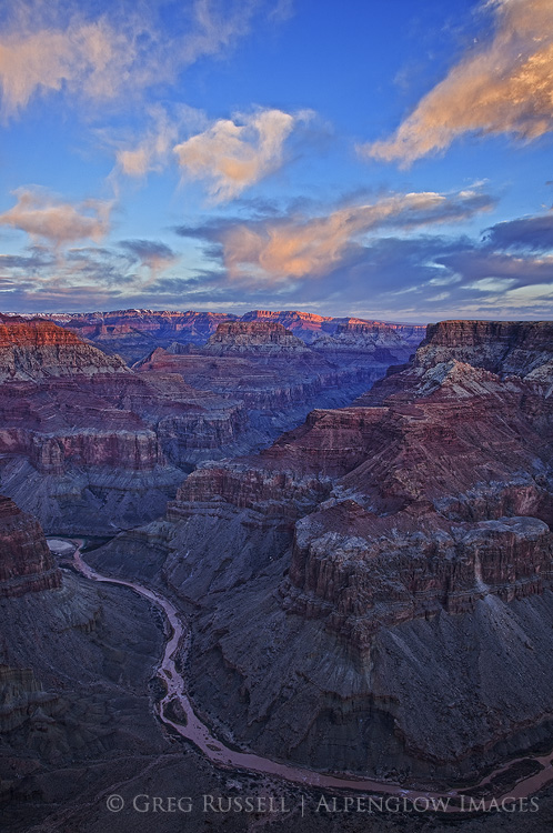
desert view sunrise, grand canyon national park
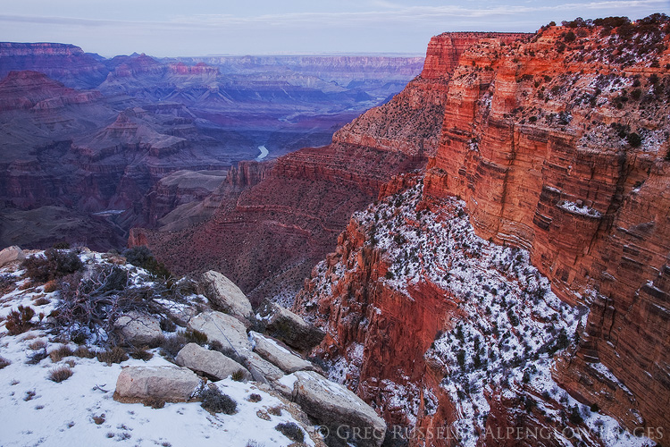
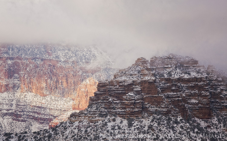
A winter evening at the south rim of the Grand Canyon
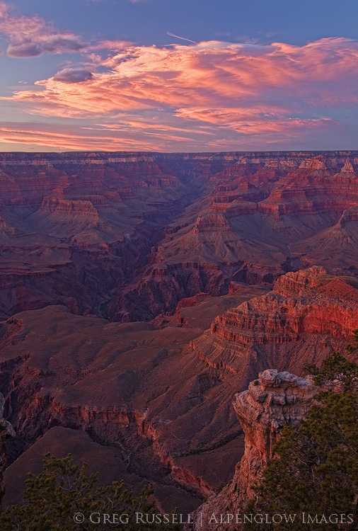
A dramatic sunset over the Grand Canyon, near Mather Point.  In this image, the South Kaibab Trail, Phantom Ranch, and the Tonto Shelf are all visible.  Grand Canyon National Park, Arizona
photo of sunrise with bright orange clouds and two rivers converging in a deep canyon
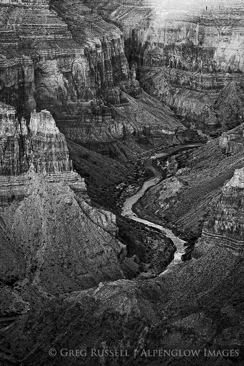
black and white photo of the little colorado river gorge as soon from the grand canyon south rim
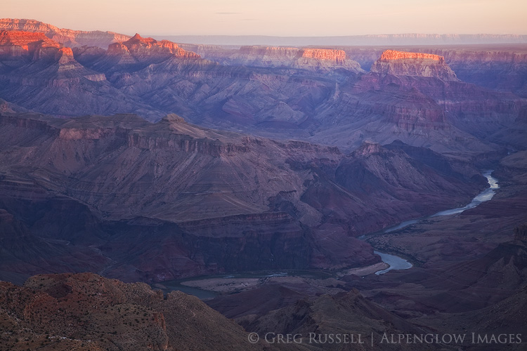
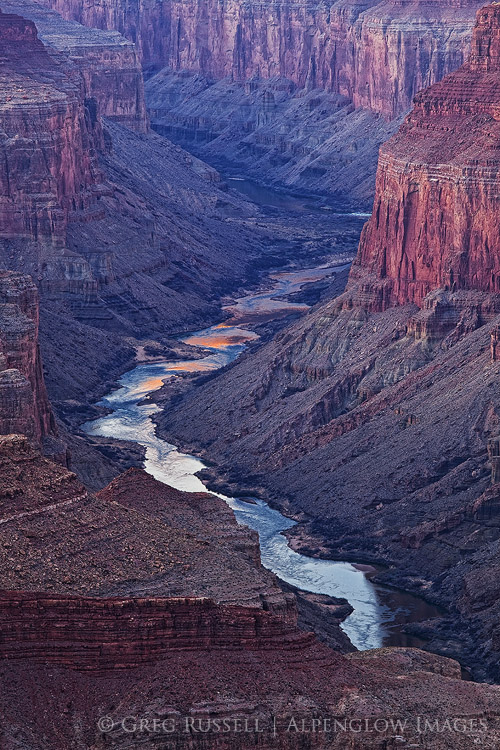
colorado river near cape solitude in grand canyon national park
 

Open for business: conserving our public lands

Written by Alpenglow Images on February 4th, 2019

The federal government re-opened–somewhat comically–minutes after I finished writing my last blog post. I’m happy to see our government operating normally again. Most importantly, our National Parks and other public lands are being staffed again. During the shut down, people damaged some of our natural–collective–treasures, perhaps irreversibly. I still don’t truly understand that. The time for conserving our public lands is now, and there is at least one very tangible thing we can all do.

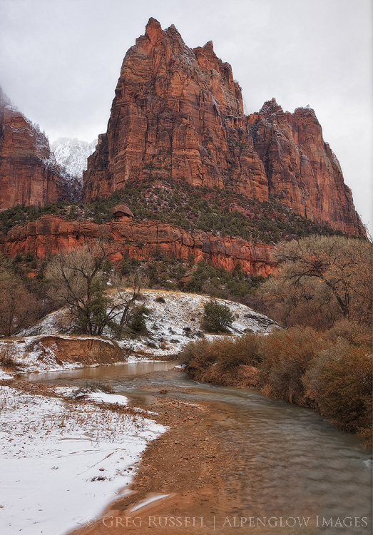
photo of snow on Jacob, one of the Patriarchs in Zion National Park, Utah

In an attempt to offset the doom and gloom in my last post, I thought I’d share some good news! One somewhat humorous bright spot from the government shutdown itself came from Point Reyes National Seashore. Elephant seals took over Drakes Beach. Females gave birth to several dozen pups there, meaning they aren’t leaving any time soon.

Back to Bears Ears

Arizona Congressman Ruben Gallego and New Mexico Congresswoman recently introduced the Bears Ears Expansion and Respect for Sovereignty Act (BEARS Act) to Congress. The BEARS Act would re-establish the full 1.9 million-acre Bears Ears National Monument as proposed by the Bears Ears Inter-Tribal Coalition in 2015. When President Obama designated Bears Ears National Monument in 2016, the boundaries more closely followed the footprint laid out in other legislation. For more on Bears Ears see previous blog posts here and here.

Support the Public Lands Policy Package

Perhaps the biggest thing that is worth watching right now is the Natural Resources Management Act (S.47) which Lisa Murkowski of Alaska recently introduced into Congress. This bill is good news for several good reasons. First, it has bipartisan support–California’s Dianne Feinstein authored a large part of it. A longtime champion of California’s deserts, Feinstein proposes the expansion of desert National Parks (like Death Valley), the expansion of existing Wilderness areas, and the creation of new ones (good news for my Wilderness Project!).

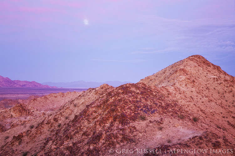
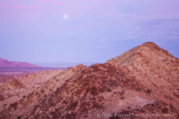
photo of a rising moon at sunset in the orocopia mountains of southern california

Second, S.47 would provide for the permanent adoption of the Land & Water Conservation Fund (LWCF). Congress initially funded the LWCF in 1965 with widespread bipartisan support. Since then, the LWCF has provided funds for all sorts of projects from the National Parks to city parks. Its funding expired last year and needs to be renewed, for the benefit of all Americans. Click here to urge your legislator to adopt S.47.

Elephant seals teach us that nature will persevere, regardless of our short-sighted actions. However, there is hope that we’ll be able to find common ground in conserving our public lands for generations to come.


Closed for business

Written by Alpenglow Images on January 25th, 2019

“If God does not exist, everything is allowed.” – Dostoyevsky’s Ivan Karamazov


If you’ve been following the news at all, you know that the US government is in the midst of the longest shutdown in its history. I have no interest in talking about the politics of it except to point out that the poster child of the shutdown has been our public lands, specifically our national parks. Trash, vandalism, and more in our popular parks have made national news, almost since day one of the shutdown. What should our land use ethic be when there is no regulating body present? Should we continue as if nothing has changed, or should we alter our approach?

The importance of our national parks can’t really be underscored enough. States, communities, and private organizations have rallied to keep our biggest national parks open during the shutdown. Grand Canyon, Bryce, and Zion and three great examples of this collective effort. The revenue these parks bring in is obviously a big factor in determining whether or not to keep them open. In the case of Zion, Utah State Route 9 runs through the middle of the park; accessibility is another factor. Another thing we can’t ignore is the importance of these places to us all. Shutting them down would–on some level–be heartbreaking.

Two weeks into the shutdown, my wife and I were married on the lawn at the Zion Lodge. It’s kind of an inarguable point that we had selfish motivations for seeing Zion remain open. What if Zion had closed for the shutdown? While disappointing, we would have understood and moved our wedding to a ‘plan B’ location.

After our wedding, we took a short road trip to Moab, Monument Valley, and the Grand Canyon. Due to a lack of resources to plow snowy roads, Arches National Park was closed. Fortunately, Moab is full of opportunities for public lands recreation. Perhaps more disappointing was that Moab Brewing Company was also closed for maintenance! The Grand Canyon–of course–was open, and functioning more or less normally.

One would assume, government shutdown or not, that the people who visit our national parks and monuments would be the caretakers, the proud public land owners. Maybe that isn’t the case though. Incidents of vandalism are rampant, perhaps the most egregarious being the chain-sawing of Joshua Trees in their namesake national park. In Zion, we witnessed people were parking on sensitive plants in the Canyon. Dogs (often off leash) were on almost every trail. It’s clear that, in the absence of enforcement, we don’t care about the rules at all. Or, to put it another way, it’s the enforcement of rules that makes us look like a good society, not an inherent quality of society itself.

Alain puts it beautifully in his Letters to Sergio Solmi on the Philosophy of Kant: “Ethics means knowing that…we have certain obligations. Ethics is neither more nor less than a sense of dignity.” Should I litter, destroy, and vandalize our national parks? It would be unworthy of me–unworthy of what humanity has become, unworthy of the education I have been given, unworthy of what I am and wish to be. I therefore refrain from such behavior. These are my ethics.

golden light is cast on Utah's Castleton Tower & The Rectory.

Should our national parks close for business completely during the shutdown? The former Director of the National Park Service certainly thinks they should be. The Mojave Desert Land Trust does too.

My ethics remain unchanged in this time of the government shutdown. I have visited national parks during this time. I am also aware that I am adding to the congestion that is partially the root of these problems. In her book The Hour of Land, Terry Tempest Williams writes, “Awe is the moment when ego surrenders to wonder. This is our inheritance – the beauty before us.” Perhaps even more so than the heartbreak of having our national parks closed is that of seeing our collective ego so big that we are willing to destroy them to satisfy ourselves.

Nearly two years ago, I wrote about my code of ethics as a photographer. We can add to that list now to suggest that we always tread lightly–even when the government is open, do not take services for granted. Pack out trash, and always be mindful of road and trail closures. Photographers can (and should) set the example of how we should treat our public lands; no photograph is worth endangering the integrity of a place, and realizing the fragility of our heavily visited national parks is paramount.


Podcast conversation with Matt Payne

Written by Alpenglow Images on January 15th, 2019

Before Christmas, I had the pleasure of visiting with fellow landscape photographer Matt Payne on his popular podcast, F-Stop Collaborate and Listen. We talked about public lands, landscape photographers’ roles in being advocates for our wild places, my Wilderness Project, and more.

Since our conversation, I have thought of a million things I wished I would have brought up. But this discussion is a good introduction into the work I’m currently doing, and the way I view the landscape photography community as wilderness advocates. You can listen here:

As I said in my last blog post, 2018 was a relatively light year for me in terms of photography and writing. I’m getting caught up though, and have some upcoming blog posts. Topics will include my thoughts on our national parks and the government shutdown, as well as a new installation in the Wilderness Project. In the meantime, feel free to continue the conversation on the podcast in the comment section! Thanks Matt, and thanks for listening.


2018 Year in Review

Written by Alpenglow Images on December 31st, 2018

My traditional 2018 year in review is arriving a little later than usual. I’m writing this on a snowy day in northern New Mexico reflecting on a year that was unusually light in terms of photography. If you follow my blog, you’ll have noticed that I haven’t made many images since February.

In 2018, my favorite images came from little-known landscapes. At the beginning of the year, I focused heavily on my Wilderness Project, and was able to discover some pockets of wilderness in southern California that I did not know existed. In addition to it being a year light in photography, the majority of my photographic efforts were close to home–this is the first year I haven’t traveled much to make images.

One unexpected result of my Wilderness Project has been the opportunity to confine myself to a particular area on the map, and get to know the personality of places that may be geographically close to one another, but in reality are quite unique. Bringing that out photographically has been challenging and satisfying.

One of the photographic highlights of the year was to be invited onto Matt Payne’s popular podcast F-Stop Collaborate and Listen. It was nice to be able to chat about ethics in landscape photography, the impact (both good and bad) photographers have on public lands, and my goals for the Wilderness Project. The episode should air in early 2019. Thanks, Matt!

The BIG highlight of the year, however was my engagement, and upcoming wedding January 4. As such, the lack of photography was backfilled with several other equally happy endeavors and adventures, and I’m looking forward to new adventures (including photography) in 2019!

In no particular order, here is my 2018 year in review. Enjoy!

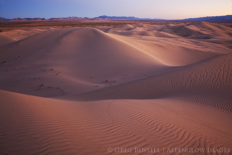
photo of Cadiz Sand Dune complex at sunset; the rolling sand dunes have a slight purple color, and the southern horizon displays sunset colors
Cadiz Dunes Wilderness, January 2018
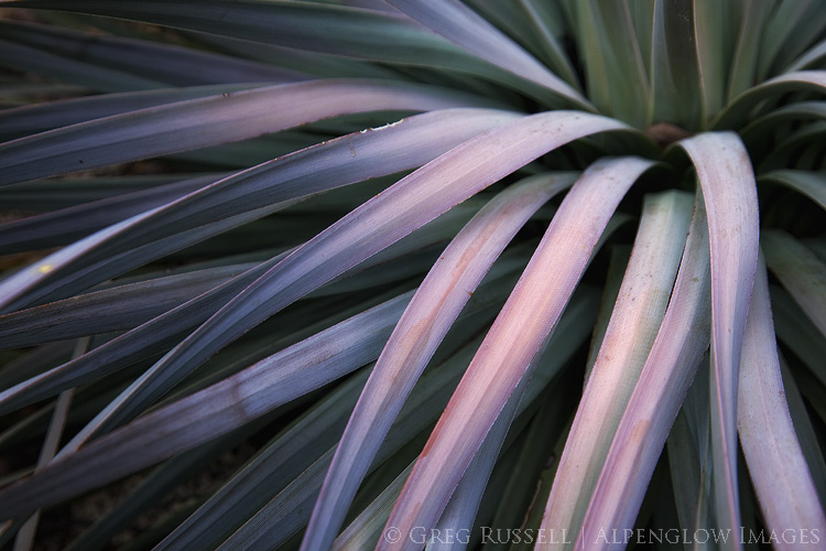
Yucca, San Jacinto Mountains, January 2018
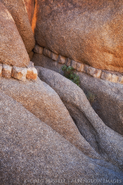
Small scene, Joshua Tree National Park, January 2018
Photo of Joshua Trees at sunrise with a boulder pile in the background. Joshua Trees are a characteristic species in the Mojave Desert, which covers approximately 28% of California's landmass.
Sunrise in Joshua Tree National Park, January 2018
Cadiz Dunes Wilderness, January 2018 (Rarely do two images from the same place make my year in review, but this evening was simply magical.)
Sunset, Mojave Desert, California, December 2018
Sunset, Orocopia Mountains Wilderness, December 2018

Past images of the year:

2010 | 2011 | 2012 | 2013 | 2014 | 2015 | 2016 | 2017


Nowhere Land

Written by Alpenglow Images on February 26th, 2018

“And here we are,” said Dr. Ford.

The boy replied, “Nowhere Land.”

“That seems hardly a fitting name for a place so full. Can’t you see it? Perhaps you’re not looking hard enough.”

– HBO’s Westworld


It’s been over 15 years since I moved to southern California, and the sheer scale & emptiness of its massive deserts are still coming into perspective. The Mojave Desert alone sprawls over 7 counties, covering 28% of California’s landmass; to truly get to know this place would take a lifetime of exploration.

To many, California’s deserts range from something that has to be tolerated on the drive from Los Angeles to Vegas to simply “the ugliest landscape I’ve ever seen.” Although many people love and cherish this landscape, it lacks intrinsic value to others. Despite (or because of?) the lack of intrinsic value, the desert is often seen as a place with only extrinsic monetary value. Because of this, it is under threat from several different directions. What are those threats, and why should we value the desert?
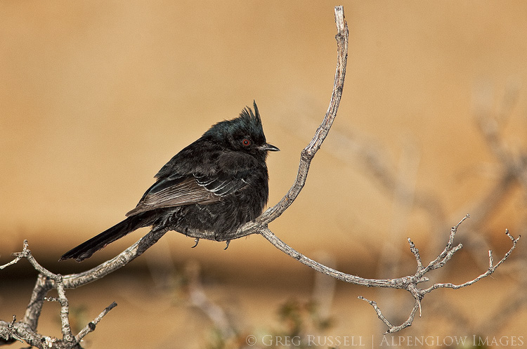
Photo of a phainopepla on a branch in Joshua Tree National park, California. Early morning light makes the blurred background golden, and the bird's characteristic red eye is apparent. The phainopepla is just one species of bird native to California's deserts.

Solar development

If California has an abundance of anything, it’s sunshine. It shouldn’t be surprising, then, that the Mojave Desert has been identified more than once for large-scale solar development. Most solar development involves “scraping” the desert floor of its native vegetation to install large arrays of solar arrays. Depending on the type of solar development, the arrays are either solar panels, or large mirrors which direct focused sunlight upwards towards a series of solar panels at the top of a tall tower.

In an effort to curtail chaotic and unplanned solar development in the California desert, the Obama administration passed the Desert Renewable Energy Conservation Plan (DRECP) in 2016. The idea behind the DRECP is simple: allow renewable energy development in certain areas of California’s deserts, while permanently protecting others.

Much of the focus of the DRECP was on prime habitat for some of the southwest’s most sensitive species, including desert tortoises. For instance, the massive Chuckwalla Bench (read more about the Chuckwalla Bench and Little Chuckwalla Mountains here), which extends from eastern Joshua Tree to the Colorado River in eastern Riverside County, is one of the best and most continuous desert tortoise habitats in the state.

At the beginning of February, the Trump Administration announced plans to revisit the DRECP with the intent of rolling back some of its original protections in order to open more of California’s deserts to renewable energy development. So far they have not offered a good reason for this.

It has been questioned whether large-scale solar development really benefits the environment or not.  What’s more, the Mojave Desert’s plants have been shown to be an incredibly good carbon sink, although their ability to reduce atmospheric carbon is heavily dependent on the occurrence of a wet winter. Thus, “scraping” away the plants on a large scale, or even covering them up, prevents the plants here from doing what they are best at. In solar arrays that focus light upward using mirrors, thousands of birds each year are accidentally incinerated (the Ivanpah solar array near the California-Nevada state line on Interstate 15 kills an estimated 6,000 birds/year).

Many solar projects have taken 3-4 years to build. From 2005-2016, all of the large-scale solar projects in California generated 1,470MW (megawatts) of energy. In 2015 alone, rooftop solar generated 1,050MW in California (source: Basin & Range Watch). I have said for years that rooftop solar should be mandatory on all new builds in the Southwest. Also, it is worth looking at other places for solar arrays, such as fields that are no longer farmed (as the city of Lancaster, California did). The bottom line is that there are alternatives to large-scale scrapes of critical desert habitat for solar.
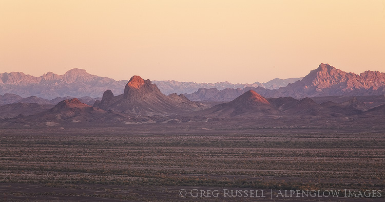
Photo of the Chuckwalla Bench at sunset, Imperial County, California. The Chuckwalla Bench is one of the areas of high conservation importance in California's deserts.

Mining

As part of the DRECP rollback, the BLM has cancelled its withdrawal of conservation lands from mining claims. In other words, conservation areas that were previously protected from new mining claims now are not. The logic is that there is such little mining occurring in the Mojave Desert that any new claims would be practically imperceptible. However, that may not be the case.

Last week, two mining companies signed MOUs (Memoranda of Understanding) expressing lithium mining interests in the Mojave Desert. Standard Lithium is exploring possible lithium deposits in the area of Bristol Dry Lake, in Cadiz Valley and Pacific Imperial Mines is developing a lithium mining operation near Death Valley Junction. With the increased demand for batteries, lithium mines are becoming more and more common in the Mojave and Great Basin Deserts.

In both mining operations–and in most in the West–lithium is extracted from brine via the use of massive evaporation ponds. As water evaporates, the minerals can be extracted. It’s no wonder why these mines would be so common in this part of the world, given high mineral content of dry lake valleys.

According to Basin & Range Watch, new claims are still subject to environmental assessment. Disturbance caps (limits on the mining in a particular region) are still enforceable, but the withdrawal of these lands from the conservation plan certainly opens up the possibility that those caps could be changed in a revised DRECP.

Water

I discussed the threat of water extraction in the Cadiz Valley previously (see this blog post). It is ironic that much of the water extracted from the Cadiz Valley would likely be used in lithium mining operations, and would never actually make it to the Colorado River aqueduct.
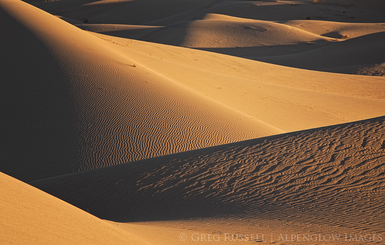
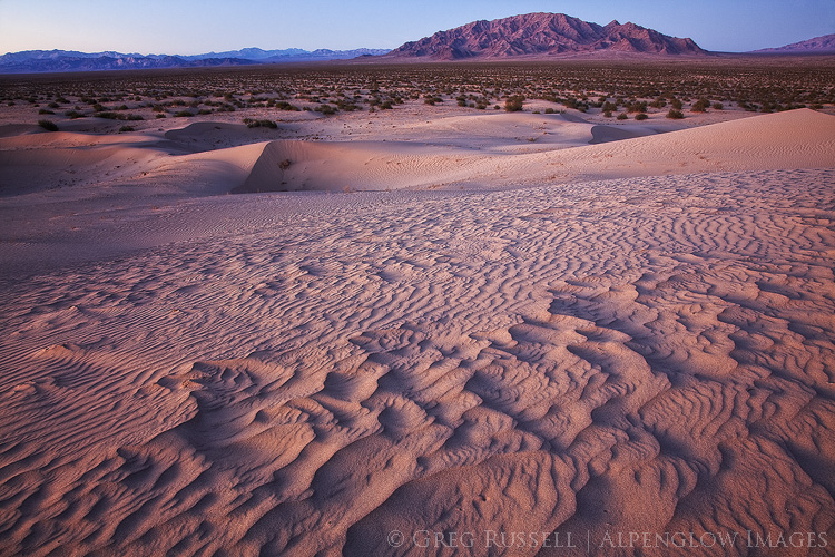
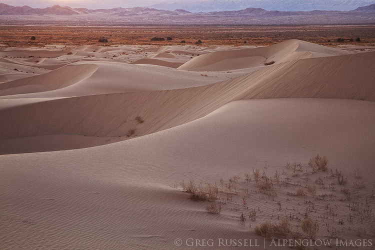
Photo of golden sand dunes at sunset in California's Cadiz Valley. Multiple hills are visible creating alternating dark and light layers, with ripples in the sand from wind.

Finding intrinsic value in a barren landscape

The science behind the desert’s importance in combating global climate change is relatively easy. Describing why the desert is beautiful to a “nonbeliever” is slightly more difficult. For me, watching a monsoon storm gather over an already imposing desert mountain range is one of the prettiest things I’ve ever seen. I also think about the first time I showed my parents a desert tortoise. Even my mom, who I wouldn’t call a desert lover, was enthralled. This past weekend, I saw my first desert pupfish in Death Valley National Park and felt a familiar and fleeting sense of joy. My son saw his first rattlesnake on a hike with me in Joshua Tree. He didn’t stop running for a solid half mile once he realized what he had just walked by, but he hasn’t forgotten about it either.
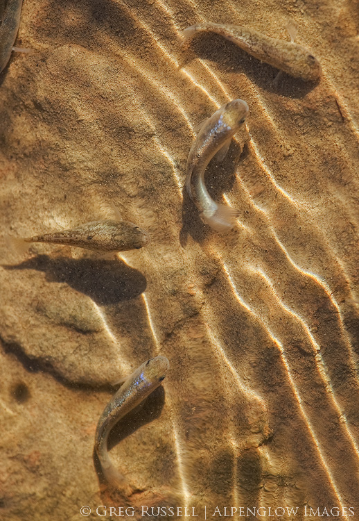
Photo of pupfish in Salt Creek, Death Valley National Park California. Desert pupfish are a critically endangered species, and are capable of living in extremely saline environments.

The point is that there are a million reasons to value and make memories in the desert. I can’t tell you what to value, just as I can’t tell you who to fall in love with. But, I can say that familiarity breeds intimacy, and California’s deserts need as many allies as possible right now.

While you’re developing your own relationship with the desert, there are some things you can do right now:

  1. Sign the online petition telling the BLM you would like to keep the DRECP intact. The BLM is accepting comments until March 22.
  2. Attend a public meeting to tell BLM representatives in person to keep the DRECP intact. I’ll be at the March 7 meeting in Palm Desert.
  3. Call or email your county supervisor. Because counties have a big role in developing the DRECP, your county supervisor will want to receive input from both residents and visitors.

California’s deserts may be barren, but they’re far from empty.
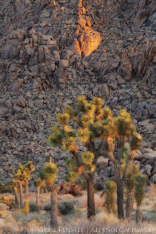
Photo of Joshua Trees at sunrise with a boulder pile in the background. Joshua Trees are a characteristic species in the Mojave Desert, which covers approximately 28% of California's landmass.


Happy birthday to the California Desert National Monuments

Written by Alpenglow Images on February 12th, 2018

All told, I have had little travel in my life which has yielded so much profit on the exertion as the old Mojave stage. I understand that the road is well furnished now with gas stations and hot dog stands, and the trip can be made in a few hours without incident. Which seems on the whole a pity.” – Mary Hunter Austin, Earth Horizon, 1932

Happiest of birthdays to California’s Desert National Monuments: Sand to Snow, Mojave Trails (which includes the Cadiz Dunes, the subject of my last blog post), and Castle Mountains. They were all designated two years ago today, on February 12, 2016. Together, their creation represents one of the largest acts in history towards the preservation of California’s deserts for future generations. May we celebrate many more birthdays for these diverse and unique monuments.

layers of sand dunes at sunset at the cadiz dunes complex within Mojave Trails National Monument

Sand dunes in Mojave Trails National Monument

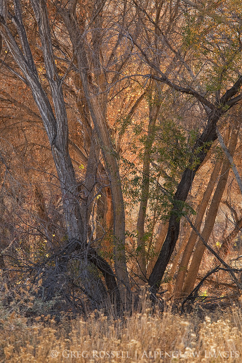
photo of backlit cottonwood trees with golden light shining through in the Sand to Snow National Monument

Cottonwood trees at Big Morongo Preserve, part of Sand to Snow National Monument


Water, sand, and the edge of wilderness

Written by Alpenglow Images on January 26th, 2018

“He said, “Americans look upon water as an inexhaustible resource. It’s not, if you’re mining it.” – John McPhee, Assembling California


If you live in southern California and read the news, you’ve probably heard about the Cadiz Water Project. The basic premise behind the project is to pump groundwater out of the Cadiz Valley in the Mojave Desert and pump it into the Colorado River aqueduct, thus delivering it to the Los Angeles Basin. For thirsty Angelenos, this seems like a great solution, and to paraphrase the old adage, if the source of the water is out of sight, it’s also out of mind.

The Cadiz Valley is also home to the Cadiz Dunes Wilderness, which is primarily made up of the Cadiz Dunes complex and portions surrounding valley.  A large part of the Cadiz Valley–including the Wilderness–are part of the Mojave Trails National Monument, which was designated in 2016. Because of increased news coverage, two friends and I recently went to the Cadiz Valley to photograph the dunes and experience the place first-hand.

The Cadiz Valley is a typical Basin and Range valley. It is surrounded by the Sheephole Mountains to the west, the Ship Mountains to the north, and the Old Woman Mountains to the east. A lake, which has long since dried up, once occupied the entire valley; blowing sand has created the Cadiz Dunes complex. Because of the minerals the lake left behind, several salt mines have popped up in the southern end of the valley. A railroad right-of-way also runs through the valley, connecting historic Route 66 with Parker, Arizona. When we visited, we drove for over 60 miles on unpaved roads and didn’t see another vehicle. As Mark said, “in southern California, that’s a pretty good indicator that you’re way out there.” Indeed, I bet it’s highly unlikely that many desert travelers give the Cadiz Valley much thought.

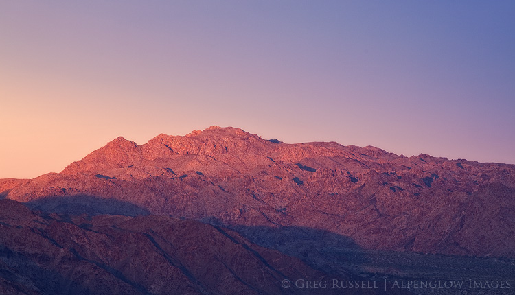
The Ship Mountains as seen from the Cadiz Dunes after sunset. Alpenglow covers the landscape.

The Cadiz Water Project

An interesting thing about the valley, and the reason it’s front-and-center in Los Angeles’ water politics, is the large aquifer that lies beneath it. Cadiz Inc., which owns several thousand acres in the valley, has proposed to pump water from the aquifer, and through a 43-mile-long pipeline, move it to the Colorado River aqueduct so it can be transported to the Los Angeles Basin.  The Cadiz Valley Water Conservation, Recovery and Storage Project–or Cadiz Water Project–has met with poor investor interest, court battles, and seemingly endless hurdles.

Last fall, however, the project got a new head of steam. David Bernhardt, a former partner at the law firm representing Cadiz, was confirmed as the Deputy Secretary of the Department of the Interior (in unrelated news, the Department of Interior also rolled back legislation limiting the use of railroad right-of-ways so the pipeline could be built) and a bill in the California state senate that would have shut down Cadiz was voted down by senate Democrats. There are still legal battles taking place, but this plan has a real possibility of happening.

Silly, and dangerously antiquated

Cadiz Inc. owns the rights to 50,000 acre-feet of water per year for the next 50 years; that’s 50,000 acre feet being pumped out of the ground each year and into the aqueduct. The aquifer is only replenishing itself at a rate of 32,000 acre feet per year. Cadiz also estimates the cost of their water between $775-$960/acre foot; the current price the Los Angeles Municipal Water District charges is $670/acre foot. Thus, water coming from this project would cost the consumer more.  Finally, the water Cadiz plans on pumping out of the aquifer contains the carcinogen hexavalent chromium. They argue that by diluting it in Colorado River water, levels of hexavalent chromium would be safe for human consumption. Finally, in seismically active southern California, any pipeline is going to require expensive maintenance.

Although the Colorado River aqueduct is an engineering achievement, it is admittedly antiquated and unsustainable. So is the Los Angeles aqueduct that brings water from the Owens Valley. For a truly sustainable solution to water woes, we need to be looking closer to the point of use: desalination plants, and water recycling make much more sense than piping water from hundreds of miles away.

photo of Cadiz Sand Dune complex at sunset; the rolling sand dunes have a slight purple color, and the southern horizon displays sunset colors

Thinking past the wilderness boundaries

A federally designated Wilderness is by definition a place of compromise. Its boundaries have been drawn as lines on a map based on public comments, input from all interested parties, and after a vote on its designation by people who will likely never see the place, or think about it again. Nevertheless, this is one of my favorite levels of protection for a place because it ensures that the land will remain as pristine as possible for generations to come. But tonight my mind is concerned with what lies beyond the edge of Wilderness boundaries. What of that landscape?

An edge, as defined by ecologists, is a place of transition between habitats: forest and meadow, for example. Deer and other herbivores can often be found along edges; they stay close to the cover of the forest, while enjoying the ability to graze in a meadow. For a hungry predator, this can be a place of incredible opportunity, but for distracted prey edges can be a great danger. Indeed, the future of the Cadiz Valley is not really all that different from a deer grazing at the edge of a meadow.

photo of expansive rolling sand dunes at sunset with the sheephole mountains in the distance

Standing on the Cadiz Dunes at sunset, looking east across a creosote sea towards the Old Woman Mountains, I was reminded why we visit these places. The road we drove in on was somewhere in front of me, but was rendered invisible due–if nothing else–to the vastness of the landscape. I found myself caught in one of those moments when the silence was deafening. In this big landscape, I was reminded of just how small I am, re-instilling my sense of humility. Looking out across the arbitrary lines protecting the Wilderness, my eyes try to imagine the dust from pipeline construction or the shimmer on the horizon from a body of evaporating water–the result of a pipeline spill. My ears try to hear the sound of pumps in the distance, sending groundwater on their long journey to Los Angeles.

The Cadiz Water Project would provide additional water to Los Angeles for 50 more years. Fifty more years to ruin a beautiful desert valley and search for another aquifer we can mine water from.

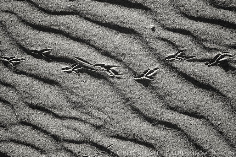
black and white photograph of roadrunner tracks going across a sand dune in the cadiz valley of southern California