sierra nevada

...now browsing by category


A path into thin air

Thursday, October 21st, 2010

“In the high country of the mind one has to become adjusted to the thinner air of uncertainty…”–Robert M. Pirsig

Late last week, we decided to take a last-minute trip to the east side of the Sierra Nevada to visit the beautiful fall colors.  Having grown up in the Rocky Mountains, my wife and I both miss the crisp air and changing colors of autumn.  We arrived in Mammoth Lakes late Friday night, and I was able to photograph sunrise at nearby Convict Lake the following morning.  Not only are the fall colors at the end of this image beautiful, but I love the textures present on Laurel Mountain, which is at the western border of the lake.

Sunrise at Convict Lake with Laurel Mountain in the background

Laurel Mountain alpenglow, October 2010

After shooting sunrise, I walked over to the aspen grove you see in the above photo.  These days, it seems like photographers go hand-in-hand with aspen groves in the eastern Sierra.  Some people might argue that the photographers outnumber the aspen trees!  The beautiful thing about this aspen grove was that although small, I had it completely to myself.  I was able to walk through the trees in silence, enjoying their beautiful show.

This time of year, the blogosphere is flooded with beautiful images of fall colors, however I have a confession.  Photographing these aspen groves is difficult for me; while beautiful, Sierra aspen groves feel “chaotic” to me, and making an original composition is difficult.  However, the quote that began this blog post applies to my feelings on my “dilemma.”  One of the best lessons to learn as a landscape photographer, in my opinion, is to not force compositions out of the landscape, but rather to let the landscape guide you.  In other words, when I found myself in this uncertain, chaotic situation, I had to let the landscape guide me, thinking outside of what I normally would do; that’s when the true creativity began to happen.

A path leading into an aspen grove near Convict Lake, Mono County California

Autumnal Path, October 2010

How do you let the landscape guide you toward compositions?  I’d love to hear what inspires you in the comments…

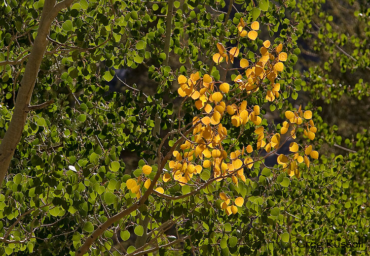
Detail of an aspen leaf in the Sierra Nevada

Aspen Leaf detail, October 2010

Photo of the Month–October

Friday, October 1st, 2010

As I wrote in my last post, fall is on its way, and I’m remembering a busy summer in the Sierra Nevada mountains very fondly.  Before this summer, it had been many years since I’d been on a proper backpacking trip, and I had forgotten how many of the day’s activities revolve around water.  Boil water for breakfast.  Filter.  Hydrate at lunch.  Filter.  Boil for dinner.  Filter.

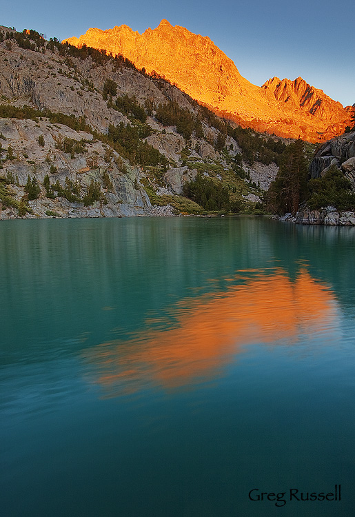
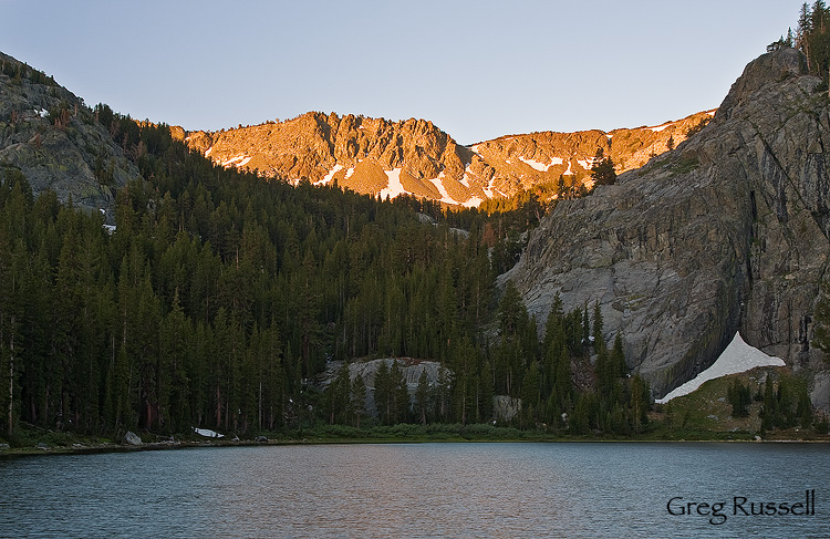
Water really is a central theme on any backpacking trip, whether in the wet Pacific Northwest, or in the dry desert.  On our last backpacking trip, the water at the lake we camped at was especially striking–a rich turquoise blue due to high amounts of glacial silt in the water.  While shooting sunrise, I wanted to get the beautiful sunlit peaks in the frame, but I also wanted to highlight the water, as it was not only beautiful but is so central to the day’s activities.

Because the trip I took this on was sort of summer’s “final hurrah,” I’ve chosen it as October’s Photo of the Month.  Enjoy!

sunrise over mt. robinson, john muir wilderness, california

Sunrise on Mt. Robinson, September 2010

Range of Light

Monday, September 20th, 2010

I’ll be the first person to admit that I don’t really fit in living in southern California.  Although I do commute to my day job, I avoid the commuter culture.  I don’t send text messages unless absolutely necessary.  My idea of high-end clothing can’t be purchased at Nordstrom’s or Bloomingdale’s, and I had no idea who Justin Bieber is until my friend’s 9-year-old daughter introduced me (I still wouldn’t know him if he showed up at my front door).  So, I don’t really fit in here.

Part of that is my fault too: I’ve avoided fitting in.  Perhaps I’ve been afraid I’d actually start to like it here if I let myself.  So it was when I was introduced to the Sierra Nevada mountains.

Within one week of moving to southern California, I was in a car with my new boss driving up the Owens Valley to the White Mountains.  There’s no doubt the Sierra is an impressive range, but was cautious to give it too much credit.

“How cliché,” I thought, “everyone likes the Sierra.”

“What could be so special about this place?”

Eight years have passed.  In that time, I’ve stood in awe at the base of giant sequoias and granite monoliths.  Some of the most amazing geology in the west has been right under my feet.  In 2010 alone, I’ve walked more than 100 miles in the Sierra backcountry, most recently my wife and I took our 2 1/2 year old son on his first backpacking trip to the North Fork of Big Pine Creek (aka the Palisades, or Palisade Lakes).

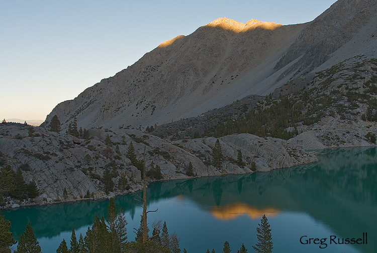
Sunset from Second Lake, John Muir Wilderness, California

Sunset, Second Lake, John Muir Wilderness, September 2010

We arrived at our campsite, high above one of the glacially-fed lakes about 5pm and set up our tent, and I went to filter water.  One of the most fantastic things about this time of year is that there are no mosquitoes.  I really can’t tell you how happy that makes me.  I got back to camp in time to see the day’s last vestiges of sunlight kissing the tops of the peaks to the north of us.

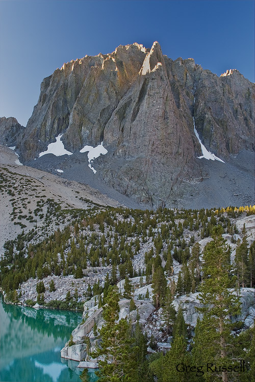
The following morning, I walked up to another one of the small chain of lakes in this area to photograph sunrise.  I’ve written before that I’m convinced there are no clouds in the Sierra.  My “curse” continued on this trip, with completely cloudless skies.  Alas.

Sunrise on Temple Crag, John Muir Wilderness, California

First Light on Temple Crag, September 2010

After shooting sunrise, I walked back to camp, and enjoyed a morning reading of “One Zany Zoo” and some oatmeal.  After breakfast, we were very sad to pack up and walk back to the car.  Its at that moment, looking up at Temple Crag and the Palisade Crest that it hit me.  This is the place where my son is learning to love the outdoors.  This is more than just a pretty mountain range.  As part of a generation who will be more likely to save trees by sending emails rather than going outdoors to climb them, his groundwork for a sense of place is being laid down right here.

With that in mind, its easy to see why John Muir was so moved by this Range of Light.

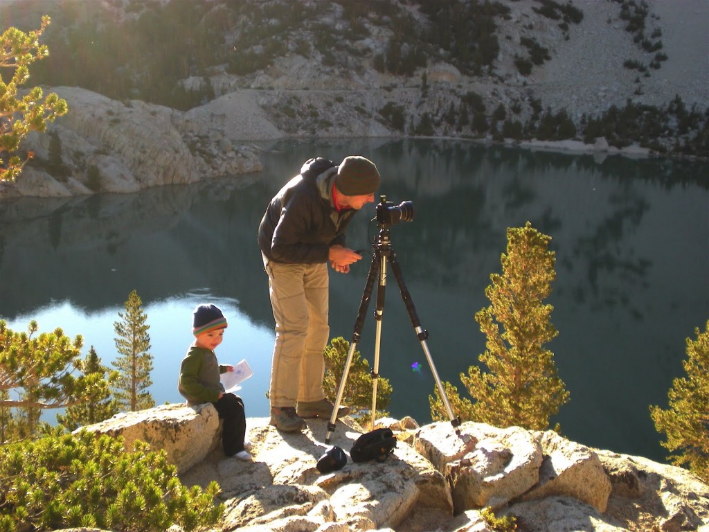
shooting photos with dad

"Babysitting", September 2010

Aspen Trunk

Friday, September 17th, 2010

Recently, I noted this aspen trunk, and thought that it would make a good vertical panorama.  Converting it to black and white using Nik Silver Efex Pro seemed to give this already graphical image the punch it needed to stand on its own.

Click on the image to see a larger version!

Aspen Trunk, Populus Tremuloides

Aspen Trunk, September 2010

Eastern Sierra Fall Color Observations

Monday, September 13th, 2010

With 2010 moving towards autumn, fall colors are on many photographers’ minds.  Just this weekend, Phil Colla published on his blog a very helpful list of fall color resources.  I won’t repeat them all here, but I did want to add some of my own observations.

We hiked into the North Fork of Big Pine Creek on 9/10-9/11.  Below 9,000′, there is no fall color yet, with all the aspen still being green.  However, above 9,000′, and up to 10,000′ there is color starting to appear.  Some trees have beautiful golden or red sections, and a few (read: very few) trees have already turned completely.

Fall colors on Aspen (populus tremuloides), Sierra Nevada California

Early Fall Colors, September 2010

The above photo illustrates well what we observed between 9,000′ and 10,000′ elevation.  I would guess that in 2-3 more weeks the colors will really be hopping at higher elevations, as well as moving down in altitude.

As a sidenote, some of the cottonwoods in the Owens Valley appear to be losing some of their color, but nothing striking yet.

Stillness

Thursday, August 19th, 2010

After leaving the Sierra high country, we hiked near the base of Half Dome (yes, we did climb it!), through Little Yosemite Valley, and eventually into Yosemite Valley itself.  While it was nice to have some of the luxuries of civilization (e.g. showers, flush toilets and beer), coming off the trail into that much chaos is a little overwhelming.   We spent the next day in the Valley picnicking, sight seeing and relaxing.  That night, we drove up to Glacier Point for one last look at the Yosemite high country, and to escape the crowds a bit.

On the way up to Glacier Point are some fantastic meadows that have gorgeous wildflowers, peaking in about mid-July.  Those meadows also have huge numbers of mosquitoes, so I didn’t spend long.

We spent most of our time enjoying the view from Glacier Point, reminiscing about the adventure we’d just had, and looking forward to the next one.  Not a bad end to a backpacking trip by any stretch of the imagination.

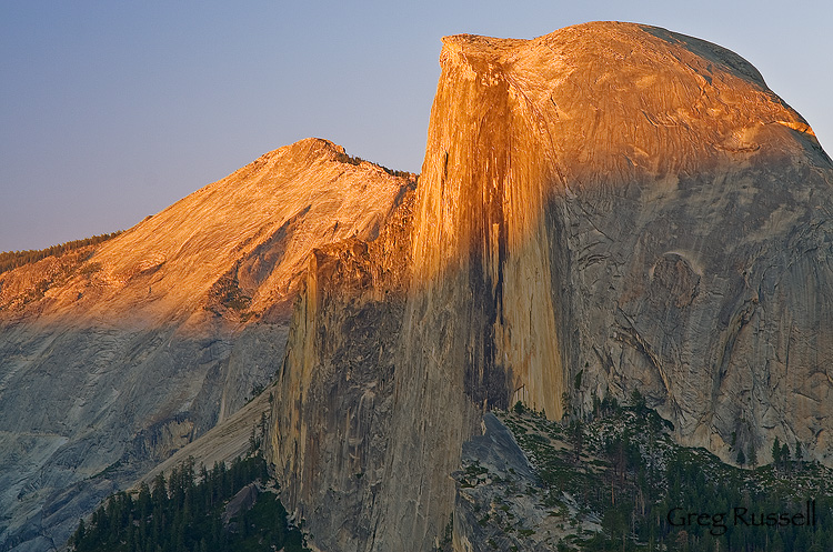
Half Dome, yosemite national park, california

Half Dome, July 2010

The Cathedral Range

Monday, August 16th, 2010

After reading Lyell Canyon, we hiked into Tuolumne Meadows–and civilization.  I have to admit that I feel like a bit of a prat “complaining” about re-entry into civilization after “only” 5 days in the backcountry, but I felt so relaxed and at ease from our adventures thus far, it was difficult to cope with suddenly being surrounded by cars, pets, and people…everywhere.  But, the cheeseburger I bought at the Meadow Grill was very welcome!

We had somewhat heavy rain all afternoon, and a fantastic sunset that night.  Unfortunately, I rode to Lee Vining with my wife and son to have dinner and help her get ready to join us on the trail the next morning.  She was more than a little excited for her first backpacking trip, and I couldn’t blame her.  How many people get to have their first backpacking experience among the most beautiful and awe-inspiring scenery in the world?

The following morning, with my friend and wife as company, we headed out towards Yosemite Valley, crossing over the Cathedral Range towards Sunrise High Sierra Camp (HSC).  The HSCs are fantastic camps with all the comforts at home.  We did our own cooking, but did enjoy not having to filter our water.  I also have to confess that I enjoyed the Minarets and the Ritter Range so much that I though the best scenery was behind us, but the views of the Echo Peaks, Mathes Crest, and Cathedral Range were among the finest of the entire trip.

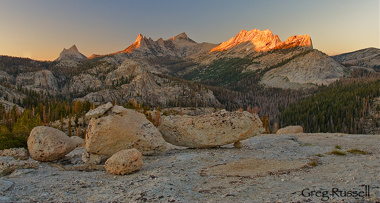
That evening, I hiked up on top of a dome near Sunrise HSC to photograph these fantastic geological features.

Cathredral range at sunset

Cathedral Peak, the Echo Peaks, and Mathes Crest, July 2010

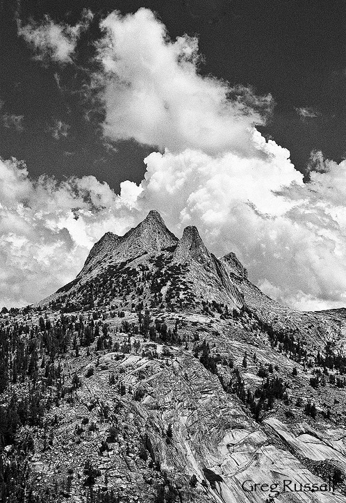
Echo Peaks, Yosemite National Park, California

The Echo Peaks, July 2010

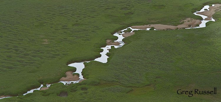
Stream in Yosemite National Park, California

Stream in Long Meadow, July 2010

It really was a fantastic evening, and was just a taste of what was to come.

Lyell Canyon

Thursday, August 12th, 2010

After leaving Thousand Island Lake, we continued north on the John Muir Trail, over Island Pass, and toward Donahue Pass.  The summit of Donahue Pass marked not only the entrance to a new watershed, but also the border between the Ansel Adams Wilderness (Inyo National Forest) and Yosemite National Park.

As expected, climbing 1300′ from Rush Creek to the summit of Donahue was not super enjoyable, and neither were the clouds of mosquitoes–probably the worst we’d encountered on our trip so far.  At one point, I set my pack down to have a snack, drink, and to rest my shoulders, and I counted about 40 mosquitoes on the shoulder straps!  However, bigger things were afoot today, as we watched the cumulus clouds condensing above us, and the thunderheads starting to build!  How exciting…perhaps my “curse” of photographing a cloudless Sierra would finally be broken.

By the time we arrived at the summit of Donahue Pass, the clouds were thick and thunder was rumbling all around us.  This is when my inner photographer began battling with my common sense.  The landscape on the Yosemite side of Donahue pass is among the most beautiful I’ve seen–fields of rich red Indian Paintbrush, gorgeous hanging valleys, a truly stunning alpine environment.  However, something inside tells me that its unwise to be above timberline when there is active lightning.  We chose to err on the side of survival and didn’t linger long for photos.

Despite my regrets about that, we did arrive in the bottom of Lyell Canyon with enough daylight to allow me to explore pretty extensively with my camera.  All of the side streams in the area (collectively known as the “Lyell Forks” of the Tuolumne River) and ever-present wildflowers, I had a fantastic time.  Plus, much to my pleasure, the mosquitoes were not bad–compared to the previous few days, I felt like they were nonexistent.  Yay!

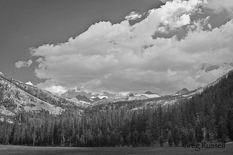
Lyell Canyon and Donahue Pass, Yosemite National Park

Lyell Canyon and Donahue Pass, July 2010

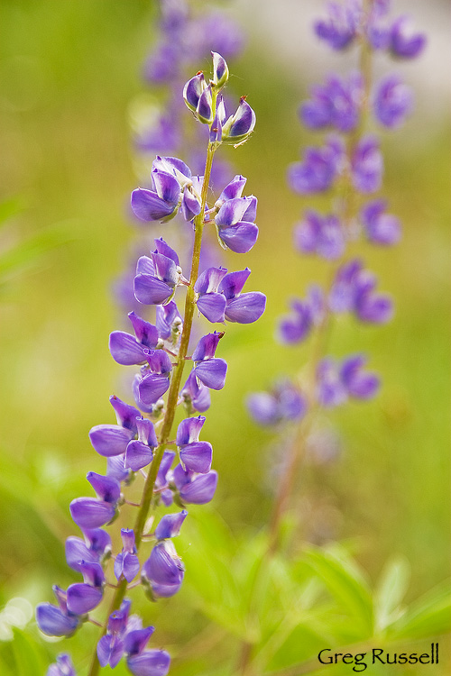
Lupine photo, Yosemite National Park

Lupine, July 2010

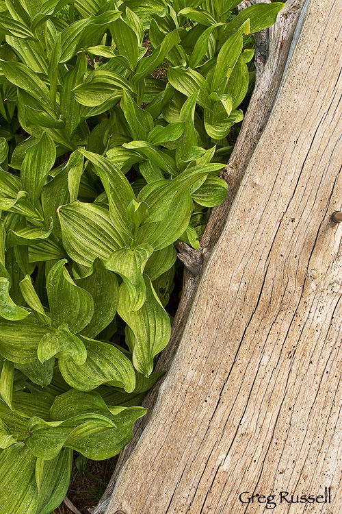
After dinner, I took another walk, heading back south, toward Donahue Pass.  My knees prevented me from hiking too far, but I did find some fantastic corn lilies (Clintonia borealis), which make fantastic abstract photos during the summer when they’re at their peak.

corn lilies and log, yosemite national park, california

Corn Lilies, July 2010

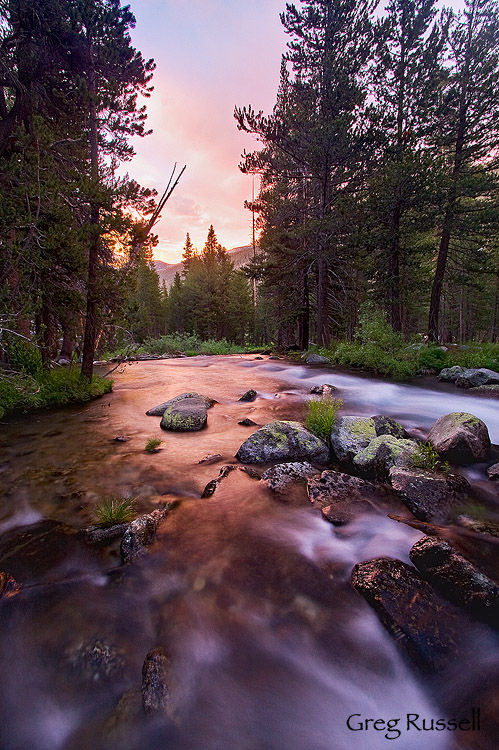
Finally, while walking back, I saw a fantastic sunset materializing through the trees.  While I didn’t have time to run back out to the open meadow, I did find an open area where I could use the river as a foreground element.  I can’t really complain at the way this image came out, making a fantastic ending to the day.

lyell forks of the tuolumne river, yosemite national park, california

Lyell Forks of the Tuolumne River, July 2010

As I laid in the tent that night, I looked forward to meeting my wife and son the next day in Tuolumne Meadows, and drifted off to sleep with visions of flush toilets, cold beer, and the Whoa Nellie Deli dancing through my head, not necessarily in that order.

To see all of my Yosemite images, click here.

Rosalie & Garnet Lakes

Friday, August 6th, 2010

After leaving our fantastic campsite on Minaret Lake, we rejoined the John Muir Trail and headed north.  For about six miles after the junction with the Minaret Lake trail, the JMT has to skirt a large volcanic ridge in order to get anywhere.  The trail isn’t difficult to follow, but it is all uphill, and its about 6 additional miles to a small, secluded lake–Rosalie Lake, where we decided to camp for the night.  This made for about a 12-mile day.  Unfortunately, the mosquitoes were much worse than we’d seen, and I’d even say they were maddening.  Of course, if there’s a mosquito within 100 miles, it’ll find me.  It just goes to show that a tent can not only be shelter, but sanctuary.

I got out the next morning to photograph sunrise on Rosalie, and got some nice images of the volcanic ridge we’d been hiking around lit up in the early morning light.

Rosalie Lake, Ansel Adams Wilderness

Rosalie Lake and Volcanic Ridge at dawn, July 2010

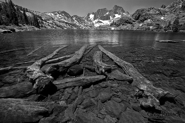
After eating breakfast and packing up, we headed down the trail to Shadow Lake, which is easily accessible as a day hike from Agnew Meadows.  We walked around Shadow Lake and headed on to Garnet Lake, which is a bit iconic, but still very pretty.  Garnet Lake offers fantastic views of  the northern Ritter Range, especially Mt. Ritter and Banner Peak.  I thought some submerged logs in Garnet would make a great foreground for this image.

Garnet lake and submerged logs, Ansel Adams Wilderness, California

Garnet Lake, July 2010

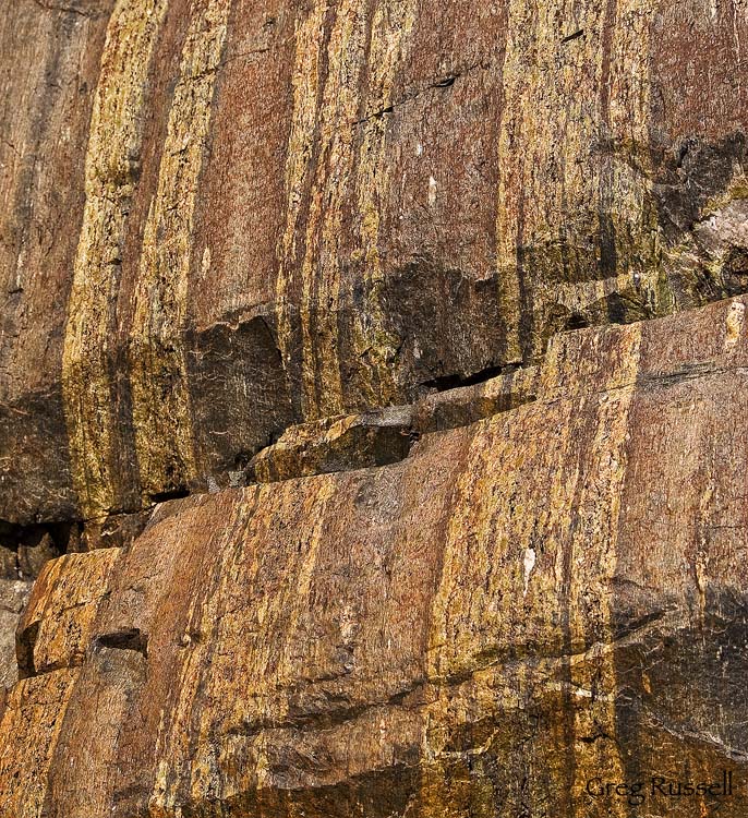
At Garnet Lake, I also found a great example of what can happen if you look underfoot.  The rocks here were fantastic, and had gorgeous bands of what I think is olivine (maybe serpentinite?) embedded in them.  I couldn’t help but photograph these rocks.  I used Tony Kuyper’s luminosity masks to really make the colors glow.

olivine

Garnet Lake Rocks, July 2010

We would continue on to Thousand Island Lake to spend the night.  That’ll be the subject of my next blog entry.  In the meantime, check out all of my Sierra Nevada photos by clicking here.

Minaret Lake

Tuesday, August 3rd, 2010

“To the south of Mount Ritter are some grand pinnacles of granite, very lofty and apparently inaccessible, to which we gave the name of ‘the Minarets.'” –California Geological Survey, 1868

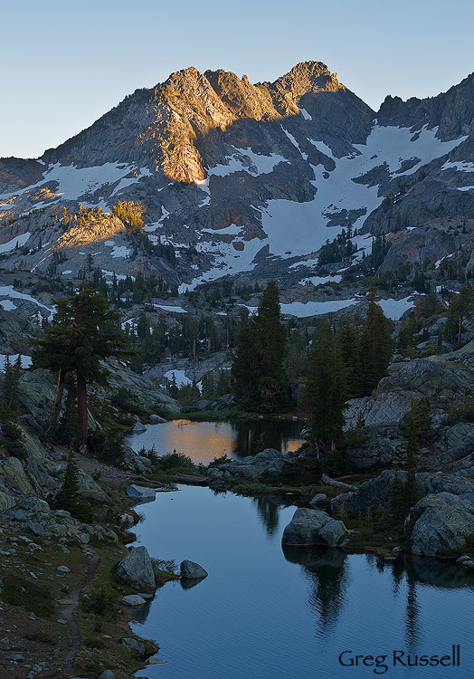
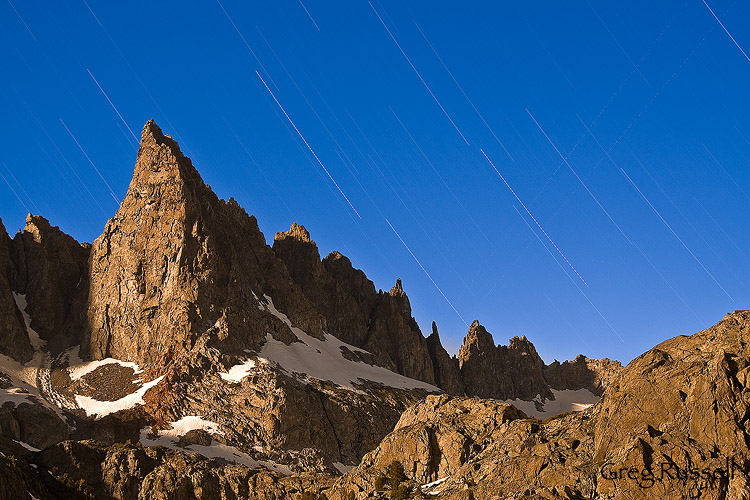
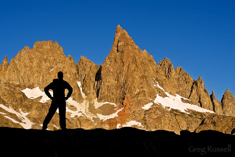
I’ve always loved the view of the Minarets from Minaret Summit, behind Mammoth Mountain.  When the opportunity came up to hike into Minaret Lake, at the base of these fantastic spires, I jumped on it.  The Minarets are an arête, a high, thin ridge formed when two glaciers work toward each other, back to back.

The hike into the lake is somewhat demanding, gaining about 2200 vertical feet over 7.8 miles.  We arrived in Mammoth about 1pm, and after catching the shuttle to Devil’s Postpile National Monument, we were able to hike into the lake by 7pm.  Unfortunately, we weren’t able to spend much time, as this was a spur trip from our goal of hiking the last 1/3 of the John Muir Trail.  We had to leave again by 9am the following morning, giving me time to photograph only one sunset and sunrise.  I would have liked to spend a few more days at this location alone!

Minaret Lake, Ansel Adams Wilderness, California

Minaret Lake evening, July 2010

Minarets, Ansel Adams Wilderness, California

The Minarets at night, July 2010

Minarets and hiker, Ansel Adams wilderness, California

Self-portrait, Minaret Lake, July 2010