locations

...now browsing by category


Donating to Navajo-Hopi COVID-19 relief

Friday, May 29th, 2020

In mid-April, Jackson Frishman and I launched a print sale in an effort to support the Navajo and Hopi tribes during the COVID-19 pandemic. We each offered a selection of prints for sale, with the net proceeds being donated entirely to an already successful GoFundMe.

Donating to the Navajo-Hopi COVID-19 relief fund.

The fundraiser was more successful that I could have imagined; thanks to you we were able to donate $1525 to the GoFundMe, which has raised over $4.4 million dollars so far. This money will be able to provide basic necessities to families on the Navajo and Hopi reservations who have been extraordinarily hard hit by the COVID-19 pandemic.

This part of the country holds a special place for both Jackson and myself. The landscape is beautiful, and so are the people. We’re both sincerely grateful for your purchase; together we were able to help a little for people who mean a lot.

Tones monochrome image of large sandstone towers in Death Valley.

2016 year in review

Monday, December 26th, 2016

As I write this, Christmas is only a couple of days away, rain is falling outside, and I’m putting together my favorite photos of the year feeling a bit of disbelief that another trip around the sun has already passed. In many ways, the past twelve months have represented contrast, a dichotomy. The world lost several great and inspiring artists this year, but I feel lucky to have discovered new artists who are a source of inspiration. Another contrast is the current state of division that the United States is ending the year in, but personally I feel more complete–less divided–that I’ve felt in quite some time.

Photographically, 2016 was one of contrasts as well. My travels between the desert and the coast really underscored this; two dramatically different landscapes, have–in their own way–become home to me. I finally put together a small (but growing) portfolio of ocean images this year, and of course expanded my portfolios of the deserts and mountains. Of course, in addition to new friends, I was able to enjoy these places with old friends. My girlfriend and I enjoyed several camping trips along the California coast, and I got to introduce her to some of my favorite desert landscapes. A couple of great backcountry trips with Jackson Frishman helped to strengthen my affinity for Great Basin landscapes.

To that end, contrast has certainly been a theme this year as I chose my favorite images for this annual year-end retrospective. I also have been thinking a lot about the role of landscape photography as art.  In 2016, it became more apparent to me the threats that face public lands (see my blog posts here and here), and producing art that changes the way people see the world seems more important now than ever. My friend Mark Hespenheide’s artist statement continues to resonate with me in this regard:

“Mediocre landscape photography can only reinforce the ideas about nature that we already hold. Good landscape photography can introduce us to new ways of seeing the world. Truly great landscape photography can change the way we perceive our place in the world and the way we interact with the world.”

May we all produce a truly great body of work in 2017.

bosque del apache snow geese fly in

Snow geese at dawn, Bosque del Apache NWR, January


montaña de oro beach

Montaña de Oro, California, June


Sunset in western Nevada

Sunset in western Nevada, January


navajo national monument sunrise

Sunrise in northern Arizona, August


Wildflowers in Death Valley, January


jalama beach sunset

Pacific Ocean sunset, June


Escalante River Sunset

Sunset over southern Utah, March


Clouds and fog in the San Gabriel Mountains at sunset

San Gabriel Mountains, November


winter storm and dark clouds over the salt playa in columbus valley nevada

Winter storm in western Nevada, January


white pine mountains sunset

Sunset in eastern Nevada’s White Pine Mountains, August


black and white image of the funeral mountains in death valley national park

Storm in Death Valley, January

Past images of the year:

2010 | 2011 | 2012 | 2013 | 2014 | 2015

Photography and our Public Lands

Friday, November 18th, 2016

Over the last several weeks, we have been reminded of very real threats–or at least dangerous precedents set–to the Western landscape, and to American public lands in general. First, all defendants in the 41-day standoff at the Malheur National Wildlife Refuge in Oregon were found not guilty of charges of federal conspiracy and gun charges. Less than two weeks later, the United States presidential election resulted in a Republican-controlled presidency and congress, leaving federal public lands at greater risk for fossil fuel development, or even return to state control.

For anyone concerned with the preservation of wilderness, our cultural landscape, or simply the health of future generations, neither of these occurrences should set well.  Together, they’ve been keeping me up at night. Reconciling all of this news is no small task.

black and white image of the funeral mountains in death valley national park

“I want people to remember how photography works, the medium that depends on perfect darkness within the camera to capture the image, for an image of boundless light would be purely black, an exposure in perfect darkness would show just the white of unexposed paper. The visible world depends on both.” -Rebecca Solnit | Hugging the Shadows

Finding purple in a sea of blue and red

Last week, shortly after the election, I had a conversation on social media regarding the proposed Bears Ears National Monument (which I have written about before). Although I have some hesitation about the Bears Ears region being designated a National Monument, it really is the perfect candidate for protection under the Antiquities Act, although a longtime friend disagreed. While we had opposite opinions, our underlying concern for the region is the same: both of us would like to see it remain as pristine as possible. While our sedimentary layers may be different, we are standing on the same bedrock.

Looking at election maps from last week, there appears to be a deep divide in ideology between rural and urban areas, however I’d like to think we’re more purple than red vs. blue, and that the bedrock most of us are standing on is the same. Indeed, if you look at the role public lands played in western elections this season, it is clear we value our public lands.

Looking forward, I have questions.  Is it possible to search for common ground, while at the same time not compromising core values? Can we find a common currency for the value we attribute to public lands? Perhaps, more importantly, what can photographers do now?

winter storm and dark clouds over the salt playa in columbus valley nevada

Working locally, reconnecting to place

There are a few resources out there for having the conversations that are sure to happen more frequently in coming months (this is a great one). One thing they all seem to mention is to talk about feelings, rather than facts, at least to start with. As a scientist, I think, “but the facts are all that matter!” but as an artist, I get it. Art, including landscape photography, has the power to change the way people look at their world. There’s been some debate about whether artists can or should be activists or whether art should exist independently, but my gut is telling me now is the time for us all to be activists. Share your work with as many people as possible. Create content, be heard.

I’ve lamented before that as a people we are woefully detached from place, so perhaps it is the job of artists to bring us back to that. Share your work locally. Every local in every town has stories to share about their “backyard”–tap into those stories and work to reconnect people with what may have been lost.

If anything, recent news is a reminder that our public lands–and the places we love to photograph–are in danger of becoming not-so-public, and should be a good reminder to us all to educate ourselves on local politics, and think of ways to use our photography to shift the tide towards a secure future.

Sunset in western Nevada

Bay of the Smoke

Tuesday, November 8th, 2016

In 1542, two Spanish ships led by Juan Rodriguez Cabrillo explored the southern California coastline.  When they arrived in either Santa Monica or San Pedro Bay (it’s unclear which one), they encountered poor air quality likely due to either smoke rising overhead from nearby Tongva villages, or from a Santa Ana Wind-fueled wildfire. They named the bay they arrived in Baya de los Fumos or Bay of the Smoke, for the lack of air quality.

Shaped by the Landscape

Nearly 500 years later, the greater Los Angeles basin is still known for its poor visibility and a nearly constant haze. Fires perhaps aren’t as prevalent as they once were, and the villages have long since been bulldozed and replaced with a megapolis of concrete, home to millions of people. Myself included.

Southern California’s topography is a major contributor to our poor air quality. Cool air being pulled onshore from the Pacific Ocean, warm air being pulled out to sea from the deserts flanking the region, and a basin closed in by tall mountain ranges all make for a fairly strong inversion that will often trap clouds, haze, and (unfortunately) pollution at low elevations in the basin. The haze Cabrillo and his men described is still a dominant part of life as many as 260 days a year.

Clouds and fog in the San Gabriel Mountains of southern California at sunset


“During my California visit, I enjoyed the company of fine friends whose grace and lack of complaint in their surroundings made me feel awkward and cynical and even envious…At meals they spoke intelligently of early Burgundian oenological monographs. I explained drip irrigation. Sea air and the presence of many, many succulent green leaves beautifully hydrated their skin. I looked like a desert lizard. I age my organic arugula with my fingers, dopey and slow like one of those Jurassic leaf-eaters with the pin head and the body the size of a truck stop.” – Ellen Meloy, The Anthropology of Turquoise


Getting Above it All

Even after 14 years of living here, southern California has always felt a bit odd, if intriguing, perhaps in a way that Ellen Meloy describes above. I’m not entirely sure it’s Los Angeles’ fault so much as my own reticence to loosen my grip on my roots in the intermountain West. Fortunately, the nearby mountains make it relatively easy to put some altitude underneath yourself to get a breath of fresh air. In my last blog post, I mentioned the San Jacinto Mountains, which lie at the far eastern end of the basin.

Perhaps much more dominant on the Los Angeles skyline are the San Gabriels, one of the transverse ranges, running along the northern edge of the basin. Over the years, one of my favorite views of southern California has been to venture into the San Gabriels to look back down on the valley below.

View down the San Gabriel River Canyon from Blue Ridge in the San Jacinto Mountains of southern California

Despite the haze, Cabrillo described southern California as lush and green, with abundant wildlife. Much of that has been wiped clean by the growing metropolis (although there are efforts to bring it back), but it’s still possible to get acquainted the southern California that was by returning to the mountains. Last week, we made a quick trip up to the San Gabriels after work. The clouds blanketing the coastal plain were hitting the mountains and fragmenting, making for a great atmospheric light show. That, combined with waning fall colors on much of the vegetation at 8,000′ elevation, made it a great day out.

As the sun set and the horizon shifted from shades of orange to red to blue, the wind stopped and there was complete and total silence. For a brief moment, hearing the dirt crunch underneath my feet and the cold air bite my nose, I forgot that the megapolis was just a little further below still. For the foreseeable future, I’ll continue to try to find my place with the masses of the greater Los Angeles basin, but it’s comforting to know that within an hour, I can be high above it all, seeing–perhaps–what Cabrillo saw in 1542.

San Gabriel Mountains of southern California at Sunset,

Autumn in the San Jacintos

Thursday, October 27th, 2016

Autumn’s first real storm rolled into southern California last weekend, and we took a short walk in the mountains to enjoy the crisp air and some rain. Fortunately the rain didn’t last long and the short walk extended to about five miles, to the high point of one of the major ridges leading to Mt. San Jacinto, a dominant peak here in southern California. It was the perfect remedy for what’s been a busy autumn so far, complete with plenty of southern California’s signature traffic.

The San Jacintos are one of my favorite mountain ranges. They were formed as a block of granite was squeezed together by the San Andreas and San Jacinto faults, and the rock here is very similar to what is seen in the Sierra Nevada, albeit on a smaller scale. There are many trailheads that are easily accessible, and cross-country walking is relatively easy.  What’s more, no one really visits the difficult to reach trailheads, which is a major bonus.

Pines cones and pine needles

“No matter how sophisticated you may be, a large granite mountain cannot be denied – it speaks in silence to the very core of your being” – Ansel Adams

stormy mt. san jacinto

I hope you’re having a great autumn so far, no matter where your trails have led you.

New Gallery: Oceans as Wilderness

Wednesday, June 15th, 2016

As hard as it is for some people I meet here in southern California to believe, I didn’t see the ocean for the first time until I was 21 years old.  I had a summer job working for the U.S. Forest Service to do carnivore population surveys in the northern Sierra Nevada, and on a string of days off a couple of coworkers and I drove to Redwood National Park.  Just outside of Arcata, California was where I put my feet in the Pacific Ocean for the first time.

My first thoughts, in no particular order, were: “Good grief, the water is cold!”  “That’s a lot of water” “How are people surfing in this?” “I wonder how many sharks there are out there.”*  But mostly I just stood in awe at the immensity of the ocean.  I felt calmed by the waves almost immediately, the sounds, the smells.  It’s easy to see why oceans get the attention they do from writers, poets, artists.

Since that trip to the northern California coast, I’ve seen the Atlantic coast in Florida and Iceland, and explored California’s coast extensively.  And although I’ve moved to southern California, and I still don’t spend as much time with the ocean as I should.  However, every time I go, I feel the same way I did when I saw the Pacific for the first time; the youthful wonder I had then stays with me now, in a myriad of ways.

As a photographer, I have tended to focus on the landscapes I identify most closely with.  I grew up in the desert southwest, and continue focusing primarily on that area in my photography.  However, I can’t deny that the ocean has found its way into my daydreams, and I have finally decided that it’s time to add a portfolio of ocean and beach images to my website.

jalama beach sunset and pacific ocean

Oceans are critical to the health of the planet, and comprise more than 70% of the earth’s surface.  In addition, less than 5% of the world’s oceans have been explored.  There are species we have not yet discovered, ones we know very little about, and ones we’re about to lose (or have lost).  To this end, oceans are truly a wilderness, one we should treat with as much respect as our terrestrial home.

montaña de oro beach

I hope you enjoy the portfolio; it’s a growing set of images that I’ll add to as I make what is sure to be more and more trips to the beach.

*When I was little I had a more than a mild obsession with sharks, so that has always stuck with me to some extent.

Guest post: Finding Grounding in the New Year

Wednesday, February 10th, 2016

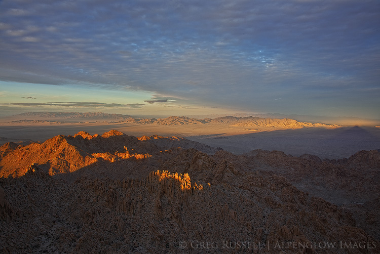
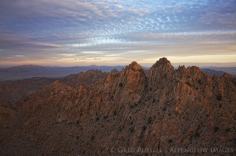
It’s been a while since I’ve had a guest post on my blog, and this is really more a cross-posting than a guest post, but I’m honored to have Dawn Chandler’s essay here nonetheless.  Dawn is a long-time friend from New Mexico and I asked her to post this blog post as a follow up to my own Bosque del Apache images, partly because I can’t get those birds off my mind, partly because I wanted to share another artist’s perspective of the Bosque, and partly because I really admire her art and have been looking for an excuse to post some of it here.  So many thanks to Dawn for allowing me to share.  You can see more of Dawn’s artwork here.  


finding grounding in the new year

I never would have thought I’d find grounding in the sky; in flight.

This new year loomed for me with a feeling of. . . . . . lack of focus? Imbalance?
My birthday is in the week between Christmas and New Year’s—a weird time when I always feel kind of in limbo, what with a sort of post-Christmas deflation coupled with contemplation about the year’s end, and uncertainty of what the new year may bring.
This winter in particular, coming onto my 51st birthday and flipping through my new 2016 calendar, I felt oddly vulnerable by the blank pages, the lack of plans. I felt a little lost in the shadow of such big accomplishments and huge travel last year. In a rare wave of uncertainty, I felt unsure where to place my focus, both in my studio and really kind of life in general. This wasn’t a sharp uncertainty, but more a kind of sluggishness.

We—[My Good Man and I]—had plans to travel over my birthday and New Year’s, but the voice of frugality (which sounded uncannily similar to my dear late mother’s) whispered to me, and so with much disappointment I cancelled those plans.
But I like doing something special on my birthday, to make the day stand out. And so, Plan B.

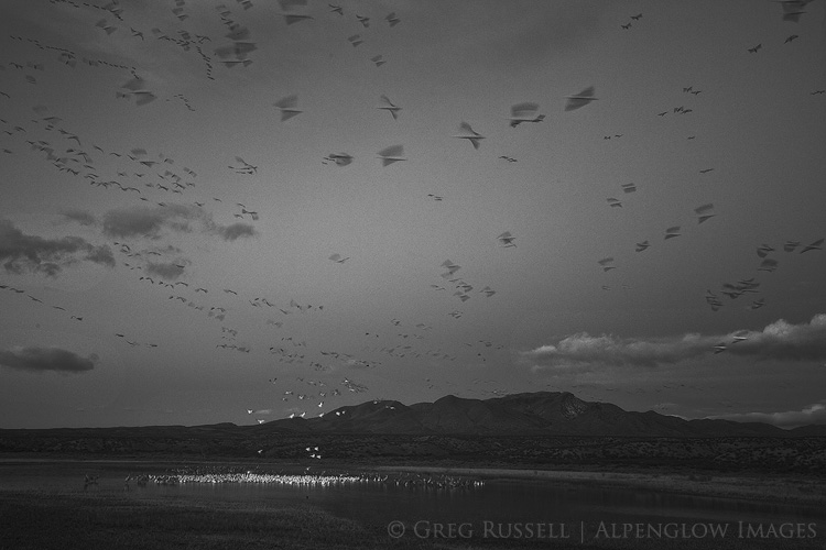
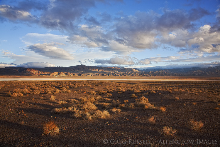
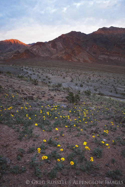
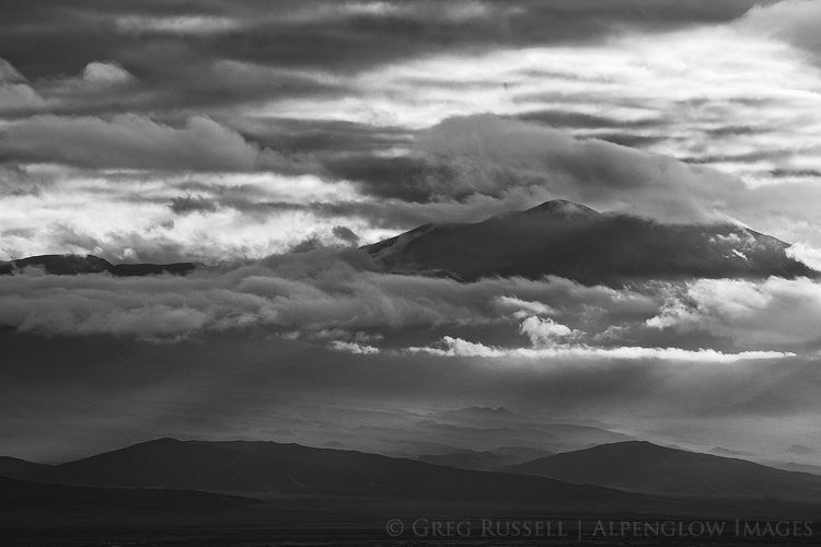
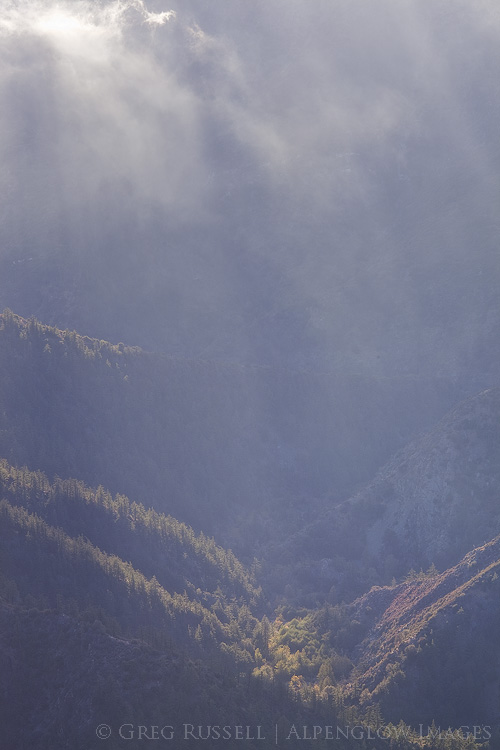
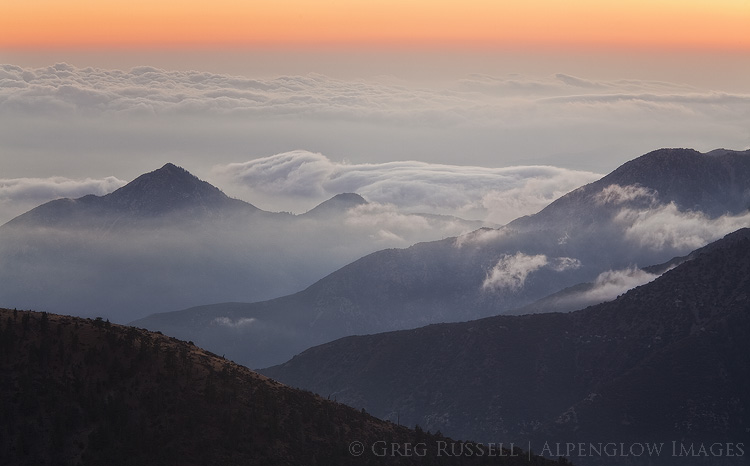
We rose in the wee hours of the morning on My Day and headed down to the Bosque del Apache National Wildlife Refuge, some 100 miles south of Albuquerque. Established in 1939 and comprising some 57,000+ acres on either side of the Rio Grande south of Socorro, ‘The Bosque’ is the wintering ground of thousands migratory birds, especially snow geese and sandhill cranes.

I like birds, and always have. My mother used to feed them back in our New Jersey home with an almost religious fervor. If ever there were a question of who to feed first during a blizzard—her own children or the birds—she very well may have chosen the birds (fortunately her loyalty was rarely tested on this). She tended several feeders in our yard, including a beautifully crafted wooden one that sat front and center in a dining room window—a handmade gift from my father in the early years of their marriage. Nearly every meal of my childhood was spent in the company of birds dining on the other side of a thin pane of glass or veil of screen.

But I don’t think I ever really saw birds until a few weeks ago when the sandhill cranes of the Bosque glided into my awareness.

And now I’m infatuated.

I don’t know, but it was as though there was this tiny shadowed corner of my being that I didn’t even know was there, but when I witnessed these graceful, elegant birds soaring, gliding, cooing and flying close overhead, that shadowed corner in me suddenly became illuminated with pure joy.

And so we returned in January, again…and again…and again, making a total of five excursions to the Bosque, two by first light, three by last.

Because all I can think about now are birds—about cranes especially—and their movements and their staggering journeys.

4,000 miles.

That’s how far the sandhill cranes will travel this spring.

Think about that.

From New Mexico to the northern most reaches of Alaska and Canada. Some even fly from Mexico to Siberia. SIBERIA!

They can live 20 years or more in the wild.

They mate for life.

And in some western states in the US, it’s legal to kill them for sport.

~

~ ~

I’m kidding, right?

~ ~

~

I wish I were.

~

~ ~

The first book I read this year is Sandhill and Whooping Cranes: Ancient Voices Over America’s Wetlands, by Paul A. Johnsgard. This paragraph—like every crane I’ve had the joy of observing—takes my breath away:

Considering the incredible hardships that lesser sandhill cranes must undergo to complete their epic spring migrations, to raise chicks under the most severe environmental conditions, and to accompany them back [thousands of miles] to traditional winter grounds while enduring a threat of gunfire from Alaska to the southern United States or Mexico, one must wonder about the humanity of people who think that killing cranes can possibly be sporting.

Well, I’m bringing those cranes who have been shot back to life, if only with paper; if only with paint.

a flock of five origami cranes, crafted by dawn chandler

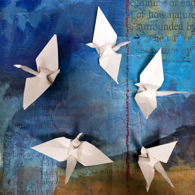
The cranes and snow geese and hawks and so many winged spirits of The Bosque are converging in great flocks in my studio, some in flicks and flecks of paint, some in inky calligraphic swirls, still others in folds and creases.

'bosque morning rising' ~ by dawn chandler ~ oil on panel ~ 12" x 24"

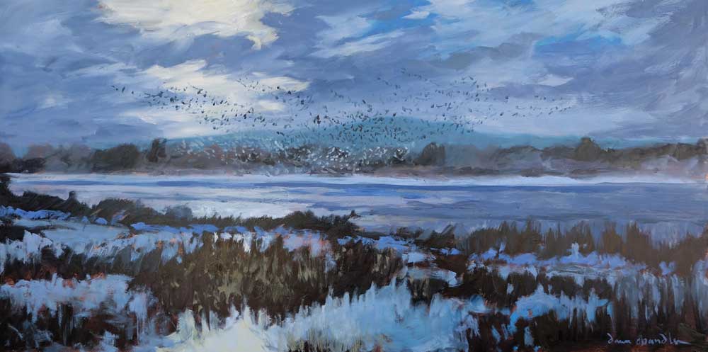
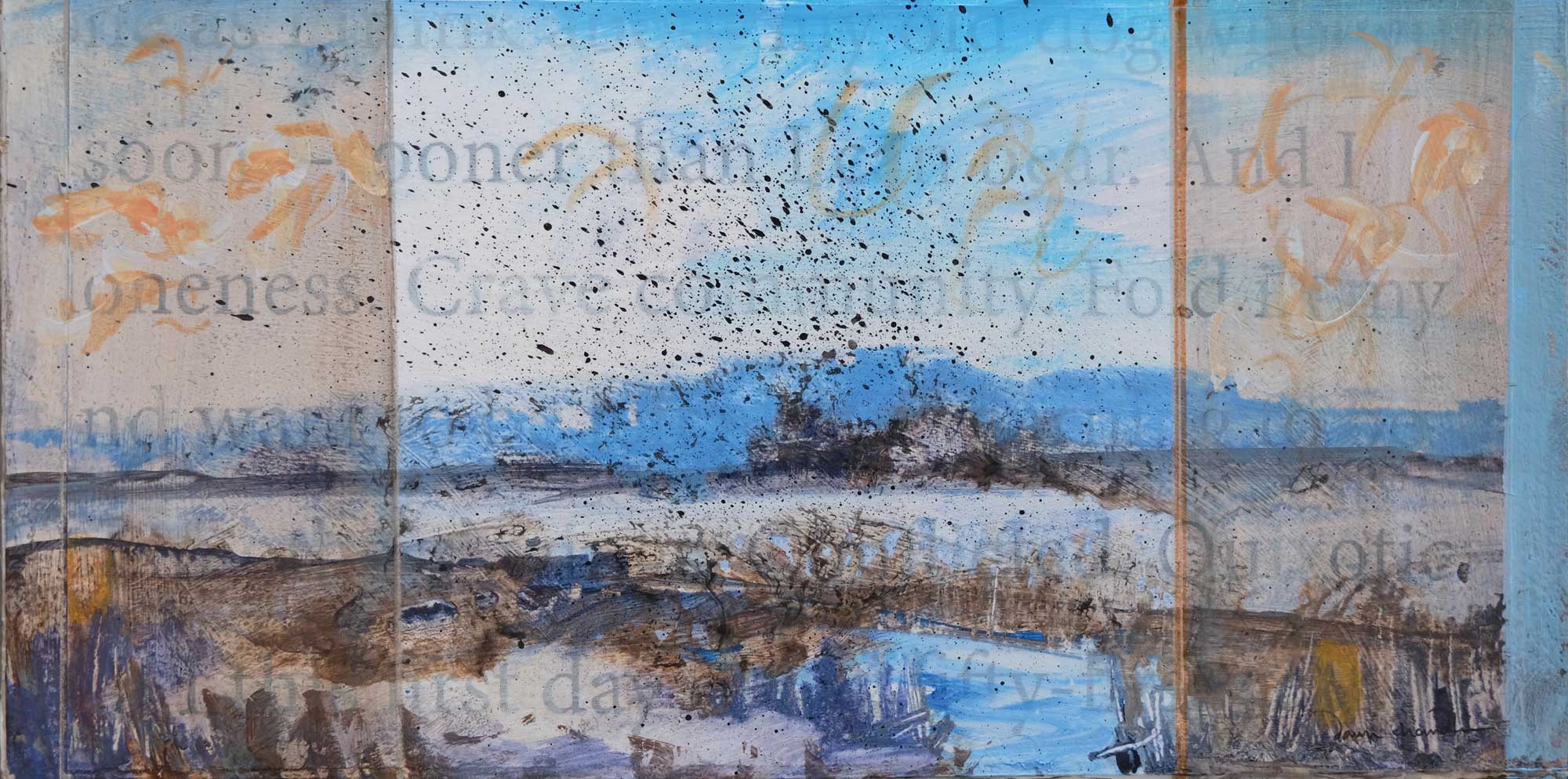
‘bosque morning rising’ ~ by dawn chandler ~ oil on panel ~ 12″ x 24″


three origami cranes, crafted by dawn chandler


'finding community' ~ by dawn chandler ~ mixed media on panel ~ 6" x 12"

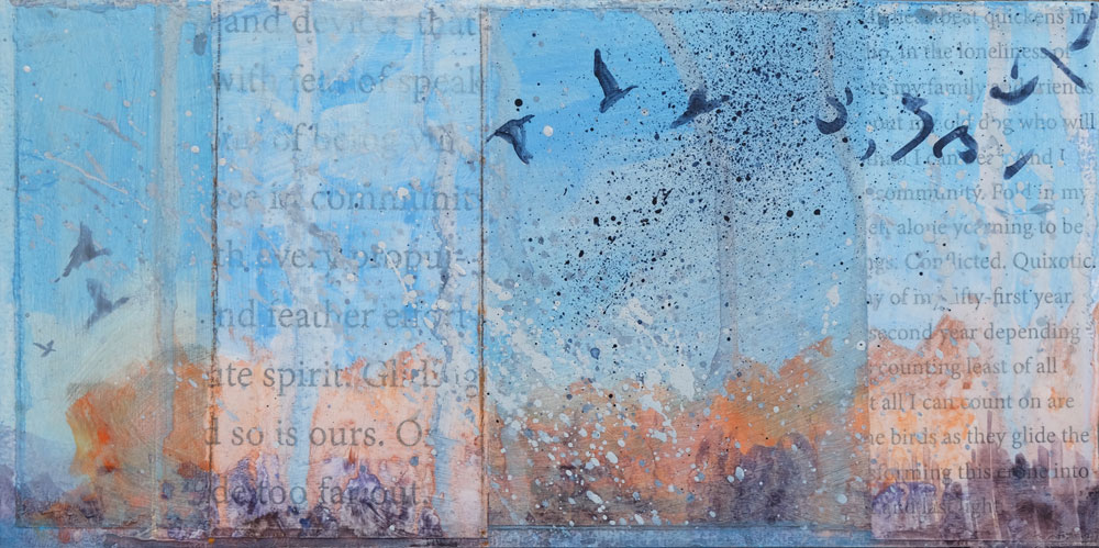
‘finding community’ ~ by dawn chandler ~ mixed media on panel ~ 6″ x 12″


'our spirits gliding' ~ by dawn chandler ~ mixed media on panel ~ 6" x 12"

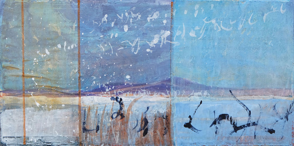
‘our spirits gliding’ ~ by dawn chandler ~ mixed media on panel ~ 6″ x 12″


'evening dawns' ~ by dawn chandler ~ mixed media on panel ~ 6" x 12"

‘evening dawns’ ~ by dawn chandler ~ mixed media on panel ~ 6″ x 12″


'as they soar' ~ by dawn chandler ~ mixed media on panel ~ 6" x 12"

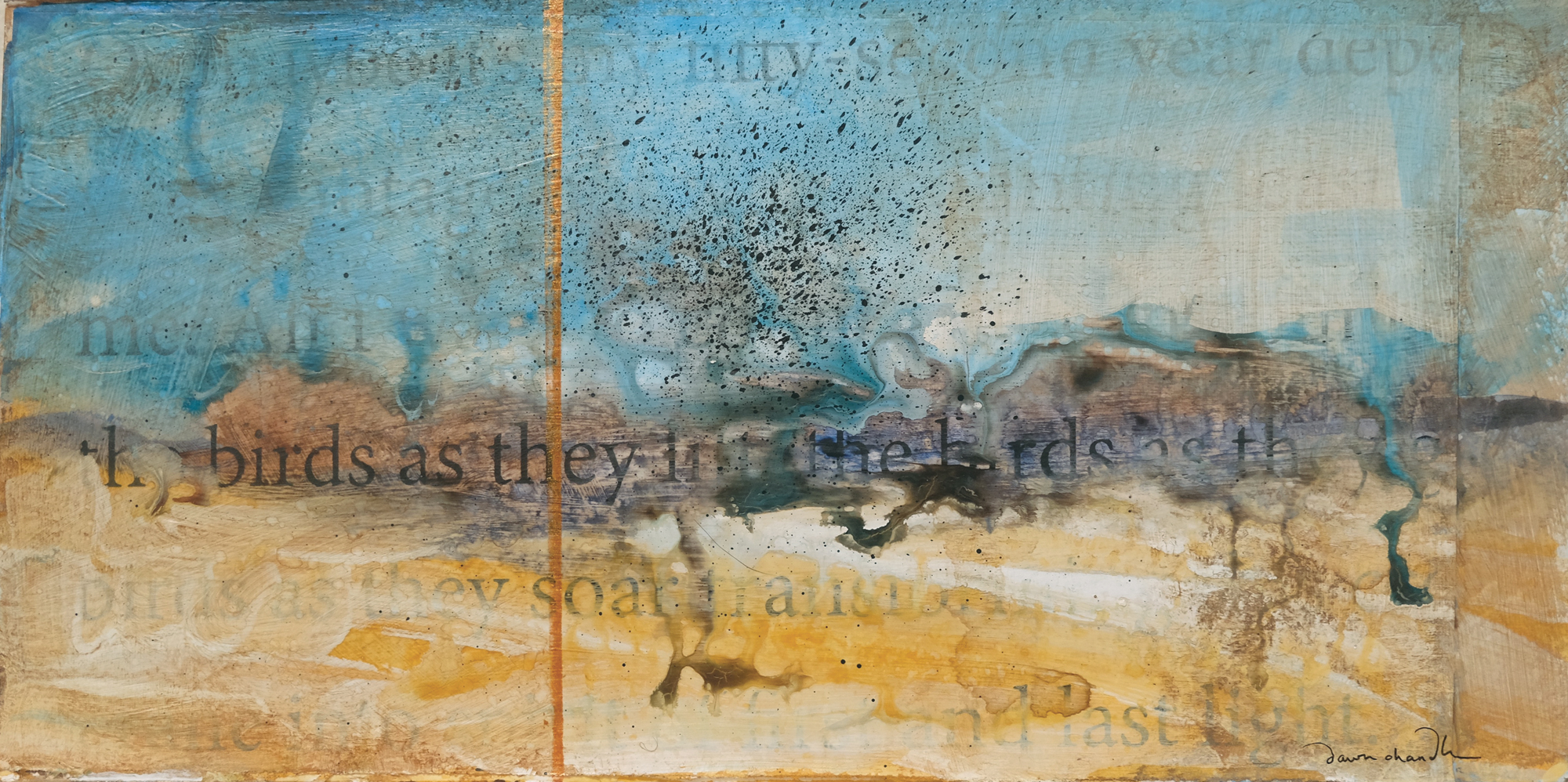
‘as they soar’ ~ by dawn chandler ~ mixed media on panel ~ 6″ x 12″

But of all the birds I’ve observed this winter, it’s the cranes who keep haunting me. . . .
Many cultures revere the crane as a symbol of good fortune, prosperity and peace. And yet the peace I find when I think about and observe these majestic beings leads me to understand that they are more than creatures, more than a symbol.They are peace in motion. And they’re moving across the pages of my calendar, the pages of my art, deep into my new year.

I can hardly wait until November, when they soar back to New Mexico, grounding me again.

~  ~ ~ ~ ~ ~ ~ ~ ~ ~

To see more of my photos of the Bosque del Apache National Wildlife Refuge, check out my Instagram account at instagram.com/taosdawn/ as well recent posts at the Travel New Mexico instagram account at instagram.com/travelnewmexico/

Chaos Theory

Saturday, January 16th, 2016

In walking around southern California, I notice many people are starting to doubt the legitimacy of the rain this record El Niño was said to bring us.  Fair enough…we’ve had only one honest storm so far, but meteorologists say it is really just starting to come into its own. Despite not rearing its head too badly yet here, much of the Sierra Nevada is already at 100%+ of snowpack, and wildflowers are starting pop up in the desert.  More on that in a minute though.

At the end of fall, right before Christmas, I made a quick trip to the Grand Canyon.  While there, I got to experience a fairly stormy day on the south rim, complete with howling winds, whiteout conditions and closed roads.  A couple of images from that trip easily made my Favorites of 2015.  Then, Jackson Frishman and I headed to Death Valley National Park, and the weather was equally spunky.  There was no snow in the valley, but there was plenty of rain, great clouds, and even a few surprises thrown in along the way.

Visiting the Grand Canyon and Death Valley so closely together in time is sort of a surreal experience.  As if I had lost it, I quickly regained my appreciation for deep geological time.  Nearly 75 million years ago during the Laramide Orogeny, the Colorado Plateau was pushed upward nearly two miles and the Colorado River (which flowed from the newly formed Rocky Mountains) started to cut into the rock, forming the Grand Canyon.  Today, the river has cut about as deeply as it can go–to the basement Vishnu Schists–giving us a look back in time about 1.7 billion years.

Death Valley’s geologic story is a bit more complex (and violent), but as the Vishnu basement rocks in the Grand Canyon were being formed, Death Valley was already in a state of unrest, with rocks in certain areas being twisted and folded.  One area of particularly complex folding has been dubbed the “Amargosa Chaos” and is found in the southern end of the Black Mountains.  Fold, fold, fold…then separate.  That’s how the Basin and Range Province creates its mountain ranges–plates are pulled apart until they tilt upward creating massive mountain ranges with deep valleys between them.  In this part of North America, as John McPhee writes, the continent is literally being pulled apart.

You also start to understand a scale of spatial immensity in these two places.  While the Grand Canyon is typically thought of as the “deep” canyon at around 6,000 feet, it’s got nothing on Death Valley, which is over two miles deep (at its deepest).  If you’re not interested geology (I know…how can you not be?), it might be just as easy to stand in awe of both of these places, allowing yourself to feel small, both as a part of the landscape, and as barely-a-blip in geological time.

It’s worth noting briefly that while spring on the Grand Canyon’s rim is a few months off, it’s already happening in (especially) the southern end of Death Valley.  Jackson and I saw fields of Desert Gold (Geraea canescens) that created a wonderful lace-work pattern among the volcanic rocks in the southern Black Mountains.  All of the other usual suspects were starting to bloom as well, but are several weeks off from peak.  Hopefully some dreary, drizzly conditions continue in Death Valley, and it’s got the possibility of becoming a very good year for wildflowers.  Jackson has several photos and more commentary on his blog as well.

A winter evening at the south rim of the Grand Canyon

Death Valley mountains and wildflowers

Stormy winter morning on the south rim of the Grand Canyon

Salt Creek Hills, Death Valley

Long-distance relationships

Thursday, June 4th, 2015

“Sense of place is the sixth sense, an internal compass and map made by memory and spatial perception together.” — Rebecca Solnit


Over the last several years, I’ve devoted much of this blog and my photographic efforts towards the Colorado Plateau.  More so than even the results I’ve shared here, I’ve devoted time and experience to the Plateau; no place I’ve visited has given me a more of a feeling of calm than that landscape of sinuous canyons, sandstone mesas, and petrified sand dunes.  That’s why I return year after year without fail; every time I go back I hear my bones say, “I’m home.”

I feel that the resulting images from my time spent on the Plateau are purpose-driven, grounded, intimate, and unique.  As an individual, no one else can see things quite like me, and I want my portfolio to reflect my own way of seeing.  Just like with any relationship, time has been invested to get to know the Plateau, as well as a few cactus pricks, scrapes, and bruises.

Because of my approach to photography, I’ve never been great at walking into a place for the first time and being comfortable making images.  I almost always experience some intangible awkwardness during the process.  How does place-based landscape photography translate to travel to distant locations, where a great distance has been traveled and the unlikelihood of ever returning again is small?  I recently found myself asking this question when my girlfriend and I ventured to Iceland for my first big trip away from the Southwest.  Tourism in Iceland has exploded in popularity over the decade or so, and I wanted to avoid making copies of everyone else’s images; I wanted to see the country with fresh eyes.


Stormy mountain scene near Vik

Planning an appropriate itinerary is key.  While it’s tempting to want to see everything, that is not conducive to thoughtful landscape photography.  We picked out three or four places that we considered ‘must-see’ locations and planned around them.  Anything more would have been difficult or impossible given the amount of time we had.

In concert with the logistics, I had to ask myself, “why is this a must-see location for me?”  Presumably the idea of it spoke to me in some way, so I proceeded to learn more about these places.  Iceland, like many European countries, has a rich history, so spending time to learn the stories of the places I wanted to visit helped me to tell the stories with my images.  Knowing the story behind many of the Icelandic sagas helped me to understand the culture and people, and reading about the geology of this ever-changing island also helped give me a sense of place.  As always, I had a map out as I did this, allowing me to connect the landscape with the stories.

Seljalandsfoss Waterfall

Being able to go back to Iceland would probably be of great benefit to me photographically.  However, the work I did before leaving home made me feel as though I had a connection to the place before ever setting foot there, which–in my opinion–made the photography that much more productive, enjoyable, and meaningful.  People and places make up the topography of our lives; the result is not much different than a landscape, with valleys and peaks, sunrises and sunsets.  My internal compass will always calibrate toward the Colorado Plateau and Southwestern United States, but I came home from my first international trip understanding that it is possible to connect with a place even if I may never visit again.

See all of my Iceland images here.

Reynisdrangar sea stacks

Jökulsárlón Lagoon

Chasing Set

Saturday, March 7th, 2015

“You will then…quickly discover the music and poetry of these magnificent rock piles…each and all are the orderly beauty-making love-beats of Nature’s heart.”  — John Muir


Every so often a place will catch my eye and after just a little research, “Hmmm that place looks interesting!” turns into a bit of an obsession. This is probably why I’ve always liked maps so much: I can imagine what a place is like, and after I’ve been there, I can mentally put individual rocks and trees on the contour lines.  This obsession isn’t driven so much by photography, but by how remote and unvisited it is.  There’s something calming about unplugging and getting far, far away.

I’ve had my eye on the Coxcomb Mountains, a small but surprisingly imposing mountain range near the California-Arizona border, for a little over a year.  After they caught my eye, I started reading the few trip reports I could find, trying to correlate them with topographic maps.  In late January a friend and I made a long day hike into the range, and it was exactly what I’d hoped for: no trails, no sound, and no easy access point.  I returned a couple of weekends ago for an overnight backpack.

Coxcomb Mountains Sunset

The mountain ranges in the Southwest deserts are basically very big piles of boulders–the Coxcombs rise over 3,000′ from the bajada.  Their canyons are choked with rocks and boulders that have come down from the high peaks during floods and winter freeze-thaw cycles.  There’s a special kind of chaos here in the desert, and after being in places like this, it’s no wonder that in Egyptian mythology Set is the god of both the desert and chaos.  Making a coherent photograph out of the disorder would require me to climb to one of the high points in the Coxcombs to confront Set on his terms.

Sunset on Dyadic Point, Coxcomb Mountains

There’s no available water to speak of in the Coxcombs, so I spent only one night, hauling in about six liters of my own water.  After a four-mile hike across the bajada, I started working my way up a canyon, towards Tensor Point, one of the three high points in the Coxcombs that make up “Aqua Peak.”  The panoramic view from the top is impressive, and one can see the San Bernardino Mountains nearly 100 miles to the west, as well as ranges that stretch into Arizona.  Additionally, the views of the Pinto Basin, in Joshua Tree National Park, are outstanding.

After sunset, I spent a couple of hours with a somewhat pesky deer mouse, and finally fell asleep.  I woke up the next morning with no deer mouse but with a thick blanket of clouds.  After breakfast, I packed my gear up and arrived at the car just about the time rain started to fall on the desert in earnest.

I’ve never had much luck making any sense of the desert’s jumbled boulder piles in a photograph.  While they’re beautiful to look at, they’ve never translated well to photographic compositions for me.  Being on top of Tensor Point allowed me to step back from that chaos and compose images that seemed to make it all fall into place.  After a nine mile cross country hike through boulder piles and thick cat’s claw, I realized that maybe to make sense of the chaos, you must fully immerse yourself in it.