The Orocopia Mountains are another of the desert wilderness areas in Riverside County. Designated in 1994 as part of the California Desert Protection Act, this wilderness protects unique plant species and has an interesting geological history.

Geology of the Orocopias
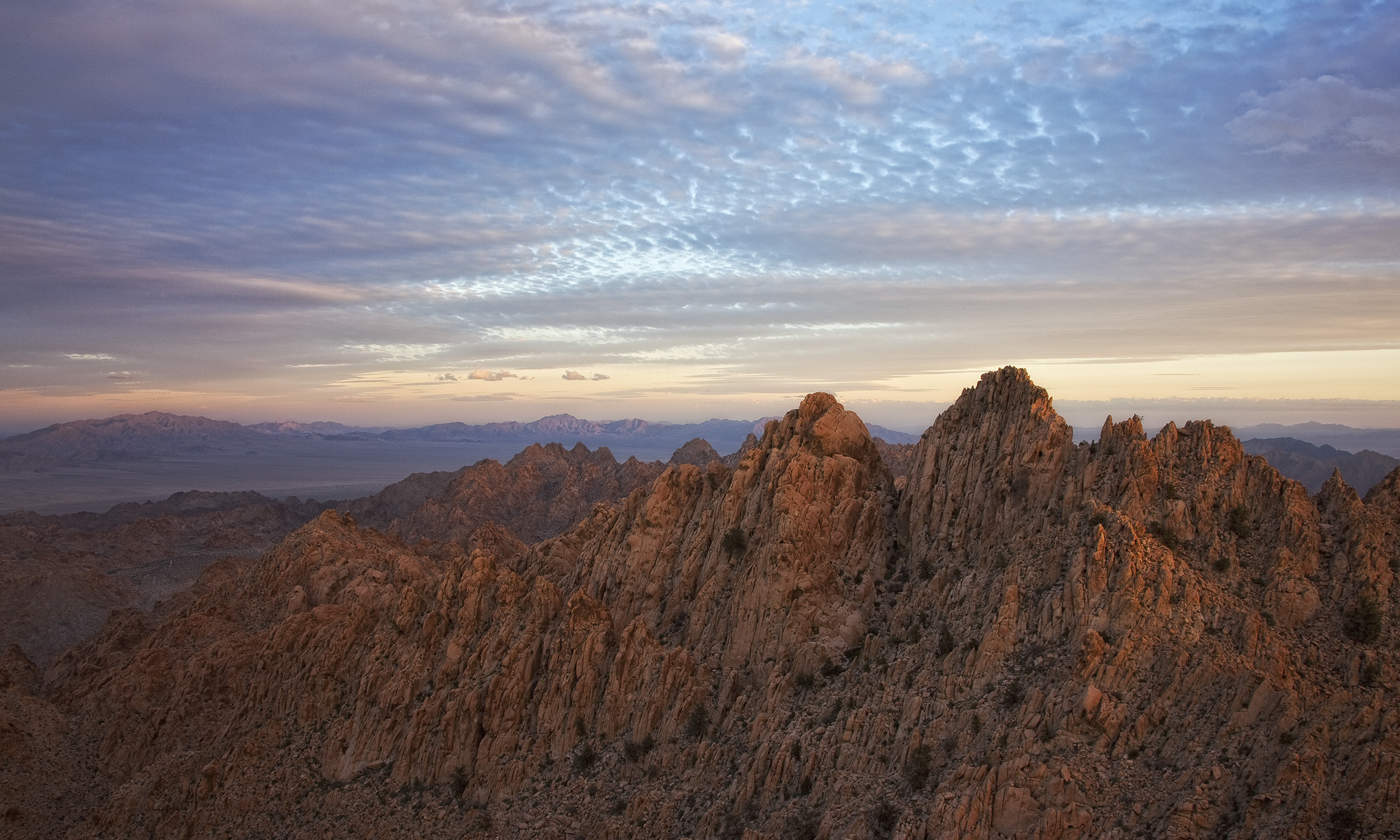
The Orocopia Mountains Wilderness is located just to the east of the Mecca Hills Wilderness. The Mecca Hills are a far more popular hiking destination from the Coachella Valley though. Like the Mecca Hills, the Orocopias sit more or less right on top of the San Andreas Fault, which separates the North American from the Pacific Plate. In 1940, the Orocopias were the site of a magnitude 7.1 earthquake that killed several people in El Centro. In the late 1970s, a magnitude 6+ earthquake also impacted the same area.

I hiked into the Orocopias from the I-10 corridor, and after passing the Wilderness Area boundary, almost immediately lost any sign of other human disturbance. There were no footprints, no artifacts (cans, etc., from mining operations), and–surprisingly–no trash. Given the terrain, it was easy to see why. The Orocopias are very steep, and made of rough Orocopia schist (see sidenote below).

The composition and assemblage of Orocopia schist closely matches that of Pelona schist in the San Gabriel Mountains, which are about 250km west of the Orocopias. This similarity was used as one of the first reference points mapping movement of the San Andreas Fault in the 1950s. The Orocopias were also a geologic field training site for multiple Apollo moon missions in the late 1960s and early 1970s.

It’s more than just rocks, though
Located in the Colorado Desert, visitors from nearby Joshua Tree National Park won’t find any Joshua Trees, but there is plenty of ocotillo and other plants. Springs hidden deep within the Orocopias provide water for California’s only native fan palm. In addition, this wilderness area is home to Orocopia sage, Alverson’s foxtail cactus, Orcutt’s woody aster, and the Mecca aster.


Bighorn sheep, desert tortoise, and burro deer also live in the Orocopia Mountains. With the rich biological diversity found here, it is no surprise this was identified as an area worth protecting. The Bradford Trail runs along the south side of the wilderness and multiple jeep trails create a somewhat noncontiguous wilderness area. But overall, the Orocopias receive relatively little visitation, thus keeping the integrity of this wonderful wilderness area intact.

(Sidenote: As I was researching this wilderness area, I found reference to it on a dog-friendly wilderness site. It appeared to be a website that uses bots to farm data from other websites because it was relatively poor in terms of information. Because of the nature of the topography of this wilderness but more so because of the geology, I would NOT recommend the Orocopia as a dog-friendly area. I can see the schist tearing up the pads on a dog’s feet very quickly.)