For centuries, the Cahuilla People used trails winding through the Santa Rosa Mountains to move in and out of California’s Coachella Valley; these mountains were their pathway to the west. They shared those foothills with the largest herd of peninsular bighorn sheep in the United States. Today the sheep move up and down the steep eastern flank of the Santa Rosas following the availability of food. The Santa Rosa Mountains are truly the home of ancient paths.
The Santa Rosa Wilderness was established in 1984 as part of the California Wilderness Act of 1984. The law focused on areas all over the state. In addition to creating wilderness in Southern California, it helped cement a continuous 150-mile stretch of wilderness in the Sierra Nevada.
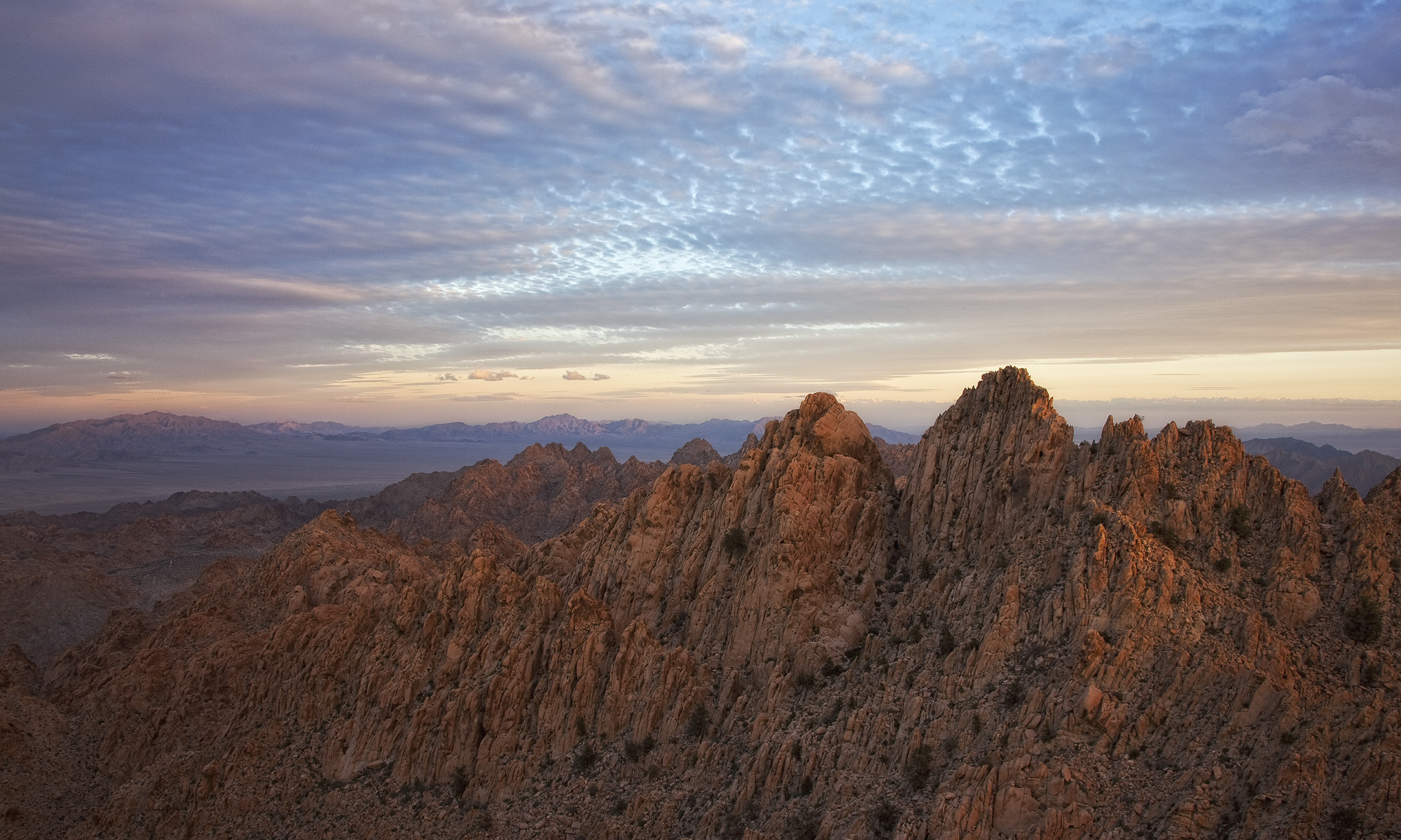
The Santa Rosas extend southward to La Quinta and San Diego County and are continuous with the San Jacinto Mountains. They create the northern Border of Anza Borrego Desert State Park. Rising from the Colorado Desert all the way to a high point over 8,700’ at Toro Peak, the Santa Rosas are a crown jewel of the sky island mountain ranges in Southern California.

The wilderness does not protect Toro Peak itself. However, the neighboring Santa Rosa and San Jacinto Mountains National Monument and the San Jacinto & South Fork San Jacinto Wildernesses help protect these peninsular mountain ranges. In addition to 19 endemic plant species, biologists estimate that around 60 peninsular bighorn sheep live in the Santa Rosas. Ovis canadensis cremnobates is a subspecies of bighorn sheep endemic to the peninsular ranges of Southern California and northern Mexico.


Because their steep rise in elevation, the Santa Rosas are one of the most botanically rich places I’ve visited. Over just a few miles, you can encounter sugar pines, cottonwoods, agave, piñon-juniper woodland, manzanita, and ribbonwood. The juxtaposition and intermingling of plant species is exquisite and often feels incongruous. The Santa Rosa Wilderness is a botanical garden, freely available to all.
The Colorado Desert ecosystem dominates the Santa Rosa Wilderness at lower elevations. Despite this, the deep canyons of the mountain range support perennial water sources that add to biodiversity.
The mountain pass between the Anza and Coachella Valleys was a trade route for the Cahuilla People between the coast and Lake Cahuilla. Lake Cahuilla was one of the largest inland lakes in California. It was created by a diversion of the Colorado River into the Salton Sink during the Holocene. Later, melting Wisconsian glaciers fed the lake. Although it disappeared in the late 1500s, Lake Cahuilla was a rich source of fish that indigenous people learned to trap in rudimentary dams. Water is life, especially in the desert.


Today, golf courses and master planned communities cover the landscape in the Coachella Valley. A hike in nearby open space often rewards visitors with glimpses into the inventive past of indigenous people. In addition to fish traps, petroglyphs, pottery shards, bedrock mortars, and other artifacts can all be seen on the remnant lakeshore of Lake Cahuilla. They remind us of the past and are a testament to the importance of these ancient pathways.