utah

...now browsing by category


Closed for business

Friday, January 25th, 2019

“If God does not exist, everything is allowed.” – Dostoyevsky’s Ivan Karamazov


If you’ve been following the news at all, you know that the US government is in the midst of the longest shutdown in its history. I have no interest in talking about the politics of it except to point out that the poster child of the shutdown has been our public lands, specifically our national parks. Trash, vandalism, and more in our popular parks have made national news, almost since day one of the shutdown. What should our land use ethic be when there is no regulating body present? Should we continue as if nothing has changed, or should we alter our approach?

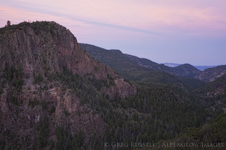
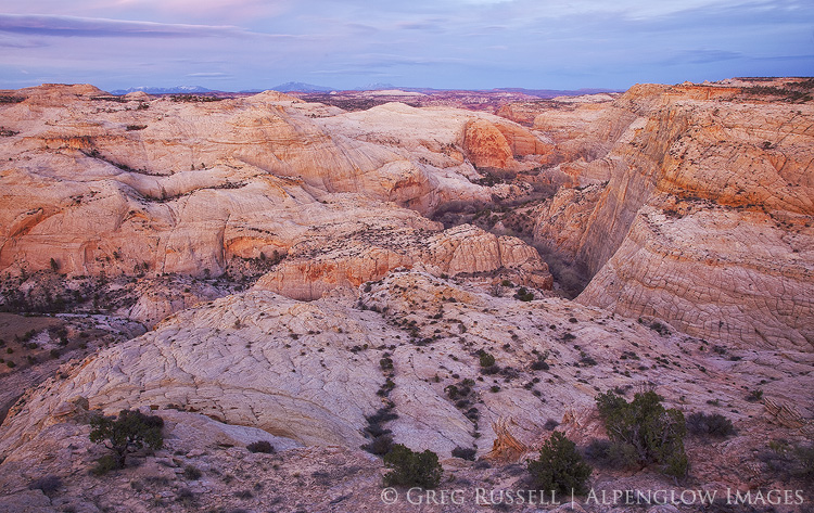
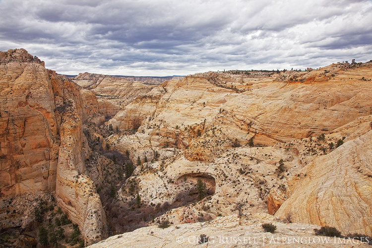
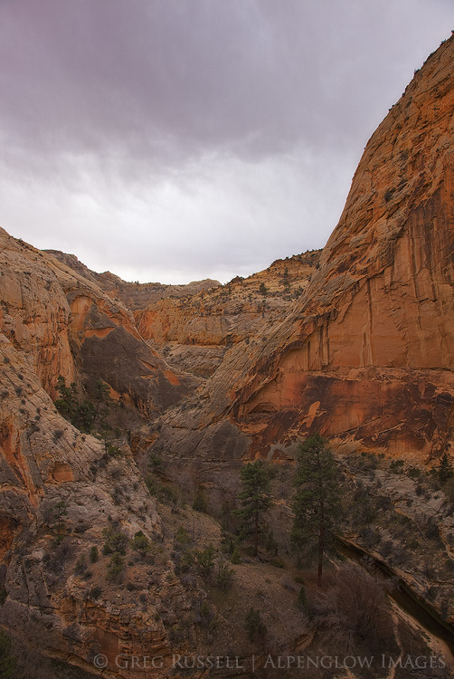
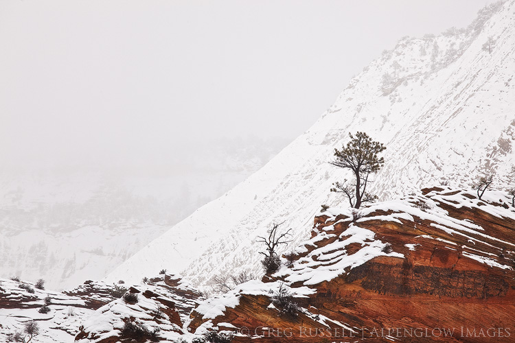
The importance of our national parks can’t really be underscored enough. States, communities, and private organizations have rallied to keep our biggest national parks open during the shutdown. Grand Canyon, Bryce, and Zion and three great examples of this collective effort. The revenue these parks bring in is obviously a big factor in determining whether or not to keep them open. In the case of Zion, Utah State Route 9 runs through the middle of the park; accessibility is another factor. Another thing we can’t ignore is the importance of these places to us all. Shutting them down would–on some level–be heartbreaking.

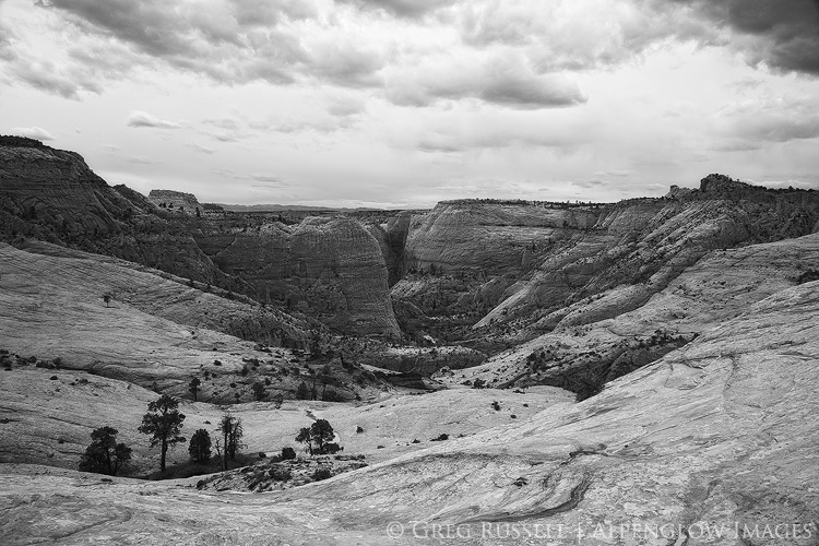
Two weeks into the shutdown, my wife and I were married on the lawn at the Zion Lodge. It’s kind of an inarguable point that we had selfish motivations for seeing Zion remain open. What if Zion had closed for the shutdown? While disappointing, we would have understood and moved our wedding to a ‘plan B’ location.

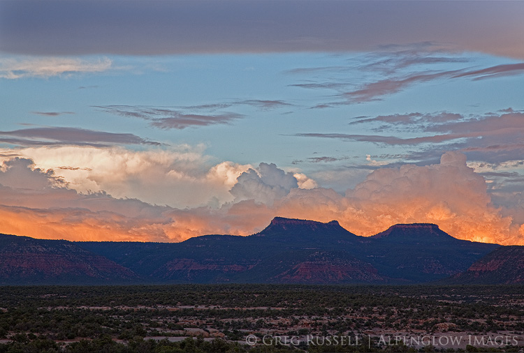
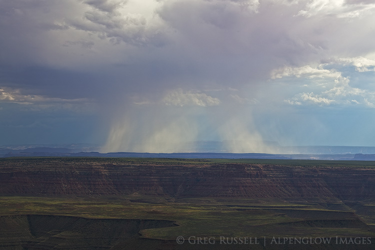
After our wedding, we took a short road trip to Moab, Monument Valley, and the Grand Canyon. Due to a lack of resources to plow snowy roads, Arches National Park was closed. Fortunately, Moab is full of opportunities for public lands recreation. Perhaps more disappointing was that Moab Brewing Company was also closed for maintenance! The Grand Canyon–of course–was open, and functioning more or less normally.

One would assume, government shutdown or not, that the people who visit our national parks and monuments would be the caretakers, the proud public land owners. Maybe that isn’t the case though. Incidents of vandalism are rampant, perhaps the most egregarious being the chain-sawing of Joshua Trees in their namesake national park. In Zion, we witnessed people were parking on sensitive plants in the Canyon. Dogs (often off leash) were on almost every trail. It’s clear that, in the absence of enforcement, we don’t care about the rules at all. Or, to put it another way, it’s the enforcement of rules that makes us look like a good society, not an inherent quality of society itself.

Alain puts it beautifully in his Letters to Sergio Solmi on the Philosophy of Kant: “Ethics means knowing that…we have certain obligations. Ethics is neither more nor less than a sense of dignity.” Should I litter, destroy, and vandalize our national parks? It would be unworthy of me–unworthy of what humanity has become, unworthy of the education I have been given, unworthy of what I am and wish to be. I therefore refrain from such behavior. These are my ethics.

golden light is cast on Utah's Castleton Tower & The Rectory.

Should our national parks close for business completely during the shutdown? The former Director of the National Park Service certainly thinks they should be. The Mojave Desert Land Trust does too.

My ethics remain unchanged in this time of the government shutdown. I have visited national parks during this time. I am also aware that I am adding to the congestion that is partially the root of these problems. In her book The Hour of Land, Terry Tempest Williams writes, “Awe is the moment when ego surrenders to wonder. This is our inheritance – the beauty before us.” Perhaps even more so than the heartbreak of having our national parks closed is that of seeing our collective ego so big that we are willing to destroy them to satisfy ourselves.

Nearly two years ago, I wrote about my code of ethics as a photographer. We can add to that list now to suggest that we always tread lightly–even when the government is open, do not take services for granted. Pack out trash, and always be mindful of road and trail closures. Photographers can (and should) set the example of how we should treat our public lands; no photograph is worth endangering the integrity of a place, and realizing the fragility of our heavily visited national parks is paramount.

Utah monument myths

Friday, December 8th, 2017

As expected, earlier this week the president reduced the size of both Grand Staircase-Escalante National Monument, and Bears Ears National Monument in Utah. This was the largest scale back of national monuments in history. Many are questioning not only of the legality of the president’s proclamation but also transparency behind the monument review process. During the time it’s taking to answer these questions, everyone seems to have an opinion on this move. Unfortunately, I’m reading a lot of misinformation that has helped to form many of these opinions (from both “sides” such as they are).

It’s no secret which side of the barbed wire fence I’m on, however I thought it would be helpful to put opinions aside for a minute and address some major misconceptions surrounding these national monuments, and to put some of the current state of things in a historical context. Late last year I wrote a blog post on public lands in the West, so you may want to start there.


1. The monuments were nothing but land grabs in the first place.

I’m starting with this one, because it’s the claim I have the most difficulty wrapping my head around. Both the Grand Staircase-Escalante and Bears Ears National Monuments were public land before and after their monument designations. The designation changed from unappropriated public lands to national monument, and with that came a change in some (but not all) management policies but it is impossible for the federal government to have grabbed land from itself.

There is one caveat to this. State trust lands represent one section in each 32-section township. They are federal land that was granted to states upon their entry into the union, and are usually considered revenue-generating land for the state. The revenue from trust lands almost always benefits public education. When both monuments were designated, some trust lands were included in those designations.

To compensate for this loss of revenue in Utah when Grand Staircase-Escalante was designated in 1996, the federal government gave the state some of its land outside of the monument in exchange for the state trust lands inside of the monument. Because of the mineral-rich quality of the new land, those parcels are now estimated to be worth over $1 billion. In addition, the US government gave Utah $50 million. This land and cash swap received overwhelming bipartisan support. A similar swap was in the plan for Bears Ears.

2. It’s good that the president gave the land back to Utah

See #1 above. There was no land to give back to Utah, since it was federal land to start with. In fact, Article III of Utah’s constitution specifically says that the land slashed from these two national monuments is not Utah’s land until it’s sold to the state.

Since it was federal land before the monument designations, it remains what is called unappropriated public land. This simply means it has no title tied to it like National Monument, National Recreation Area, National Park, etc.

3. Without national monument status, the vast landscape of the Bears Ears region will be subjected to unchecked exploitation.

Utah Governor Gary Herbert addressed this with a misleading statement earlier this week in the Deseret News. What he didn’t mention is that state trust lands can (and have) been sold off in the recent past. In 2015, a section of state trust land on Comb Ridge was sold; that could be developed, but also restricts public access. One can only speculate whether this would happen again, but no one can say that it couldn’t. Finally, interjecting here with a bit of my opinion: When these lands are sold, they create a discontinuous cultural landscape, and are gone for good.

4. Ranchers have been kicked out of their historic range.

This is untrue. The original monument proclamation at Grand Staircase-Escalante in 1996 included specific language to keep grazing permits intact. See this document from the BLM regarding grazing.

5. National monuments aren’t good for the economy.

National monuments bring tourism to the area, and with that comes jobs. While some studies show an increase in per capita income, others show no change, but no studies show a decline.

6. Hunting and fishing isn’t allowed on national monuments, nor is anything else my family has done for generations.

There is concern that activities that people have enjoyed for decades will be forbidden or limited with national monument designations. To be sure, national parks do limit certain activities, such as collection of herbs or plant material, and very few parks allow hunting. However, monuments are different. Backcountry Hunters & Anglers has a really nice interactive webpage to illustrate exactly what is hunted in each of the national monuments that have been identified for “modification.” Further, Utah Diné Bikeyah outlines what else is allowed in Bears Ears National Monument on their website.

7. Archaeological sites have always been protected, so the monument designation is meaningless (i.e., it doesn’t add any additional protections).

In a recent statement, Secretary of the Interior Zinke said, “Whether these resources are found on land designated as a monument, national forest, BLM- managed public land, or other federal land, it is generally illegal to remove or disrupt these resources without a permit issued by the federal government.” True enough, but with the amount of looting that has been documented, there’s no way anyone sane could claim these places have had any meaningful protection pre-monument. See a Washington Post article here, and a Smithsonian Magazine article here that discuss the looting problem in more detail.


However, it’s important to have correct information as you build your opinions, so what would you add? Have you heard any misconceptions regarding these monuments, or the monument review that happened earlier this year? Let me know and I can add it in to this blog post.

close-up photo of whimsical sandstone patterns in grand staircase-escalate national monument, utah

Giving Tuesday

Tuesday, November 28th, 2017

If you’re reading from the United States, I hope you had a great Thanksgiving holiday, and that you managed to somehow survive the deluge of marketing that comes with it. Despite the commercialized insanity this time of year, I rather like the notion behind today–Giving Tuesday. Giving is truly more joyous than receiving, and that’s something we can all be reminded of from time to time.

As I’ve written about before, our public lands–and specifically our national monuments–are under threat. While the overwhelming majority of Americans rejected the idea that we shrink any of our national monuments, President Trump is traveling to Utah on Monday to announce that both the Bears Ears and Grand Staircase National Monuments will be reduced in size.

The president will be–in my opinion wrongly–pushing through the largest elimination of protection for land and wildlife in US history. While the Antiquities Act states that the protection of our antiquities should be confined to the smallest possible area of land, both of these monuments are contiguous wild and cultural landscapes that can’t be subdivided for the sake of development.

In the spirit of Giving Tuesday, I am writing to ask for your help. This action (and likely more in the future) by the president is likely to be met by opposition and legal action. While I can write about my own opinions, they don’t pay legal bills. As a community, we need to support those organizations who are fighting this flawed legislation on the ground. So, that’s what I’m asking you to do: donate to a group that advocates for our public lands.

What do you get in return? If you show me you donated, I’ll send you a free 8×12 print of your choice to thank you for being a supporter of our public lands.

Some Resources

Not sure who to donate to? There are a lot of groups out there; some work locally, and some–like the Sierra Club–work at a national level. I won’t tell you who to donate to, but personally I try to donate to groups who do the most with my dollar. Neutral websites like Charity Navigator tell you where your dollar goes within the organization.

If you want to donate to a local group that’s great! Pick your favorite place, and find a group who works there. Friends of Nevada Wilderness, Southern Utah Wilderness Alliance, Grand Canyon Trust, and Backcountry Hunters & Anglers are a few of my favorites, although there are many (many) others.

I don’t care how much you donate, or who you donate to. All you have to do is show me you did, then pick your print. It’s that easy! This offer is good through President Trump’s Utah visit next Monday.

Thank you for helping to support our public lands!

Three photos of monuments in southern utah, which are all under attack by the Trump administration

Return to Middle Earth

Tuesday, September 26th, 2017

I want to see mountains again, Gandalf, mountains, and then find somewhere where I can rest. In peace and quiet, without a lot of relatives prying around, and a string of confounded visitors hanging on the bell. I might find somewhere where I can finish my book. I have thought of a nice ending for it: and he lived happily ever after to the end of his days.” – J.R.R. Tolkien


Autumn is, without a doubt, my favorite season. The light is longer, even warm days have a different tone, birds make their escape to warmer climates, and to paraphrase Gretel Ehrlich, the beautiful changing leaves are the verbs that conjugate the seasons. Autumn is almost certainly the time of the year I am the happiest.

Although I should have been working on my Wilderness Project, I opted to start the season by escaping to the high country. In hopes of getting a much-needed taste of Autumn, last week I visited the Tushar Mountains, a small mountain range in central Utah. I arrived right as a fall storm was moving out of the area. In the days before my visit, it had deposited a skiff of fresh snow in the higher parts of the range. Elk were bugling in the thickets, and aspens had begun to turn. Autumn was definitely in the air!

detail of a high altitude hillside in the tushar mountains of southern utah

We first visited this lovely mountain range in July. Always struck by the way a landscape can affect–or speak to–a person, I knew instantly the Tushars had claimed another victim in me. These mountains are unlike anything I’ve ever seen. Broad high altitude ridge lines, stout peaks, steep canyons, and verdant hanging valleys (“pockets”) remind me of something from Tolkien’s Middle Earth. The way the light played on the ridges and snowfields extending from the summit of Delano Peak (12,169′)–the highest point in the Tushars–was simply magical. Yup, I knew I had to go back.

The Tushars are a volcanic mountain range that sit on the ecological cusp of the Great Basin and Colorado Plateau. They are geologically interesting; two separate volcanic events have shaped them, erosion has worn them down, and glaciers have carved their canyons. The Toquima Mountains in Nevada and the San Juan Mountains in Colorado are also good examples of  volcanic ranges. The Tushars’ white peaks–formed by ash flow–stand in stark contrast to the darker volcanic rock of the lower canyons.

photo of a small waterfall and colorful aspen trees in front of two mountains peaks in utah's tushar mountains

photo of a volcanic rock outcropping at sunrise in beaver canyon, utah

Although they are beautiful and unique, images don’t present themselves easily. Because of their nature, you don’t find majestic skylines like you would in the Tetons. To the casual traveler viewing the Tushar Mountains for the first time, they look nondescript…not especially noteworthy. As they say though, most things worth getting to know require a bit of time. The US Forest Service, which manages the public lands in the Tushars (part of the Fishlake National Forest), has a trail system in the Tushars, and off-trail travel is easy. Thus, it’s easy to “choose your own adventure.”


In addition to what was mostly solo hiking, I enjoyed talking with a couple of mountain goat hunters, locals whose families had been in the Tushars for generations. I was also fortunate to connect with a local landscape photographer, Brady Nay, who spent a day hiking with me and showing me some of the places he grew up with. It is always nice to meet other photographers whose images are driven by a sense of connection to a particular landscape. Brady’s certainly are, and it was a really fun day to explore some of the canyons in the Tushars with him. Whether it’s hunting or photography, public lands really do bind us all together.

a two-tiered waterfall with pale rock and bright green moss in the tushar mountains of southern utah

photo of a hunter leading his horse off of a snow-covered slope in the tussah mountains of southern utah

Wherever autumn finds you, I hope you find someplace you can rest, in peace and quiet, to enjoy the season’s best!

In defense of Bears Ears National Monument

Thursday, May 11th, 2017

In my last blog post, I talked about Executive Order 13792, which orders a review of the national monuments, many of which in the West, established since 1996. This review is to ensure that they were created in accordance with the original intent of the Antiquities Act of 1906. The most pressing national monument “under review” is Bears Ears. The Department of Interior has opened the public comment period for this order, and for Bears Ears, it is only 15 days long. Please make your opinion heard; it is the only way for the the Secretary to hear our thoughts on this matter. Below is my letter about Bears Ears specifically.

Comments may be submitted online at http://www.regulations.gov by entering “DOI-2017-0002” in the Search bar and clicking “Search,” or by mail to Monument Review, MS-1530, U.S. Department of the Interior, 1849 C Street NW, Washington, DC 20240.


Secretary Zinke,

This letter regards Executive Order 13792, and specifically Bears Ears National Monument in southeastern Utah.

Bears Ears is home to several thousand archaeological sites. The sites themselves as well as the landscape are sacred to several Native American tribes. As such, the advocacy group Utah Diné Bikeyah formed from a collaborative effort between these tribes to protect this landscape. If there ever was a place that the Antiquities Act seems “written for,” Bears Ears most certainly is it. When President Obama designated the national monument in December 2016, it was was worthy of celebration because the preservation of these sites is now guaranteed as part of our national heritage. President Obama’s proclamation was also a testament to the sovereignty of these tribes, and the importance of their history to the nation.

Within the monument, recreational activities that were permissible before the monument designation are still allowed. With a permit, people can still gather firewood, herbs, and shrubs. Thus, the use and enjoyment of the land has not been affected. However, I am writing this letter to specifically address two other arguments against Bears Ears. The first is the size of the monument, and the economic impact that could have on local communities.

thunderstorm and fiery sunset at bears ears buttes in san juan county utah

In 2013, Representatives Rob Bishop and Jason Chaffetz put forward what they called the Public Lands Initiative (PLI), in which they would set aside part of the Bears Ears region as a national recreation area, which would essentially provide the same protections from oil and gas development or uranium mining as a monument designation under the Antiquities Act. Utah Diné Bikeyah proposed a similar, albeit larger, set of borders for their visualized national monument.

When the Obama administration designated Bears Ears National Monument, the borders they drafted more closely matched the national recreation area proposed in the PLI than those proposed by Utah Diné Bikeyah. What’s more, GIS data from the state of Utah show that the majority of oil and gas wells currently lie outside of the monument (possibly due to low success and complex terrain for drilling). The area’s most significant coal reserves lie completely outside of the monument boundaries. No areas within the monument are currently classified as having “high potential” for uranium mines either. When the monument was created, these data must surely have been available to the Obama administration.

Finally, critics have expressed concern for Utah’s schools. There are several inholdings of state trust land parcels within Bears Ears; they cannot be developed for mineral extraction because they lie within the monument. In 1996, when President Clinton designated Grand Staircase-Escalante National Monument, the federal government and the state eventually “swapped” for 139,000 acres of federal land that was outside of the monument with the Utah Trust Lands Administration for those types of private inholdings. In addition, the federal government paid the state of Utah $50 million. To date, the mineral extraction from that swapped land has yielded ~$1.7 billion in revenue for the state of Utah. Senator Bennett called this a “model for future land swaps,” and I agree with him. It was a win-win for all parties, and I believe it could work equally well in Bears Ears.

I grew up in the northwestern corner of New Mexico, and had many backpacking outings in the Bears Ears region. With my dad, and with my Boy Scout troop, we explored many of the canyons on Cedar Mesa, and saw many of the archaeological sites that are now protected. These are some of my fondest memories of time spent in the outdoors. Just like so many of our national parks and monuments, Bears Ears is one of our national treasures. As Westerners, we are bound to protect these lands; it is not in our nature to hastily exploit them for short-term gain. The preservation of Bears Ears keeps a promise to past and future generations, and is one that can transcend partisan politics. Please join me in standing with Bears Ears and making it our nation’s common ground.

photo of valley of the gods located in bears ears national monument

Welcome Bears Ears National Monument!

Sunday, February 5th, 2017

President Obama used the Antiquities Act to designate Bears Ears National Monument on December 28, 2016. The greater Bears Ears region and national monument includes Cedar Mesa, Comb Ridge, Valley of the Gods, Elk Ridge, Beef Basin, Indian Creek and Lockhart Basin, among others.

map of bears ears national monument

Credit: Stephanie Smith, Grand Canyon Trust

In large part, the designation of this monument was due to the arduous work of Utah Diné Bikéyah, a collective of five Native American tribes, who all hold parts of the new monument sacred. Bears Ears is the first truly Native American national monument, and these tribes’ collective heritage will now be protected for generations to come.

photograph of intact native american ruin in bears ears national monument

On a personal note, having grown up in the Four Corners region of the southwestern United States, many of my early backpacking trips were on Cedar Mesa and Grand Gulch. I can still remember discovering just a few of the hundreds of Ancestral Puebloan ruins and rock art in this area; these are some of my favorite memories of time spent in the outdoors. Today, whenever I visit my parents, who still live in northwestern New Mexico, the Bears Ears buttes are a landmark that I see to tell me I’m home. I’m very grateful to Utah Diné Bikéyah and others whose hard work made this monument possible. I’ve blogged many times on Bears Ears and Cedar Mesa (see posts here, here, and here, for instance).

photograph of clouds and rocks in valley of the gods utah

To celebrate the designation of Bears Ears, I’ve put together a collection of my images from the monument in one place. Hopefully I’ll be able to visit soon and add more.

Although I’ve published this gallery on social media, I have been a little bit slow in getting it to my blog. Since the monument was designated, it’s come under heavy fire (see links here and here for details). This criticism as a “land grab,” has come primarily from Utah Republican lawmakers who are also key leaders in the land transfer movement (see my blog post here for details). So, ironically, although Bears Ears has protection, it now needs your support more than ever. Please consider a donation directly to Utah Diné Bikéyah or the Grand Canyon Trust to help them combat efforts to reverse the monument designation, and contact your lawmakers to voice your opposition to it.

The ties that bind

Thursday, May 12th, 2016

“What holds people together long enough to realize their power as citizens is their common inhabiting of a single place.” – Daniel Kemmis

“Our gadgets and electronic maps read our exact location and desires virtually anytime and anywhere. Never before have we been so located – and yet so lost.” – Bryan Pfeiffer


I recently read an article, “Ghosts and tiny treasures,” by Bryan Pfeiffer.  He uses an example of the way we react to the killing of an individual lion by a trophy hunter, yet at the same time many of us fail to take note of the impending extinction of an entire non-charismatic keystone species like the Poweshiek skipperling, a butterfly.  Pfeiffer makes the argument is that we clearly care about other animals and places, but we have not developed what he calls a “chronic passion” for nature. Martin Litton, who was probably a bit more gruff about the subject than Pfeiffer, argued for years that we don’t harbor enough hatred in our hearts when it comes to the destruction and development of the natural world. Finding my own personal balancing point between Pfeiffer’s passion and Litton’s hatred is something that’s been on my mind for quite some time.

I recently reposted an image on my Facebook page of the Bears Ears buttes in southern Utah.  Reaching almost 9,000′ elevation, the Bears Ears are the high point of the Cedar Mesa and greater Canyonlands area.  Visible from much of the Four Corners region, they never fail to announce that I’m almost home when I drive back to northern New Mexico from my house in southern California to visit my parents.

The mesas and canyons that extend off of the Bears Ears–the Dark Canyon complex, Grand Gulch, White and Arch Canyons–make up some of the most remote, rugged, and spectacular scenery in North America.  As if the scenery isn’t enough, the greater Bears Ears area houses what may be the highest density of archaeological treasures in the country.  There are literally hundreds if not thousands of archaeological sites (ruins, rock art, etc) here, and visitors can gain a tangible connection with the past simply by walking a few hundred feet into this wonderful area.

Bears Ears Sunset

The Bears Ears buttes are the centerpiece of a proposed national monument in southern Utah

Although most of the archaeological sites are Ancestral Puebloan (ancestors of the modern day pueblo people, like Hopi and Zuni), the Navajo and Ute people, who live adjacent to the area on their respective reservations also have stories contained in–and on–this stone.  While the area is receives significantly less use than Utah’s “Big Five” national parks, it certainly isn’t unvisited. In addition to recreation pressures, oil drilling, and human development in general are knocking on the door of the area, and undesirable activities like archaeological looting run rampant.  In response to these potential threats, the Navajo, Zuni, Hope and Ute tribes have come together collectively as Utah Diné Bikeyah, and have proposed the Bears Ears National Monument to protect all of these resources for future generations.

The ecological importance of the Poweshiek skipperling–which Pfeiffer talks about in his article–might not be immediately obvious to everyone, at least not on first glance.  Similarly, the significance of cultural and natural treasures in the greater Bears Ears region may not seem that valuable, or worth protecting.  Thus, on the most basic level, Pfeiffer’s call for us to develop a chronic passion for nature and Utah Diné Bikeyah’s proposal for us to honor the wild landscape and cultural history surrounding the Bears Ears by creating a national monument are really no different.  They both symbolize a commitment to the ties that bind all of us together.

In so many ways right now in the United States especially, we’re at curious place, and the commitment that Pfeiffer and Utah Diné Bikeyah are asking for seems somewhat unobtainable, which is paradoxical to me.  While we want change (look at any social media outlet–not only do we want it, we’re downright angry about it!) and are more electronically connected to the things we want to change than ever before (webcam, anyone?), we seem to have lost the connections that really matter. Connection to place, to other organisms, to each other, is something we desperately lack right now as a people.

Now is the time to preserve not only natural Earth and the ties to our evolutionary history, but our ties to human history. But we need to re-establish our connections to both of them to do that. There is no other way.

I suppose this wasn’t really a blog post about photography, but about connection to a place, which–when present–makes photography more meaningful and personal.  In that spirit consider this the beginning of a dialogue…about connection, purpose-driven photography, and endeavoring to protect that connection.

Thanks for reading.

Muley Point Utah

A photographer in the proposed Bears Ears National Monument

More from the Escalante

Monday, May 2nd, 2016

“We spend our days trying to be big. In the middle of nowhere, though, we can surrender to smallness again and instead find where we fit in the landscape. Out there, where there’s nothing, is where there’s the most to learn.” – Christopher Solomon, A Case for Getting Far, Far Away


In my last post, I briefly described a backpack through the canyons of the upper Escalante River.  This entire area of southern Utah is among the most remote in the western United States.  As a result of this (or maybe because of this) it is sparsely populated; depending on where you’re at, the nearest traffic signal can be hundreds of miles away and the stars in dark night skies vastly outnumber any town lights.

Escalante River Sunset

The Escalante River and its tributaries have cut sinuously through the sandstone in this area below the Aquarius Plateau.  As I said in my last post, it’s rugged country, but its matched perhaps only by the mettle of the area’s first explorers*.

As an underscore to the already remote nature of this country, about a century after the Escalante-Dominguez expedition, Major John Wesley Powell came through this area (roughly) on his Colorado River expedition.  He named the Henry Mountains, which are not insignificant, and are visible from much of southeastern Utah. The Henries were the last mountain range in the contiguous United States to be named and explored (the Navajo call them Dził Bizhiʼ Ádiní–mountain whose name is missing).

Henry Mountains Sunset

Grand Staircase Sunset

There are certainly places you can go in the Grand Staircase-Escalante National Monument where you would feel anything but alone, but there are far more that would give you a feeling of complete isolation.  I can’t help but think that perhaps searching out that feeling of solitude–taking time to listen to the deafening silence–is something we should do from time to time.  I’m grateful there are still places like this for us to do just that.

*Father Silvestre Vélez de Escalante is regarded as one of the first Europeans to have explored this area as part of the Escalante-Dominguez expedition in 1776.  Before reaching this area, they were forced to kill and  eat their horses while searching for a crossing of the Colorado River (the place where they eventually crossed is now known as the Crossing of the Fathers, which is underneath Padre Bay in Lake Powell).

Backpacking a wilderness of rock

Monday, April 18th, 2016

“The upper Escalante Canyons, in the northeastern reaches of the monument, are distinctive: in addition to several major arches and natural bridges, vivid geological features are laid bare in narrow, serpentine canyons, where erosion has exposed sandstone and shale deposits in shades of red, maroon, chocolate, tan, gray, and white. Such diverse objects make the monument outstanding for purposes of geologic study.” – Presidential Proclamation 6920 (establishing the Grand Staircase-Escalante National Monument), September 18, 1996


A wilderness of rock.  That’s what I imagined the historic Boulder Mail Trail would be when my dad and I set off to backpack it last month.  Indeed, to paraphrase Maynard Dixon, the upper Escalante Canyons expose the earth’s skeleton in a beautiful, if austere, way, exposing the earth’s skeleton.

The Boulder Mail Trail (which isn’t much of a trail at all), is the historic mail delivery route between the hamlets of Boulder and Escalante, Utah.  Highway 12, which now connects Boulder and Escalante, wasn’t paved until the 1970s, so the Mail Trail was the quickest route for quite some time.  All along the route, the old telegraph wire connecting these towns is also very obvious, although it’s fallen down in a few places.  The Mail Trail now lies almost entirely within the Grand Staircase-Escalante National Monument.

A couple of months ago, my dad asked if I wanted to go backpacking this spring, and of course I jumped at the chance.  A while back, I wrote a blog post about January trips with my dad, and I continue to feel really fortunate that my parents are both willing and able to be active.  It was our first backpacking trip together in many years, but it ended up being very fun, and just the right length for two old “geezers.”

For early spring, the weather was what one can expect on the Colorado Plateau: windy and cold.  Out of the wind in the sun, it was pleasant, but it was never too hot.  When we set off from the trailhead outside of Boulder, snow flurries were ducking in and out of the canyons on the Aquarius Plateau to the north, and looked like they might reach us within a few hours.  Dark skies to the west seemed to promise wet weather as well.  That’s better than boring blue skies, though, right?

Box-Death Hollow Wilderness, Utah

The Mail Trail is more than just a walk across sandstone, as it crosses a few fairly large tributaries of the Escalante River.  The most significant of these is Death Hollow, which despite the name is known for being a fun backpacking trip in its own right (save for the poison ivy it is also well known for!) and is about halfway along the Mail Trail. Death Hollow is surprisingly lush (hence the poison ivy), and is a wonderful riparian habitat tucked neatly away into the desert. We ended up camping in the bottom of the canyon amongst giant ponderosa pines because the weather was just spunky enough that we didn’t want to get blown off the rim and into the night as we slept.  We ended up falling asleep early, and despite a small sprinkle of rain and major sandblasting from the wind, the storm never really developed.

Box-Death Hollow Wilderness, Utah

The next morning, we hiked about a mile down Death Hollow before the route continued out the west side of the canyon, and towards Escalante.  We were able to see Escalante within a few hours, but it took much longer to wind our way down through the sandstone and back to the car we had parked at that end of the Mail Trail.  A quick run up to Boulder for the other car, and a beer (or two) at Hell’s Backbone Grill topped off the trip.

Box-Death Hollow Wilderness, Utah

Despite the increased popularity of the Escalante area since President Clinton included it in his massive 1996 National Monument, the upper canyons of the Escalante River seem to be less visited than other more popular areas along the lower river.  It was nice to be able to experience a little bit of history, wilderness, and complete solitude for two days.  That said, solitude shouldn’t come as that big of a surprise–there isn’t a traffic signal for at least 100 miles from Escalante, and this is one of the most remote and rural places in the lower 48 states.  Combine that with world class scenery, and this wilderness of rock is truly an area to be cherished.

Box-Death Hollow Wilderness, Utah

The Savages of the Colorado Plateau

Thursday, July 16th, 2015

In early July, I made it home to the Four Corners region of the Southwest to visit my parents.  Although I haven’t lived there in close to two decades, I use the word home to describe it because that’s how it feels–no matter how long I’ve been gone, it always feels like I haven’t left.  Perhaps this isn’t a good thing, implying things about a lack of progress, etc., but I prefer to think that feeling is due to an intangible familiarity that is coded in our DNA.  Safe, familiar, known–space becomes place.

As I usually try to do on my visits home, I visited the Cedar Mesa area of southern Utah.  Driving across the unassuming highway that crosses the Grand Gulch Plateau, I was reminded of the many backpacking trips I took there when I was younger.  My friends and I climbed the ledges of the canyons, busted through the willows, and–yes–explored the numerous Ancestral Puebloan ruins in hands-on style.  While we were never destructive, we certainly never hesitated to climb inside, living in our own fantasies of what the lives of these people must have been like, completely oblivious to the historical context of the sites.


Last week, I took my seven-year-old son backpacking in our local mountains here in southern California.  After driving home from New Mexico, he wanted a “short car ride,” and I was happy to oblige.  The San Jacintos have really wonderful Sierra Nevada-esque piles of granite boulders, and after arriving at our campsite for the day, he was content to play in these makeshift forts, but of course from a seven year-old’s perspective, a fort can always be improved on.

After a few hours of playing, he asked for help moving a huge number of logs and deadfall into a particular area to create a wall.  My first reaction was that moving that wood would violate Leave No Trace principles, and I caught myself starting to redirect his attention towards something less impactful for future visitors.  But then I looked around: impact abounded around us.  Visitors from the weekend had left a 5-gallon bucket of water, there was trash in the next door.  One weekend’s crowds leave, another’s roll in.  I happily picked up my first log and put it where I was directed–this was going to be a wall that could stop Hannibal and his elephants.

After getting home, I read an article that perfectly echoed my sentiments from that evening in the San Jacintos.  Environmental education (for kids especially) has almost gone so far as to turn kids off from nature.  As the author of the article says, kids need to be untutored savages in nature for just a while in order to appreciate it, treasure it.  My afternoon of asking my son to appreciate being outside went completely unheard; after building the wall together, he asked if we could live in the mountains for the rest of the summer.  All it took was 20 minutes.


Back to Cedar Mesa, and my childhood years running rampant through its canyons.  Today we know the area was colonized at least twice by Ancestral Puebloans, and it is incredibly rich with archaeological sites.  Some of them are well known and can be reached easily (like the sites I visited as a kid), but others are more remote, their locations are more guarded to prevent looting and just to keep them from being “loved to death.”  Today, I feel incredibly connected to this place–probably more so than anywhere on earth–but if you had tried telling the twelve-year-old me the area’s history, I would have tuned out for sure.  Looking back, I feel like I needed to be an untutored savage on those backpacking trips to have the appreciation I do for the place today.

The timing of my recent trips and this article are serendipitous, and it does seem like certain things intersect in our lives at opportune times.  Understanding the nature of nature education is research that needs to be done; instilling a notion of the inherent value of the land in our children needs to be done now, and with urgency.  This is especially true on Cedar Mesa.

Given my years of running freely there, I admittedly have some internal conflict about it, but I can’t help but feel the area needs more protection.  Some pockets–like Natural Bridges National Monument–are protected, but the area at large is managed loosely by the Bureau of Land Management, and the oversight is minimal.  The “guarded” archaeological sites I mentioned are becoming less so by the day with GPS coordinates popping up here and there on the internet, putting them at risk for looting (which is shockingly rampant) or simply being “loved to death.”  Add these threats to the area’s cultural history to potential development, and we are forced to ask at what point we impose stricter rules via protection.  It’s never an easy issue on public lands.

storm cell over Monument Valley, seen from Cedar Mesa, Utah

This recent article from the High Country News summarizes the groups involved in Cedar Mesa’s protection and the compromises being made on that long journey.


“One final paragraph of advice: do not burn yourselves out. Be as I am – a reluctant enthusiast….a part-time crusader, a half-hearted fanatic. Save the other half of yourselves and your lives for pleasure and adventure. It is not enough to fight for the land; it is even more important to enjoy it. While you can. While it’s still here. So get out there and hunt and fish and mess around with your friends, ramble out yonder and explore the forests, climb the mountains, bag the peaks, run the rivers, breathe deep of that yet sweet and lucid air, sit quietly for a while and contemplate the precious stillness, the lovely, mysterious, and awesome space. Enjoy yourselves, keep your brain in your head and your head firmly attached to the body, the body active and alive, and I promise you this much; I promise you this one sweet victory over our enemies, over those desk-bound men and women with their hearts in a safe deposit box, and their eyes hypnotized by desk calculators. I promise you this; You will outlive the bastards.”  — Edward Abbey

An Untutored Savage