Fire in the sky

Written by Alpenglow Images on August 18th, 2017

“The agent by which fire was first brought down to earth and made available to mortal man was lightning. To this source every hearth owes its flames.” – Lucretius, De Rerum Natura


The sky has long been a source of wonder for humankind. Colorful sunrises and sets, stargazing, and of course events like eclipses are all things that evoke awe and inspiration. People in certain parts of the United States are gearing up for the upcoming solar eclipse on Monday, August 21. Personally, I’ll be driving across northern Arizona during the eclipse. I intend only to pull over and enjoy what will be about 75% occlusion as the moon passes between Earth and the sun.

While the solar eclipse will be the capstone of summer for many, the season–to me–is sadly becoming defined less by swimming pools and barbecues and more by wildland fires. Currently, there are 56 large fires burning in the United States; 55 of them are in the West. This is a particularly bad year for fires, but over the past few summers my own wilderness exploration has depended heavily on where smoke is not obscuring the views. Despite what Lucretius opined in his first century poem De Rerum Natura, most wildland fires today are human-caused. Only a small percentage are caused by lightning.

Earlier this week, Jackson Frishman and I managed to get our boys out for a short overnight backpack in the John Muir Wilderness. Smoke from several fires burning in the Sierra Nevada obscured views in the Owens Valley, but as we hiked up, the air seemed to clear. A few clouds in the sky made a colorful sunset seem promising.

photo of grass along the edge of matlock lake and university peak with late day light in the john muir wilderness of california

Indeed, as the sun went down, the sky started to light up. I was using a polarizing filter to help reduce glare on the lake we were camped by. As sunset got nearer, I noticed a very strange effect on the images I was making. What I can only conclude was “invisible” smoke in the upper atmosphere was showing up in my polarized images, intermingling with the pink clouds. The result, I think, is unique and pretty (despite its cause).

photo of a colorful sunset at Matlock Lake in the John Muir Wilderness, California

If you are going outdoors with family and friends next week to view the eclipse, I wish you luck. I also hope smoke does not obscure your view. Please make sure to not add to the smoke by being very careful with any fires you make.


Thriving Communities

Written by Alpenglow Images on July 10th, 2017

This is my eleventh hour letter to the Secretary of the Interior. As Edward Abbey wrote, my vox clamantis in deserto, my voice crying in the wilderness.

Today is the final day to submit your comments on Executive Order 13792, which orders a review of all national monuments established since 1996. This review is to ensure that they were created in accordance with the original intent of the Antiquities Act of 1906. The most pressing national monument “under review” is Bears Ears, although there are many others, several of which are in the West. Please make your opinion heard; it is the only way for the the Secretary to hear our thoughts on this matter. You can read my other thoughts on this in these blog posts (here and here).

Comments may be submitted online at http://www.regulations.gov by entering “DOI-2017-0002” in the Search bar and clicking “Search,” or by mail to Monument Review, MS-1530, U.S. Department of the Interior, 1849 C Street NW, Washington, DC 20240.


Mojave Trails National Monument

With July 10th looming closer, I decided to spend the part of the weekend in the desert, photographing monsoon thunderstorms. Perhaps more than that, I simply wanted to be out on my public lands. After considering where the storms were moving, I ended up on the western edge of Mojave Trails National Monument, one of the monuments currently under review by the Department of Interior. While the scenery did not disappoint, a small foible of my own began a series of events that has caused my view of our National Monuments to evolve.

Mojave Trails is just a little less than 2 years old, and protects a very large swath of the Mojave Desert in southern California. The Cadiz Dunes and parts of historic Route 66 are two highlights of the monument, but there are countless other mountain ranges and valleys, each with their own bits of natural wonder and history. The casual observer may see only miles of desolate, lonely creosote in Mojave Trails. However, a 2014 study published in the scientific journal Nature identified the Mojave Desert as a huge sink for carbon–in other words, the plants here do an incredible job of removing carbon from the atmosphere, thus curtailing global warming. Uninterrupted patches of desert are even more important than we originally thought.

photo of mountain ranges and valleys in Mojave Trails National Monument

A Sandy Situation

After entering the monument, I pulled off the highway, ate lunch, and continued down a long dirt road. My plan was to get as close to Ship Mountain as possible, for views of the Sheepshole Mountains, as well as the Cadiz Valley to the east. With temperatures well over 100 degrees, I was content to enjoy the air conditioning while I enjoyed the scenery.

Like most backcountry roads in the Mojave, I encountered several patches of sand, which I floated through effortlessly. Then, I got to the big sand pit. As soon as I realized I shouldn’t be there, I put the car in reverse and floored the gas. All I got was a giant dust cloud. I realized I was stuck immediately, so I used some wood I found to try to build a bridge for my car’s tires. Still nothing. I found something I could dig with, and actually got to a hard bottom of the sand, but my tires still couldn’t find purchase. I tried everything I could think of, but it soon became clear that I needed help.

It’s time for me to dine on crow for a bit, and admit that I screwed up. Although I normally am very aware of my limits, I was in a 2WD vehicle on a backcountry road, and did not have the proper equipment (like a shovel, or an air pump so I could deflate my tires) to extract myself. However, I did have a full tank of gas (for air conditioning), a GPS messenger, and lots of water and food. More importantly, I had cell service.

I called my girlfriend to ask her to call AAA for me, hoping they would be able to send a wrecker to pull me out. Of course, the nearest service wanted $1500 for their time, so that wasn’t an option. Still, my girlfriend and her dad drove out to pick me up, and we left the car for the night.

On our way home, we stopped for dinner, and happened to ask our waiter (somewhat jokingly) if he knew anyone with a 4×4 who would be willing to pull me out. Turns out he did! We got into contact with an entire network of good samaritan off-roading enthusiasts who pull people like me out of sticky situations for free. I posted my GPS coordinates and a description of my problem on one of their forums and within minutes I had several people willing and ready to help. The next morning I met two servicemen stationed in Twentynine Palms, and they had me out within minutes. We even stopped on the way to my car so they could help another motorist in need.

The cost of their goodwill? A handshake.

Our National Monuments as common ground

Even today, writing this, I’m blown away by their simple willingness to help, and wanting nothing in return. They would have driven anywhere to help me, and one of them even offered to come help me at 3am, before he realized I had gotten a ride out for the night. This neighborly goodwill and cooperation is what Daniel Kemmis writes about extensively in his excellent book, “Community and the Politics of Place.

Although I likely won’t cross paths with those men again, I am thankful for their selfless willingness to help. I am also reminded of the common ground that brings us together: our public lands. While they enjoy a different activity than I do, our monuments and backcountry views bring both of us outdoors, together.

In the same way the Mojave Desert plants create a healthy ecosystem, there is another community of outdoorsmen that is simply thriving. In a time when we are feeling idealogical and political rifts more than ever, I believe it’s more important than ever to seek common ground, make connections, and make our collective voices heard.

There are only a few hours left to do just that. Mojave Trails, just like the other monuments under review, deserves to be protected for countless reasons. Have you submitted your comments yet?

black and white photo of Ship Mountain in Mojave Trails National Monument at sunset


In defense of Bears Ears National Monument

Written by Alpenglow Images on May 11th, 2017

In my last blog post, I talked about Executive Order 13792, which orders a review of the national monuments, many of which in the West, established since 1996. This review is to ensure that they were created in accordance with the original intent of the Antiquities Act of 1906. The most pressing national monument “under review” is Bears Ears. The Department of Interior has opened the public comment period for this order, and for Bears Ears, it is only 15 days long. Please make your opinion heard; it is the only way for the the Secretary to hear our thoughts on this matter. Below is my letter about Bears Ears specifically.

Comments may be submitted online at http://www.regulations.gov by entering “DOI-2017-0002” in the Search bar and clicking “Search,” or by mail to Monument Review, MS-1530, U.S. Department of the Interior, 1849 C Street NW, Washington, DC 20240.


Secretary Zinke,

This letter regards Executive Order 13792, and specifically Bears Ears National Monument in southeastern Utah.

Bears Ears is home to several thousand archaeological sites. The sites themselves as well as the landscape are sacred to several Native American tribes. As such, the advocacy group Utah Diné Bikeyah formed from a collaborative effort between these tribes to protect this landscape. If there ever was a place that the Antiquities Act seems “written for,” Bears Ears most certainly is it. When President Obama designated the national monument in December 2016, it was was worthy of celebration because the preservation of these sites is now guaranteed as part of our national heritage. President Obama’s proclamation was also a testament to the sovereignty of these tribes, and the importance of their history to the nation.

Within the monument, recreational activities that were permissible before the monument designation are still allowed. With a permit, people can still gather firewood, herbs, and shrubs. Thus, the use and enjoyment of the land has not been affected. However, I am writing this letter to specifically address two other arguments against Bears Ears. The first is the size of the monument, and the economic impact that could have on local communities.

thunderstorm and fiery sunset at bears ears buttes in san juan county utah

In 2013, Representatives Rob Bishop and Jason Chaffetz put forward what they called the Public Lands Initiative (PLI), in which they would set aside part of the Bears Ears region as a national recreation area, which would essentially provide the same protections from oil and gas development or uranium mining as a monument designation under the Antiquities Act. Utah Diné Bikeyah proposed a similar, albeit larger, set of borders for their visualized national monument.

When the Obama administration designated Bears Ears National Monument, the borders they drafted more closely matched the national recreation area proposed in the PLI than those proposed by Utah Diné Bikeyah. What’s more, GIS data from the state of Utah show that the majority of oil and gas wells currently lie outside of the monument (possibly due to low success and complex terrain for drilling). The area’s most significant coal reserves lie completely outside of the monument boundaries. No areas within the monument are currently classified as having “high potential” for uranium mines either. When the monument was created, these data must surely have been available to the Obama administration.

Finally, critics have expressed concern for Utah’s schools. There are several inholdings of state trust land parcels within Bears Ears; they cannot be developed for mineral extraction because they lie within the monument. In 1996, when President Clinton designated Grand Staircase-Escalante National Monument, the federal government and the state eventually “swapped” for 139,000 acres of federal land that was outside of the monument with the Utah Trust Lands Administration for those types of private inholdings. In addition, the federal government paid the state of Utah $50 million. To date, the mineral extraction from that swapped land has yielded ~$1.7 billion in revenue for the state of Utah. Senator Bennett called this a “model for future land swaps,” and I agree with him. It was a win-win for all parties, and I believe it could work equally well in Bears Ears.

I grew up in the northwestern corner of New Mexico, and had many backpacking outings in the Bears Ears region. With my dad, and with my Boy Scout troop, we explored many of the canyons on Cedar Mesa, and saw many of the archaeological sites that are now protected. These are some of my fondest memories of time spent in the outdoors. Just like so many of our national parks and monuments, Bears Ears is one of our national treasures. As Westerners, we are bound to protect these lands; it is not in our nature to hastily exploit them for short-term gain. The preservation of Bears Ears keeps a promise to past and future generations, and is one that can transcend partisan politics. Please join me in standing with Bears Ears and making it our nation’s common ground.

photo of valley of the gods located in bears ears national monument


A letter to Secretary Zinke

Written by Alpenglow Images on May 8th, 2017

Dear Interior Secretary Zinke:

Last Friday, your office released a memo of the National Monuments under review per executive order 13792. This letter is regarding that order.

Much has been written about the “Western ethos.” This intangible set of characteristics enabled the pioneers to settle and explore the lands west of the Mississippi. Today that same tenacity and those values live on in Westerners who eek out a living in our arid Western landscape. Perhaps more than any of the other values, vision is the one I think is the most uniquely Western. Today, just as 150 years ago, we have a vision of what the West should be; our collective actions have been an (often unsuccessful) attempt to make the landscape to conform with our vision.

In the Antiquities Act, Theodore Roosevelt also had a vision for the West. The national monuments he and the presidents who have followed him have left behind for America are a tangible reminder of Western vision and tenacity. As Wallace Stegner said, the Western landscape–whose crown jewels are protected by our national parks and monuments–is what we as a people have built our very character against.

Much of this land has inherent monetary value, as the men who have looted archaeological sites for years on Cedar Mesa, which is now protected as part of Bears Ears National Monument in southeastern Utah, would tell you. Or the men who want to drill oil and gas wells in Papahanaumokuakea Marine National Monument in Hawaii or mine uranium from Grand Canyon-Parashant National Monument in Arizona, would tell you. However, some of it simply has been protected for the sake of protection.

thunderstorm and fiery sunset at bears ears buttes in san juan county utah

San Gabriel Mountains National Monument in southern California houses three federally-designated Wildernesses, and is home to last bighorn sheep herd in the Transverse Ranges. Carrizo Plain National Monument in California is the home of critically endangered species such as the giant kangaroo rat (Dipodomys ingens, a keystone species), San Joaquin antelope ground squirrel (Ammospermophilus nelsoni), and San Joaquin kit fox (Vulpes macrotis mutica). Finally, back to Bears Ears and moving beyond its monetary value, the monument symbolizes Native American sovereignty, and our government’s heartfelt acknowledgement that indigenous tribal history is one of the threads that holds our nation together.

antelope ground squirrel with grass in its mouth at carrizo plain national monument in southern california

In using the Antiquities Act, President Roosevelt personified the characteristic of possessing vision. He also showed incredible restraint, the rarest of virtues. The President would have remained vigilant of the landscape’s monetary value to the people, but he would have reminded us sometimes we need to protect a place simply so that future generations can experience it. In this sense, he would have worked to compromise in the creation of National Monuments. Indeed, the men who followed Roosevelt saw that that was the case in Grand Staircase-Escalante, Gold Butte, Grand Canyon-Parashant, and the others. Borders of these monuments were carefully set, with the interests of all “sides” in mind.

As a self-proclaimed disciple of Mr. Roosevelt, I’m sure you are familiar with his New Nationalism speech from 1910, in which he said, “It is of little use for us to pay lip-loyalty to the mighty men of the past unless we sincerely endeavor to apply to the problems of the present precisely the qualities which in other crises enabled the men of that day to meet those crises.” Secretary Zinke, I am asking you to look not only at our past, but also how far we’ve come as a nation as you endeavor to begin this review of our National Monuments. To paraphrase John Sawhill, you have the ability to ensure that future generations judge us by what we have chosen to protect, rather than by what we have extracted from the earth.

Keep our National Monuments intact.

apricot globe mallow wildflowers and buttes near lake mead at sunrise in gold butte national monument, nevada


Field Notes: 2017 wildflower season, and some thoughts

Written by Alpenglow Images on April 24th, 2017

Super bloom

After what’s been a remarkable precipitation winter here in California, we’re moving into spring. Here in southern California, temperatures are inching upwards, my morning runs are getting earlier (to escape the heat), and the hills around my house are slowly turning from green to brown. Despite the quick fade-to-brown, just a few weeks ago those green hills were home to a remarkable wildflower super bloom; the flowers have since moved north to the Carrizo Plain National Monument, where it will probably fade soon too.

photograph of a photographer kneeling in a field of wildflowers during the 2008 wildflower season

A friend snapped this photo of me in Walker Canyon in 2008 (note my not-quite-bald head for dating accuracy). Poppies for days and not a soul to be seen. Photo: Mark Chappell

I first noticed California poppies starting to dot the hillsides around my home in mid-February. It wasn’t long before the news outlets noticed as well. I managed to get out to some remote patches early on, and planned on visiting some of my other favorite spots once things got better. It turns out that “one of my favorite spots” is the Walker Canyon area near Lake Elsinore. In 2008 (the last ‘superbloom’ year), I visited several times and never once saw another person. This year, I drove by. That’s it. After being featured by multiple news sources, I found hundreds of cars parked off the freeway’s frontage road, and people in every conceivable corner of the poppies. I kept on driving.

photo of poppies and other wildflowers in southern california during the 2017 super bloom

I heard the same scenario was true in other parts of southern California; Anza Borrego Desert State Park was full of bumper to bumper traffic on its peak weekends, and I heard that the Carrizo Plain has been very crowded as well. Other commitments prevented me from getting out more, but I was content to seek out some wonderful patches of Calochortus (Mariposa lily) and apricot globe mallow in the northern Mojave without fighting the crowds.

photo of a mariposa lily in gold butte national monument, nevada

photo of apricot globe mallow in gold butte national monument, nevada

Looking back on the wildflowers–what impact did we have?

The super bloom this year was indeed super. I loved that almost every time I went to the hills I said, “wow, look at those flowers!” It’s no wonder that the news outlets picked up on it because it was indeed hard to miss. Despite not getting out to what used to be my usual spot, I’m not really that upset about it.

A few blog posts ago, I wrote in my code of ethics that “avoiding the cultivation of disorder” is important in landscape photography. This statement has meaning on several levels. First, I was referring to the mayhem of popular photography locations at peak times. When I first wrote that blog post, I was thinking specifically about Horsetail Falls, but this year’s popular wildflower locations certainly fall into the same category. If thoughtful photography or a connection with nature is your goal, I don’t see how it’s possible when trying to work around hundreds of other people.

Second, referring again to the mayhem of hundreds of people visiting a single spot, I have genuine concerns about the impact on the land, and how we contribute to it. Before I sound like a total grouch about people visiting these spots, I should say that I am happy people are getting outside. We truly need more of that. But, the impact should be spread out, not localized. Photographers are partially to blame for this, and the discussion of whether or not to geotag photographs has been had elsewhere. As the information age continues to advance, I feel the need to be more and more vague about certain image locations. This article has made the rounds a few times, and expands on the topic very well.

Finally, by avoiding crowds, you can find new locations you might not have found otherwise. I very much enjoyed scouting locations on long trail runs this spring, then coming back to a few with my camera later on. Also, consider visiting some of the more popular locations in the off season–there are still amazing things to see!

photo of wildflowers and green in hills in Box Springs Mountains Reserve, Riverside County California


Upcoming Presentation in the Coachella Valley

Written by Alpenglow Images on April 20th, 2017

Next Tuesday, April 25, I’ll be the guest speaker at the Coachella Valley Desert Camera Club’s (CVDCC) monthly meeting. The topic of my talk will be two-fold; I’ll be talking about a sense of place in landscape photography, and the importance of connection to place now, perhaps more than ever. I’ll also talk about the impacts that we have as landscape photographers, and leave an open-ended question regarding what we can do to reduce our collective footprints.

It should be a fun night; I’ll be showing several new images as well as a few old favorites. I also look forward to a lively discussion of these topics. If you’re in the area (or if you already plan on attending the meeting) I’ll look forward to seeing you there!

When: April 25, 2017, 6pm

Where: Portola Community Center, 45480 Portola Ave, Palm Desert, CA 92260

whimsical sandstone formations of little finland in gold butte national monument


Anatomy of a desert storm

Written by Alpenglow Images on April 10th, 2017

“Let me say this before rain becomes a utility that they can plan and distribute for money. By “they” I mean the people who cannot understand that rain is a festival, who do not appreciate its gratuity, who think that what has no price has no value, that what cannot be sold is not real, so that the only way to make something actual is to place it on the market. The time will come when they will sell you even your rain. At the moment it is still free, and I am in it. I celebrate its gratuity and its meaninglessness.” – Thomas Merton, from Raids on the Unspeakable


Here in the desert southwest, we’re coming off an amazing winter of rain. The color green seems a color more appropriately likened to Ireland than the Mojave Desert, but the grass popping up between very happy creosote and salt bush doesn’t tell any lies: it was a good winter. The big, soaking storms are long gone as we transition into summer, but some spring squalls are still hanging on. Desert rain storms are really quite remarkable; they are swift, powerful, and incredibly rewarding.

You’re sitting on the rock in the late afternoon, enjoying the warmth of the sun, perhaps enjoying a beer after a long day of hiking. Dark clouds hang on the horizon, but they look like they are quite far away. As the wind starts picking up, you realize that your beer bottle might get blown over if you don’t take cover, and that perhaps those clouds weren’t as far as you thought.

photograph of mountain ranges and rain in nevada

Fortunately, you save your beer from a near complete loss, and as you do, you look towards the storm and realize there’s an incredible light show taking place behind it. Backlit virga hangs like tattered curtains and you stand there admiring the desert mountain ranges–which appear in various shades of blue–receding behind the squall. The wind begins to sandblast you and you start to feel the first drops of water hitting your face.

Soon, rain begins to fall in earnest, but this lasts approximately 10% of the entire length of the storm; the whole thing is really just a big tease. The clouds pass overhead, and you look towards the horizon from whence the storm came; any trace of the storm that just blew through has been hidden.  Then, you turn around, and discover what the storm has left you as it moves away into the distance.

photograph of a rainbow at sunset in the gold butte national monument

The sun is setting now, shining on the storm clouds which are no longer backlit. The trailing wisps of the storm catch the light, turning bright orange and pink, while the storm itself maintains its deep, menacing blue. You look above your head to see a rainbow arching overhead, completing this amazing sunset.

The entire thing lasts about 20 minutes and the landscape takes 25 degree temperature drop from start to end. Several times over the course of the storm you’ve nearly forgotten to take photos, but you make images, which you’re grateful for. But mostly you just stand in awe, thankful for what you’ve just experienced, and where you’re standing. This is meaningless joy, and it’s wonderful.

photograph of sunset after a rain storm in gold butte national monument


Towards deep ethics

Written by Alpenglow Images on April 3rd, 2017

Recently, the proliferative and educational photographers Darwin Wiggett and Samantha Chrysanthou unveiled their newest project, the League of Landscape Photographers. The intent was to be a voice of reason in a landscape photography culture that has become focused on “getting the shot,” or winning likes or shares on social media. I rather like the idea of bringing attention back to thoughtful photography and photographic projects; a huge amount of intentional but less “wow-worthy” photography seems get buried (and sadly, unseen) in the static of social media. I agree with Samantha and Darwin, who believe the first step away from this mentality begins with a tangible and published code of ethics.

The League offers a template code of ethics here. It includes much of the stuff that you would expect landscape photographers to already be doing. Indeed, this is a comprehensive and thoughtful list. Since reading it, I’ve been thinking about something more, something I can only think to call “deep ethics.” While I’m sure anyone reading this blog, regardless of their political leanings, can say a lot about the current political climate in the United States, one thing we probably can’t argue about is that we are all paying attention, and everything we do right now matters. It turns out this dovetails well with what I consider to be my deep ethics.

photo of rocks and bushes as the sun sets in joshua tree national park


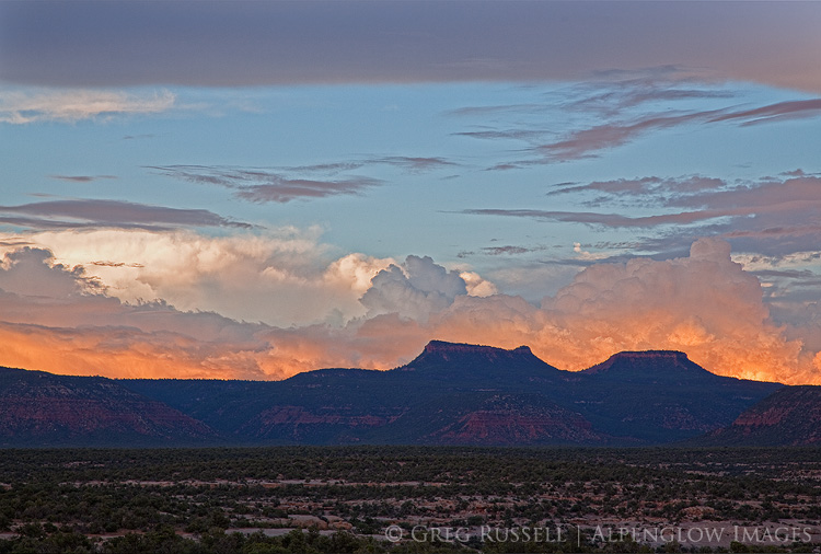
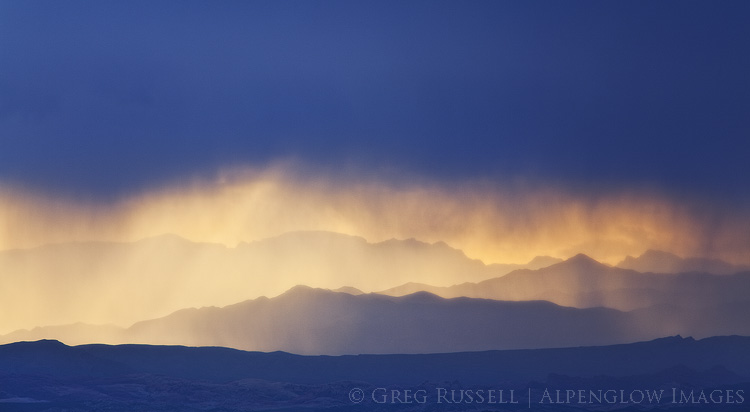
“A thing is right when it tends to preserve the integrity, stability and beauty of the biotic community. It is wrong when it tends otherwise.” – Aldo Leopold

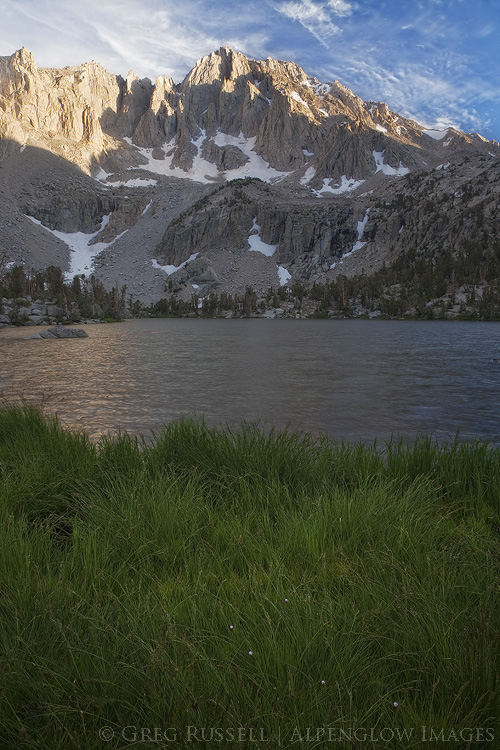
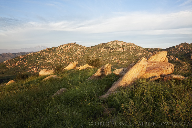
The health of the land is the standard by which we measure our work.

The popularity of photography as a hobby is at an all-time high. Combine this with the huge popularity of our national parks in general (see the most recent statistics on the top 10 most visited parks) and politically-fueled interest in our public lands; these all equate to increased impact on the land, with tangible effects.

We are responsible for the impacts on the landscape that result from our photography.  In as much as we are bound to by realism in photography, we have the obligation to ask how things will be, how we want them to be, and how they should be. When we are unwilling to compromise the health of the land as our standard, advocacy will follow in our art. My unwillingness to compromise and my commitment to advocacy is the first point in my code of ethics.

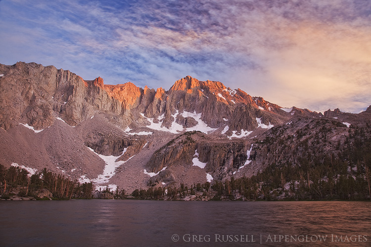
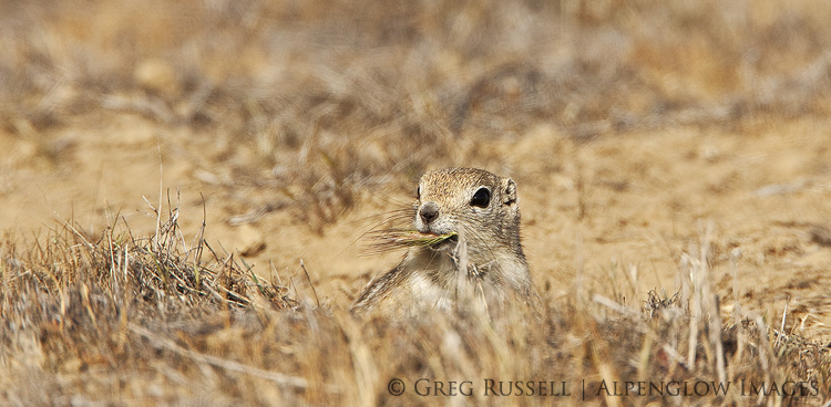
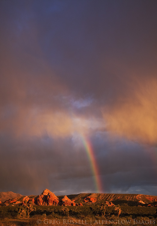
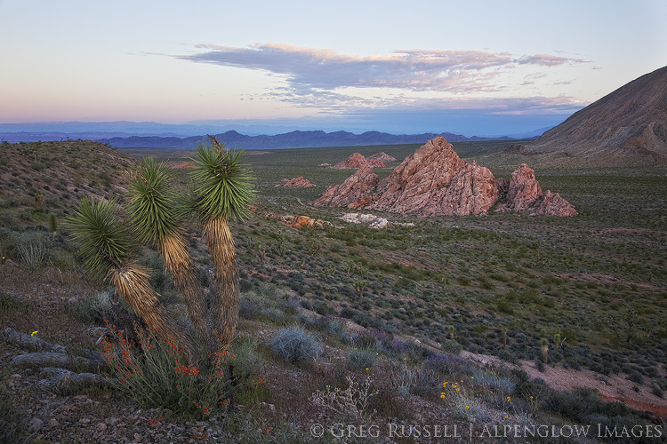
Actions make advocacy tangible.

The idea of “commitment to advocacy” is a nice notion, but how can it be made tangible? Photographers might answer by saying that they hope their work inspires others to protect a particular wild or open space. Indeed, that would be wonderful (of course, publicizing locations carries its own caveats, which I discuss briefly later). What else? Print sales would be nice, especially if they can directly benefit a grassroots activist activity or environmental group somehow. Photographers could also consider donating image usage or prints to particularly worthy groups, many of whom are working on thin budgets as it is.

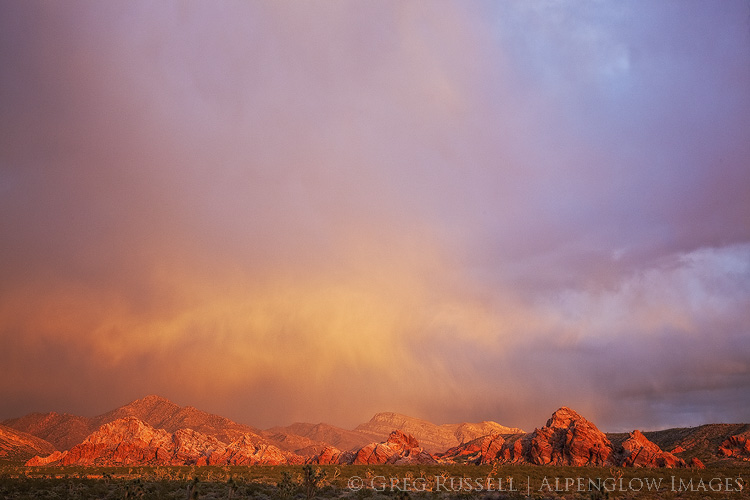
Finally, one that has me particularly intrigued is that photographers and backpackers don’t really “pay to play” in the same way that other outdoorsmen like hunters or anglers do; we aren’t taxed in the same way that hunters are for their ammunition, and we don’t purchase hunting or fishing licenses. This revenue is used to make habitat better for wildlife. We certainly reap the harvest from these habitat improvements, just as we enjoy well-maintained trails, and clean campsites, but what are we putting back into the coffers to make sure these things happen?

Until something more formal is put into place, the thought I have is to practice a self-imposed excise tax on goods that I buy for use in the outdoors. If I were to buy a new lens, or backpack, or headlamp, I would “tax” the purchase price, thus donating a predetermined amount at the end of the year to a group working on the ground to make the landscape better, and consequently making my experience better. If I’m not in the position to give financially, I would volunteer my time. Regardless of what we do as photographers, “advocacy” absolutely must be a tangible thing; this is my second point in my code of ethics.

photo of sunset in box springs mountains park, riverside county california


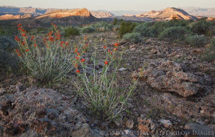
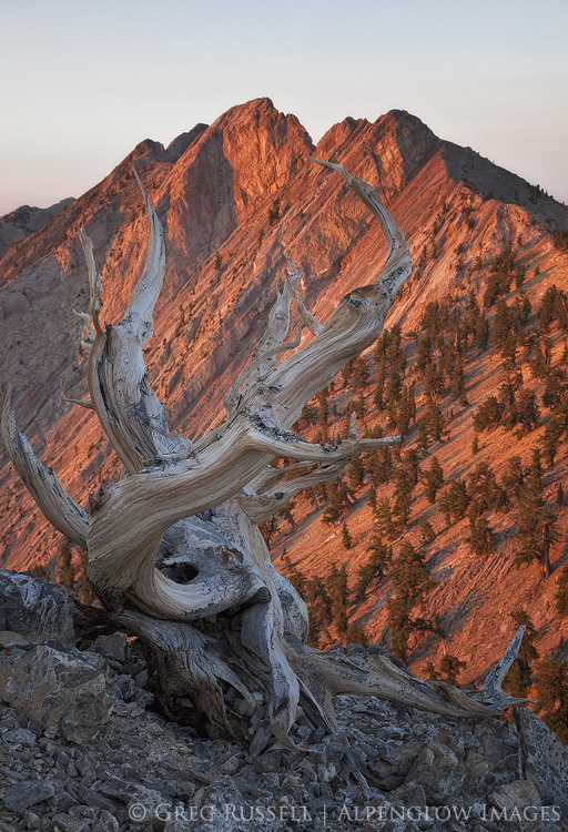
“What counts finally in a work are not novel and interesting things, though these can be important, but the absolutely authentic. I think that there is a spirit of place, a presence asking to be expressed; and sometimes when we are lucky…and quiet in a way few of us want to be anymore, a voice enters our own…” – John Haines


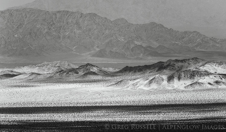
Only by opposing the cultivation of disorder will we see a coherent body of work.

From a philosophical point of view, photography’s popularity is troublesome because–as the article above points out–we photograph everything but really don’t take the time to look at anything. Continuing on from the passage above from his book of critical essays Living Off the Country, John Haines writes, “I have come to feel that there is here in North America a hidden place obscured by what we have built upon it, and that whenever we penetrate the surface of the life around us that place and its spirit can be found.”

Perhaps now, more than ever, we need to know place. The third point in my code of ethics is to avoid passing photography fads and locations. Not only will I have become more connected with place by focusing on and producing a personal photography portfolio, it will reduce impact on places that are heavily photographed, thus improving the health of the land.

photo of wildflowers and joshua trees at sunrise in gold butte national monument nevada


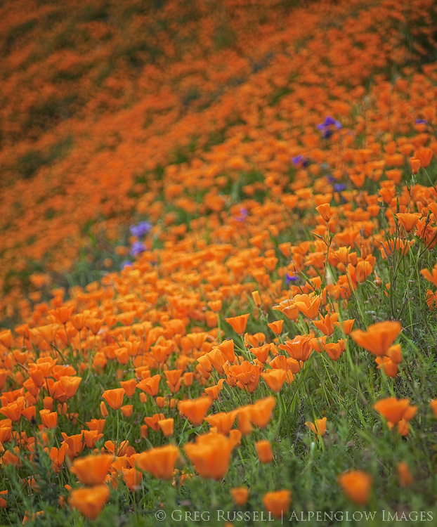
“There is no better high than discovery.” – E.O.Wilson


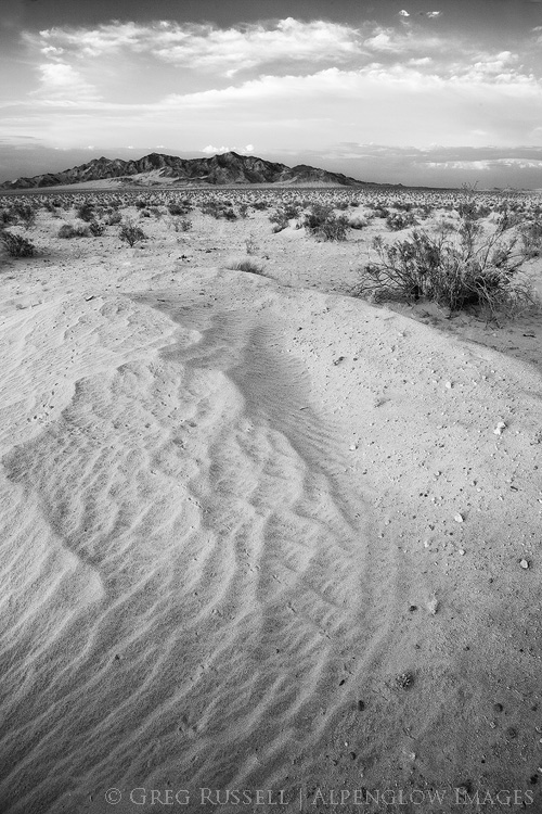
Ensure the experience remains sacred.

Photographers face a tough challenge. If we are truly advocates for the land, then we must inspire our viewers to want to protect it. However, at the same time, by inspiring them, visitation increases, ultimately creating greater impact. Reconciling these two things is no small task, and much attention has been given elsewhere as to the ethics of whether to reveal photography locations. Some photographers are unwilling to share anything about any of their “secret” locations. Others are more forthcoming, and yet others have developed apps that allow for “crowd sharing” of locations. It runs the gamut.

Personally, I lie somewhere between the former two points on the spectrum. I believe that it shouldn’t really matter where a photograph was taken–it’s all beautiful, and we should be stewards for it all. However, at the same time, I also believe that sometimes a general location is appropriate to include with commentary of a particular photograph. That said, I also believe that we need to find our own reasons to love anything (landscape or not), and that sentiment just doesn’t work if the reasons to love a place are dictated to us. So, the fourth point in my code of ethics is to share relevant information as appropriate, but I refuse to spoil anyone’s joy of discovery.

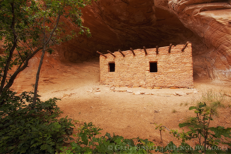
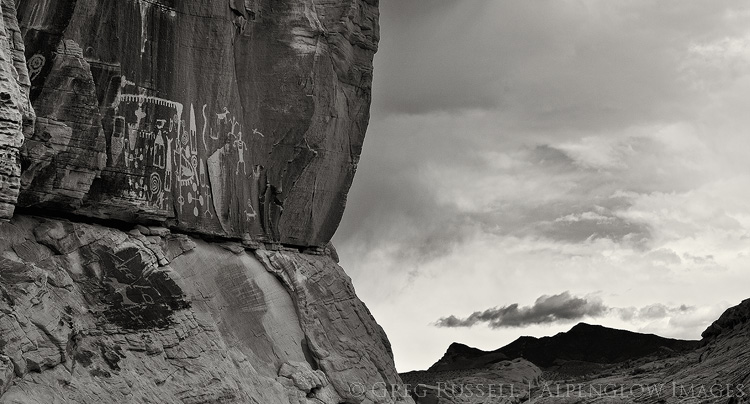
It’s worth mentioning archaeological sites here. There are some, which have common colloquial names and are visited regularly by hundreds of people. Their locations are practically common knowledge, and I will refer to them by their colloquial names from time to time. Others however, I will protect the location of, and will not give details for, except privately to trusted friends.

photo of native american rock art in southern nevada

This is the beginning of my code of ethics. I’ll surely be adding things, but in the meantime what would you add? Many thanks to Samantha and Darwin for this thoughtful exercise.


Acts of submission

Written by Alpenglow Images on February 18th, 2017

“‘The land was ours before we were the land’s,’ says Robert Frost’s poem. Only in the act of submission is the sense of place realized and a sustainable relationship between people and earth established.” – Wallace Stegner

Stegner was probably one of the West’s most influential writers; he seemed to be deeply in tune with the mettle it took for early pioneers to build a life in the West, and the challenges today’s inhabitants face, both from an environmental and geopolitical viewpoint. He’s one of my favorite writers, and his commentary is sorely missed.

He would have been 108 years old today.

photo of a bristlecone pine and currant mountain at sunrise


Welcome Bears Ears National Monument!

Written by Alpenglow Images on February 5th, 2017

President Obama used the Antiquities Act to designate Bears Ears National Monument on December 28, 2016. The greater Bears Ears region and national monument includes Cedar Mesa, Comb Ridge, Valley of the Gods, Elk Ridge, Beef Basin, Indian Creek and Lockhart Basin, among others.

map of bears ears national monument

Credit: Stephanie Smith, Grand Canyon Trust

In large part, the designation of this monument was due to the arduous work of Utah Diné Bikéyah, a collective of five Native American tribes, who all hold parts of the new monument sacred. Bears Ears is the first truly Native American national monument, and these tribes’ collective heritage will now be protected for generations to come.

photograph of intact native american ruin in bears ears national monument

On a personal note, having grown up in the Four Corners region of the southwestern United States, many of my early backpacking trips were on Cedar Mesa and Grand Gulch. I can still remember discovering just a few of the hundreds of Ancestral Puebloan ruins and rock art in this area; these are some of my favorite memories of time spent in the outdoors. Today, whenever I visit my parents, who still live in northwestern New Mexico, the Bears Ears buttes are a landmark that I see to tell me I’m home. I’m very grateful to Utah Diné Bikéyah and others whose hard work made this monument possible. I’ve blogged many times on Bears Ears and Cedar Mesa (see posts here, here, and here, for instance).

photograph of clouds and rocks in valley of the gods utah

To celebrate the designation of Bears Ears, I’ve put together a collection of my images from the monument in one place. Hopefully I’ll be able to visit soon and add more.

Although I’ve published this gallery on social media, I have been a little bit slow in getting it to my blog. Since the monument was designated, it’s come under heavy fire (see links here and here for details). This criticism as a “land grab,” has come primarily from Utah Republican lawmakers who are also key leaders in the land transfer movement (see my blog post here for details). So, ironically, although Bears Ears has protection, it now needs your support more than ever. Please consider a donation directly to Utah Diné Bikéyah or the Grand Canyon Trust to help them combat efforts to reverse the monument designation, and contact your lawmakers to voice your opposition to it.