Treasured Lands, and our national parks

Written by Alpenglow Images on January 12th, 2017

“Laws change; people die; the land remains.” – Abraham Lincoln

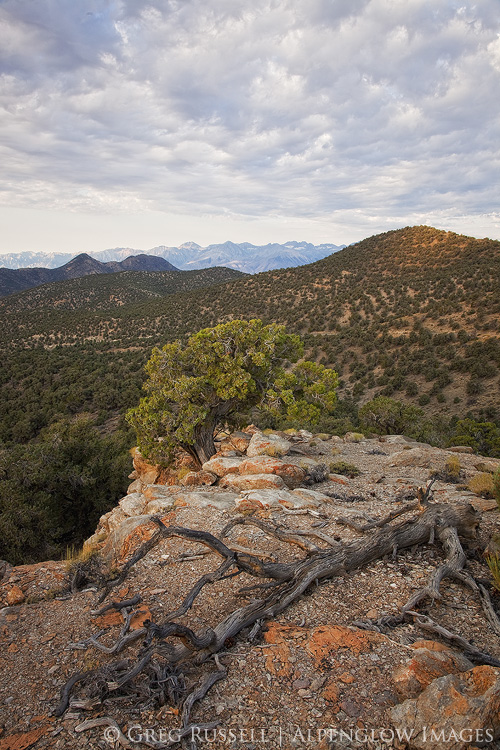
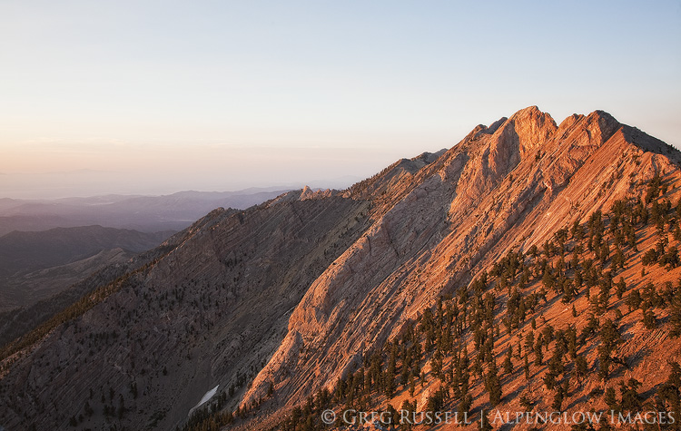
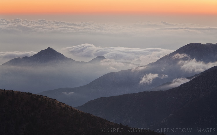
As a nation, we have made the decision to set aside large areas of land that remain largely free of development for the sake of saving them.  This land comes in the form of national monuments, wilderness areas, national wildlife refuges, and of course our national parks, which have been called America’s best idea.  In 2016, the National Park Service, which manages our national parks, celebrated its 100th anniversary.  Indeed, each year, families, hikers, backpackers, photographers, and other tourists flock to our 59 national parks to see all that America has to offer, and it was truly a landmark year, worthy of grand celebration.

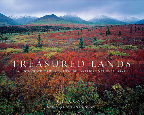
One of the most noteworthy things to appear in 2016 was QT (Tuan) Luong’s book, Treasured Lands: A Photographic Odyssey through America’s National Parks. Containing more than 500 photographs, 450 pages, and weighing in at 7 lbs, Treasured Lands is Tuan’s labor of love. Tuan is the only photographer to have made large-format images in every single national park, and the images in this book represent 20 years and hundreds of visits to all of them.

I first met Tuan on Photo.net discussion forums when I was just beginning taking photos, nearly 15 years ago. He weighed in on topics that varied from computers, to cameras, to photography locations. Then, as now, he has shown himself to be a master of the craft, the true consummate professional.  So, when I read about the upcoming publication of his book, I knew it would be wonderful, and it is.

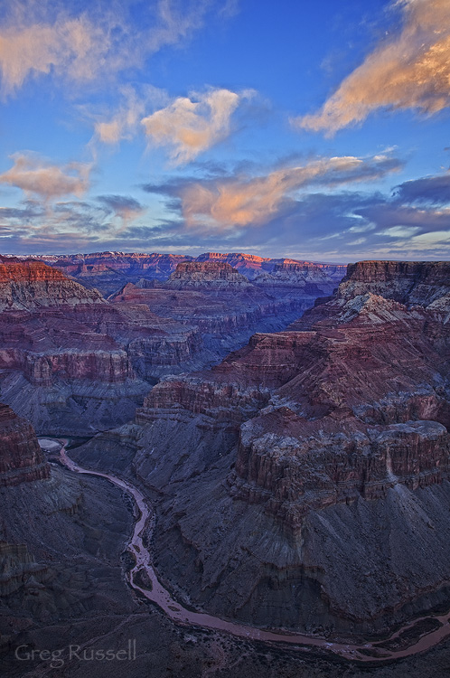
My first national park experience was at the Grand Canyon, backpacking with my Boy Scout troop. I was in junior high school, and we visited during spring break; it was snowing hard on the South Rim when we arrived. As many first-time backpackers and novice campers are, I was woefully underprepared and remember putting plastic grocery sacks over my socks in an attempt to keep them dry, among other things. Hiking into the canyon the next day felt incredibly treacherous on the ice that had formed overnight (in hindsight, it probably was), but cold and wet, I hiked on. However, I also remember the feeling of the sun at the river the next day; it warmed me and rejuvenated my soggy spirits. When we finished the trip, I couldn’t wait to get back to it…to backpacking, to the Grand Canyon, to as many national parks as I could visit. I was sold.

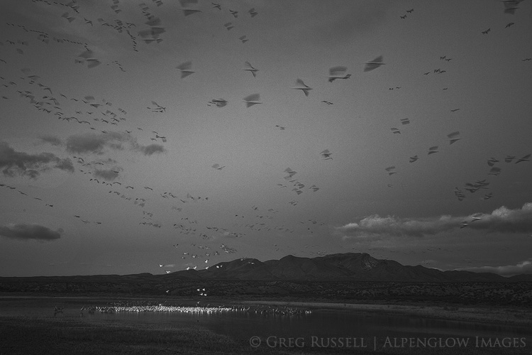
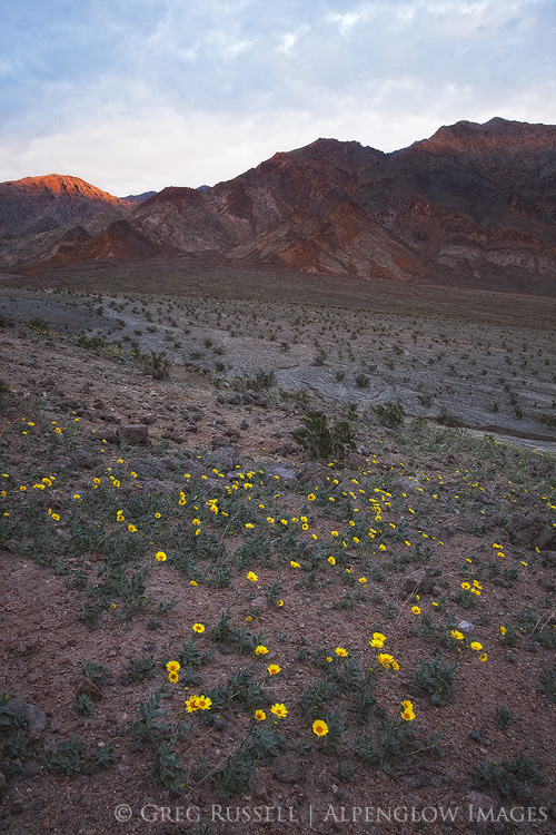
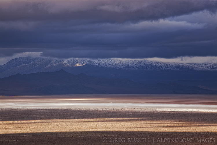
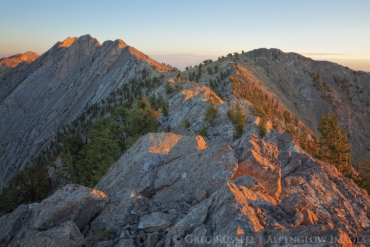
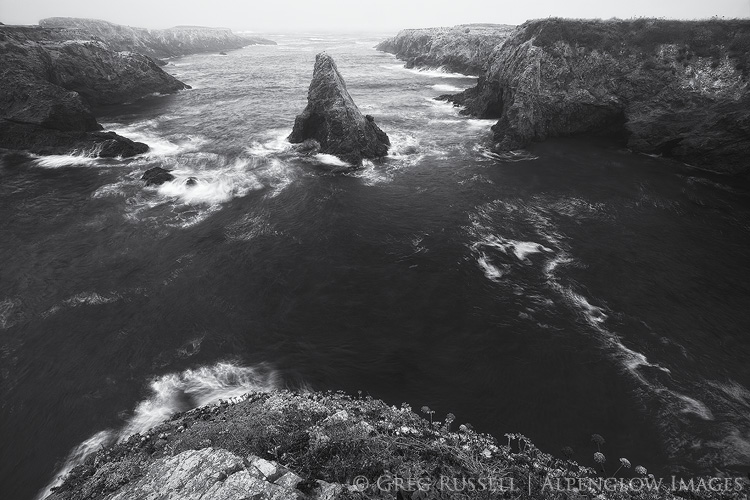
Since that Grand Canyon trip, I’ve backpacked the Grand Canyon several more times, and have spent countless hours in many of our other national parks. Yet, while the Park Service’s 100th anniversary is a landmark occasion worthy of celebration, it’s left me feeling a bit conflicted. Just before Christmas, I waited in line for nearly an hour to get into Joshua Tree National Park; in 15 years of visiting, I haven’t waited in line a single time. Zion National Park is considering a lottery system to determine who gets to visit the overcrowded canyon on any given day. Arches National Park has lines of cars reaching almost back into Moab from its entrance station several miles north of town.

Visitation to our parks is at a record high. Americans are visiting their parks. I can’t help but think that it leaves the Park Service in a bit of a conundrum on their 100th anniversary. They are tasked with preserving our national treasures, but at the same time ensuring access for the public, and those two tasks often don’t overlap. Park and Interior Department officials must be asking themselves, “at what point have we loved our parks to death, and how do we avoid it?” As a photographer who works in the national parks, how am I contributing to this? How are places–like Zion or Joshua Tree–that have traditionally been places of refuge for me going to change with this surge in visitation?  None of these things is easy to reconcile, but Tuan’s book gives me hope, and a fresh perspective.

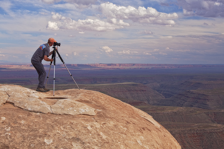
One piece of advice I would give to aspiring photographers is to look at as much photography as possible. Critique it, make lists of things you like and don’t like. Take notes on composition, lighting. This is the reason I became involved in the forums on which I met Tuan in the first place, but it’s sound advice, I think.  However, this practice of critique can often be taken so far that photographers fail to let great photographs inspire them; Tuan’s images are indeed technically sound, but for someone who has had a quarter century love affair with our national parks, they serve the greater purpose of inspiration. Looking through Treasured Lands, I felt a deep happiness inside of me. These treasured lands will indeed remain for a long time, to be celebrated by generations to come.  Thank you, Tuan, for that reminder.

cover photograph of treasured lands book by qt long

Tuan has been a friend for a long time, but I have no financial interest in the success of Treasured Lands. It is simply a lovely book that you will enjoy for hours.


2016 year in review

Written by Alpenglow Images on December 26th, 2016

As I write this, Christmas is only a couple of days away, rain is falling outside, and I’m putting together my favorite photos of the year feeling a bit of disbelief that another trip around the sun has already passed. In many ways, the past twelve months have represented contrast, a dichotomy. The world lost several great and inspiring artists this year, but I feel lucky to have discovered new artists who are a source of inspiration. Another contrast is the current state of division that the United States is ending the year in, but personally I feel more complete–less divided–that I’ve felt in quite some time.

Photographically, 2016 was one of contrasts as well. My travels between the desert and the coast really underscored this; two dramatically different landscapes, have–in their own way–become home to me. I finally put together a small (but growing) portfolio of ocean images this year, and of course expanded my portfolios of the deserts and mountains. Of course, in addition to new friends, I was able to enjoy these places with old friends. My girlfriend and I enjoyed several camping trips along the California coast, and I got to introduce her to some of my favorite desert landscapes. A couple of great backcountry trips with Jackson Frishman helped to strengthen my affinity for Great Basin landscapes.

To that end, contrast has certainly been a theme this year as I chose my favorite images for this annual year-end retrospective. I also have been thinking a lot about the role of landscape photography as art.  In 2016, it became more apparent to me the threats that face public lands (see my blog posts here and here), and producing art that changes the way people see the world seems more important now than ever. My friend Mark Hespenheide’s artist statement continues to resonate with me in this regard:

“Mediocre landscape photography can only reinforce the ideas about nature that we already hold. Good landscape photography can introduce us to new ways of seeing the world. Truly great landscape photography can change the way we perceive our place in the world and the way we interact with the world.”

May we all produce a truly great body of work in 2017.

bosque del apache snow geese fly in

Snow geese at dawn, Bosque del Apache NWR, January


montaña de oro beach

Montaña de Oro, California, June


Sunset in western Nevada

Sunset in western Nevada, January


navajo national monument sunrise

Sunrise in northern Arizona, August


Wildflowers in Death Valley, January


jalama beach sunset

Pacific Ocean sunset, June


Escalante River Sunset

Sunset over southern Utah, March


Clouds and fog in the San Gabriel Mountains at sunset

San Gabriel Mountains, November


winter storm and dark clouds over the salt playa in columbus valley nevada

Winter storm in western Nevada, January


white pine mountains sunset

Sunset in eastern Nevada’s White Pine Mountains, August


black and white image of the funeral mountains in death valley national park

Storm in Death Valley, January

Past images of the year:

2010 | 2011 | 2012 | 2013 | 2014 | 2015


Photography and Public Lands, a continuation

Written by Alpenglow Images on December 13th, 2016

In my last blog post, I expressed a somewhat emotional response to the current threats facing our Western public lands. In this post, I’d like to provide a bit of context to some of the current threats, as well as the land transfer movement in general. It’s an especially complicated web of interactions and is really difficult to sum up in one blog post, so consider this an introduction. I believe that an understanding of these issues are something any Westerner should be aware of, as well as anyone working in the West (which includes landscape photographers, who have a vested interest in the preservation of wild space).

A look at our nation’s history

To understand what’s happening now in the West, we have to go back to 1862, and the passage of the first of the Homestead Acts. The Homestead Acts awarded 40-acre parcels of public land at little or no cost to homesteaders who were willing to improve it for agriculture for a period of 5 years.  Because most of the public land lied in the West, this basically amounted to the opening of the frontier, especially in the wake of the Civil War, when later Homestead Acts were passed.

As anyone who has spent any time in the West can attest, it’s a hardscrabble place with little rainfall, and it’s difficult to make a living here. So, it’s no surprise that many lands were left unclaimed because of the barriers the landscape presented. Combine this with the entry of two large Western states–Arizona and New Mexico–into the union in 1913, and the federal government was left with a huge amount of public land to manage. Although the soil may not have been conducive to farming, and (lack of) rainfall may not have made grazing easy, minerals and timber were abundant, so the government ultimately created the US Forest Service (1905) and Bureau of Land Management (BLM; 1946) to manage much of these resources, and to ease the burden on the Department of Interior, which oversees the National Park Service.

Let’s think about this for a moment. One of the things many Westerners identify with is a rugged individualism, the settling of the wild frontier. When the frontier opened during the nation’s reconstruction and the US government was basically giving parcels of land for free, Western culture laid down its roots. Within several decades, the US government, who was now in control of most public lands in the West (and still is, see the map below), needed a management plan. From the point of view of many homesteaders, this amounted to the government saying, “We gave you this land, and you settled it, but now we’re going to tell you how we want it managed.”

Map of public lands in the united states of america

Most of the nation’s public lands are in the West. Public Domain image downloaded from Wikipedia

As you can imagine, a homesteader who was suddenly being told how the land they had been mining, or grazing their cattle on might be a little bit upset. So, to some extent there’s always been some level of anti-government sentiment in the West, which has been compounded by people who move to the West for added seclusion and an increased sense of isolationism. Indeed, such high profile incidents as Ruby Ridge, and even the car bombing of a federal building in Oklahoma City in 1995 have either directly or indirectly been the result of rugged individualism clashing with government oversight.

Land transfer & the Sagebrush Rebellion

While private development is not usually allowed on public lands, grazing allotments can be leased, there are some mining claims, and of course recreation is allowed such as hiking, rock climbing, photography, and hunting and fishing, although specific rules vary somewhat depending on the management agency, etc. For instance, no hunting or fishing is allowed in national parks.

In 1932, the federal government did try to transfer land back to the states, but in post-Depression America, states were concerned about having the funds to manage the lands effectively, etc. As a result they stayed under federal control. Today, the federal government pays states for the land that cannot be developed, and as a result, taxed. These payments in lieu of taxes can be a significant revenue generator for certain counties that have a large proportion of public land.  Similarly, other sources of income like the ones resulting from the Taylor Grazing Act are important for certain counties (see reference below).

In 1976, in an effort to more explicitly regulate some of the above-mentioned activities on federal lands, Congress passed the Federal Land Policy and Management Act (FLPMA) that officially ended homesteading and formalized processes for regulating activities on federal lands, specifically those administered by the BLM. Within a year, the FLPMA had drawn enough ire from ranchers and miners that legislation was introduced into Congress that would transfer some land back to the states with the idea being that the land could be managed more directly for the sake of individual interests there.  This legislation–which was introduced twice but did not pass–was the birth of a movement known as the Sagebrush Rebellion.

Where are we now?

Since the late 1970s the Sagebrush Rebellion hasn’t really garnered much attention per se, although there have been some very high profile incidents that revolve around the federal government and disagreements with private citizens (The standoff at the Bundy Ranch in Nevada and the occupation of the Malheur National Wildlife Refuge in Oregon are two of the most well known). Despite the fact none of these incidents have resulted in major legislative changes, there is the argument that they really are counterproductive to their stated original intent (see here and here), driving wedges where they don’t really belong.

That ‘stated original intent’ is also a bit cloudy. When you dig into the web of what’s morphed from the Sagebrush Rebellion into the Land Transfer Movement, things get confusing fast. Ranchers aren’t the only concerned parties it seems, but militia members and “alt-right” conservatives also seem to have a vested interest in returning public land to the states or private parties. Similarly, members of Congress also have ties to groups like the American Lands Council (which has a misleading name but is the biggest proponent of the Land Transfer Movement).

Most recently, representative Rob Bishop from Utah introduced the Public Lands Initiative to Congress, which would have returned public lands in Utah to state control; fortunately it was not voted on before Congress ended their session in late 2016, effectively killing the bill.

Sunrise at Grandview Point, in the white mountains of eastern california

What’s the big deal, and what next?

With all of these failed attempts to return Western public lands to state control, why should you care? There are several reasons.  First, the vocal minority who are perpetrating the highest-profile standoffs with government officials are becoming increasingly violent. Threats to public lands employees are becoming more common. Second, while this legislation has failed in the past, it doesn’t mean it always will. Rob Bishop is the chairman of the House Committee on Natural Resources, and advocates development of Utah’s wild places. Sooner or later, he’ll catch the ear of influential people who can make things happen. This is underscored by the fact that it’s becoming clearer that the Land Transfer Movement is incredibly well funded.

Lands transferred to state or private control do stand a higher chance of oil and gas or large scale mining development, among other things. This would make it more difficult to pass legislation fighting global warming, and thus would set heartbreaking precedents, and do irreversible damage to our Western landscapes. A common response I’ve seen to these threats on social media is, “It’ll never happen!” Maybe not, but the stakes are simply too high to sit back and assume it won’t happen.

There is hope, though. Although a vocal minority is favor of the transfer of Western public lands, the majority of Westerners are not. This was well illustrated just last month in Nevada’s general election as well as in the Montana governor’s race. As Westerners we all need to be educated, and see through the politics, and look for common ground together. Very few of us would disagree that there is room on public lands for everyone–grazing interests, hunters, photographers, backpackers, etc. None of us want these magnificent landscapes spoiled.

As photographers what can we do?  I have several ideas. First, you can donate your images to worthy nonprofit groups (e.g., the Southern Utah Wilderness Alliance or Grand Canyon Trust). If that is financially prohibitive, consider donating a portion of your proceeds to these causes, or to the support of quality journalism. Second, tap into your local community. Learn what the land use issues are, and how your images can support groups advocating for your position. Similarly, take advantage of public comment periods on these issues (and use your images to support your comments).  Third, build bridges outside of your box. Hunters and anglers are equally as vested in the land as you are–how can your images help advocate for issues important to them?

This is just a start–feel free to offer more ideas in the comments.

sunrise on currant mountain, near ely nevada

References

Read the Homestead Act of 1862 here.

An in-depth history of in-lieu programs for western federal lands can be found here.

Read the Federal Land Policy and Management Act here.


Photography and our Public Lands

Written by Alpenglow Images on November 18th, 2016

Over the last several weeks, we have been reminded of very real threats–or at least dangerous precedents set–to the Western landscape, and to American public lands in general. First, all defendants in the 41-day standoff at the Malheur National Wildlife Refuge in Oregon were found not guilty of charges of federal conspiracy and gun charges. Less than two weeks later, the United States presidential election resulted in a Republican-controlled presidency and congress, leaving federal public lands at greater risk for fossil fuel development, or even return to state control.

For anyone concerned with the preservation of wilderness, our cultural landscape, or simply the health of future generations, neither of these occurrences should set well.  Together, they’ve been keeping me up at night. Reconciling all of this news is no small task.

black and white image of the funeral mountains in death valley national park

“I want people to remember how photography works, the medium that depends on perfect darkness within the camera to capture the image, for an image of boundless light would be purely black, an exposure in perfect darkness would show just the white of unexposed paper. The visible world depends on both.” -Rebecca Solnit | Hugging the Shadows

Finding purple in a sea of blue and red

Last week, shortly after the election, I had a conversation on social media regarding the proposed Bears Ears National Monument (which I have written about before). Although I have some hesitation about the Bears Ears region being designated a National Monument, it really is the perfect candidate for protection under the Antiquities Act, although a longtime friend disagreed. While we had opposite opinions, our underlying concern for the region is the same: both of us would like to see it remain as pristine as possible. While our sedimentary layers may be different, we are standing on the same bedrock.

Looking at election maps from last week, there appears to be a deep divide in ideology between rural and urban areas, however I’d like to think we’re more purple than red vs. blue, and that the bedrock most of us are standing on is the same. Indeed, if you look at the role public lands played in western elections this season, it is clear we value our public lands.

Looking forward, I have questions.  Is it possible to search for common ground, while at the same time not compromising core values? Can we find a common currency for the value we attribute to public lands? Perhaps, more importantly, what can photographers do now?

winter storm and dark clouds over the salt playa in columbus valley nevada

Working locally, reconnecting to place

There are a few resources out there for having the conversations that are sure to happen more frequently in coming months (this is a great one). One thing they all seem to mention is to talk about feelings, rather than facts, at least to start with. As a scientist, I think, “but the facts are all that matter!” but as an artist, I get it. Art, including landscape photography, has the power to change the way people look at their world. There’s been some debate about whether artists can or should be activists or whether art should exist independently, but my gut is telling me now is the time for us all to be activists. Share your work with as many people as possible. Create content, be heard.

I’ve lamented before that as a people we are woefully detached from place, so perhaps it is the job of artists to bring us back to that. Share your work locally. Every local in every town has stories to share about their “backyard”–tap into those stories and work to reconnect people with what may have been lost.

If anything, recent news is a reminder that our public lands–and the places we love to photograph–are in danger of becoming not-so-public, and should be a good reminder to us all to educate ourselves on local politics, and think of ways to use our photography to shift the tide towards a secure future.

Sunset in western Nevada


Bay of the Smoke

Written by Alpenglow Images on November 8th, 2016

In 1542, two Spanish ships led by Juan Rodriguez Cabrillo explored the southern California coastline.  When they arrived in either Santa Monica or San Pedro Bay (it’s unclear which one), they encountered poor air quality likely due to either smoke rising overhead from nearby Tongva villages, or from a Santa Ana Wind-fueled wildfire. They named the bay they arrived in Baya de los Fumos or Bay of the Smoke, for the lack of air quality.

Shaped by the Landscape

Nearly 500 years later, the greater Los Angeles basin is still known for its poor visibility and a nearly constant haze. Fires perhaps aren’t as prevalent as they once were, and the villages have long since been bulldozed and replaced with a megapolis of concrete, home to millions of people. Myself included.

Southern California’s topography is a major contributor to our poor air quality. Cool air being pulled onshore from the Pacific Ocean, warm air being pulled out to sea from the deserts flanking the region, and a basin closed in by tall mountain ranges all make for a fairly strong inversion that will often trap clouds, haze, and (unfortunately) pollution at low elevations in the basin. The haze Cabrillo and his men described is still a dominant part of life as many as 260 days a year.

Clouds and fog in the San Gabriel Mountains of southern California at sunset


“During my California visit, I enjoyed the company of fine friends whose grace and lack of complaint in their surroundings made me feel awkward and cynical and even envious…At meals they spoke intelligently of early Burgundian oenological monographs. I explained drip irrigation. Sea air and the presence of many, many succulent green leaves beautifully hydrated their skin. I looked like a desert lizard. I age my organic arugula with my fingers, dopey and slow like one of those Jurassic leaf-eaters with the pin head and the body the size of a truck stop.” – Ellen Meloy, The Anthropology of Turquoise


Getting Above it All

Even after 14 years of living here, southern California has always felt a bit odd, if intriguing, perhaps in a way that Ellen Meloy describes above. I’m not entirely sure it’s Los Angeles’ fault so much as my own reticence to loosen my grip on my roots in the intermountain West. Fortunately, the nearby mountains make it relatively easy to put some altitude underneath yourself to get a breath of fresh air. In my last blog post, I mentioned the San Jacinto Mountains, which lie at the far eastern end of the basin.

Perhaps much more dominant on the Los Angeles skyline are the San Gabriels, one of the transverse ranges, running along the northern edge of the basin. Over the years, one of my favorite views of southern California has been to venture into the San Gabriels to look back down on the valley below.

View down the San Gabriel River Canyon from Blue Ridge in the San Jacinto Mountains of southern California

Despite the haze, Cabrillo described southern California as lush and green, with abundant wildlife. Much of that has been wiped clean by the growing metropolis (although there are efforts to bring it back), but it’s still possible to get acquainted the southern California that was by returning to the mountains. Last week, we made a quick trip up to the San Gabriels after work. The clouds blanketing the coastal plain were hitting the mountains and fragmenting, making for a great atmospheric light show. That, combined with waning fall colors on much of the vegetation at 8,000′ elevation, made it a great day out.

As the sun set and the horizon shifted from shades of orange to red to blue, the wind stopped and there was complete and total silence. For a brief moment, hearing the dirt crunch underneath my feet and the cold air bite my nose, I forgot that the megapolis was just a little further below still. For the foreseeable future, I’ll continue to try to find my place with the masses of the greater Los Angeles basin, but it’s comforting to know that within an hour, I can be high above it all, seeing–perhaps–what Cabrillo saw in 1542.

San Gabriel Mountains of southern California at Sunset,


Autumn in the San Jacintos

Written by Alpenglow Images on October 27th, 2016

Autumn’s first real storm rolled into southern California last weekend, and we took a short walk in the mountains to enjoy the crisp air and some rain. Fortunately the rain didn’t last long and the short walk extended to about five miles, to the high point of one of the major ridges leading to Mt. San Jacinto, a dominant peak here in southern California. It was the perfect remedy for what’s been a busy autumn so far, complete with plenty of southern California’s signature traffic.

The San Jacintos are one of my favorite mountain ranges. They were formed as a block of granite was squeezed together by the San Andreas and San Jacinto faults, and the rock here is very similar to what is seen in the Sierra Nevada, albeit on a smaller scale. There are many trailheads that are easily accessible, and cross-country walking is relatively easy.  What’s more, no one really visits the difficult to reach trailheads, which is a major bonus.

Pines cones and pine needles

“No matter how sophisticated you may be, a large granite mountain cannot be denied – it speaks in silence to the very core of your being” – Ansel Adams

stormy mt. san jacinto

I hope you’re having a great autumn so far, no matter where your trails have led you.


Lay of the Land

Written by Alpenglow Images on September 9th, 2016

“To rise above tree line is to go above thought, and after, the descent back into birdsong, bog orchids, willows, and firs is to sink into the preliterate parts of ourselves.” – Gretel Ehrlich


The entire summer seemed busy, but August flew by at an unusually rapid pace. My son and I drove from California to New Mexico to visit my parents; on our way out there we broke up the drive by spending a quiet and welcoming night at Navajo National Monument in northern Arizona. Four days after getting home from that trip, my girlfriend and I left on a trip to the north coast of California, visiting friends and family along the way. That leg of our travels culminated at South Lake Tahoe (I know, it’s not the north coast. Don’t ask.), and my dropping her at the airport in Reno to fly home.

From there, I drove south to eastern California, picked up Jackson Frishman at his house in the Deep Springs Valley, and we headed to eastern Nevada to backpack and photograph some Great Basin mountain ranges. By the time I got home from my second trip, my car had more than 3,000 new miles and I guess you could say I really got the lay of the land.

Over the years I’ve spent outdoors, I’ve become acutely aware of moments where time seems to stand still and that particular snapshot in time seems to transcend all others. In those particular rare moments, I’m overcome with an almost indescribable peace, feeling as though there’s no other place on earth I would rather–or should–be. I imagine that Buddhists would describe these moments as feeling very much like Nirvana, when one’s soul is freed from continuous rebirth, thus permanently taking its small place in the world. Put another way, these moments represent true peace.

I’ve always liked the above passage by Gretel Ehrlich because I think perhaps she used tree line as the metaphoric “rising above,” which has always seemed more eloquent than any way I’ve found to describe the feeling. My August travels only took me above topographical tree line a couple of times, but I felt like every turn of the journey somehow took me above Ehrlich’s metaphorical tree line, and I am indeed very fortunate for that. Here are a few of my favorite images from the last month or so.

engineer-mountain-wildflowers

Wildflowers in Colorado’s San Juan Mountains

navajo national monument sunrise

August sunrise in northern Arizona.

fort-bragg-coastline

Coastline along the rugged north coast of California

mendocino headlands sunset

A foggy sunset along California’s north coast

white mountains california

Sunrise over the Deep Springs Valley, California

white pine mountains sunset

Sunset on Currant Mountain, Nevada


Public Comments on the Grand Canyon Escalade Project

Written by Alpenglow Images on September 1st, 2016

Earlier this week, Bill 0293-16 came before the Navajo Nation Council for approval. This bill contains the much-contested Grand Canyon Escalade Project, which is a massive development project on the east rim of the Grand Canyon near Grand Canyon National Park and the confluence of the Colorado and Little Colorado Rivers. Grand Canyon Escalade would be destructive on several levels, and I believe it should be opposed. The nonprofit group Save the Confluence has much more about the project on their website. 

The Navajo Nation Council is asking for public comments on the bill until 9/3/16 (which is not much time). You can submit your comments directly to the council by emailing them at comments@navajo-nsn.gov, with Bill 0293-16 in the subject line. 

Here are the comments I sent the council regarding Grand Canyon Escalade this morning.

Esteemed council members:

I am writing regarding the proposed Grand Canyon Escalade Project, which is up for approval as part of Bill 0293-16 and is currently before you.  As I understand it, the bill asks for approval of several items, including significant development of an area on the Grand Canyon’s east rim, near the confluence of the Colorado and Little Colorado Rivers, near the border of the Navajo Nation and Grand Canyon National Park. I understand this project would bring tourism and revenue to the Navajo Nation and as a non-tribal member of the community, I cannot speak for what the confluence means to the families and clans who live west of Highway 89. Nonetheless, I submit my comments for your consideration.

As places go, the Grand Canyon has faced its share of threats, and fortunately it has dodged some of the biggest ones (like the Bridge and Marble dams, whose progress was halted permanently in 1969). Today it seems like the West along with many other concerned people around the world is again holding its breath to see how the Grand Canyon Escalade Project will play out.

In 1993, I came to the Grand Canyon for the first time with my Boy Scout troop from Farmington, New Mexico. We backpacked into the Canyon from the South Rim; it was my first backpacking trip and I made many lifelong memories. Since then, I have become an avid backpacker, even taking my son into the wilderness for the first time when he was two. In an increasingly busy world, wilderness provides solitude, solace, and sanctuary. I have returned many times to the Grand Canyon since 1993 and in 2013 (twenty years after my first visit) I again found myself backpacking the Grand Canyon, only this time I was hiking to Cape Solitude to see the confluence–and the proposed site for Grand Canyon Escalade–myself.

The trip was impactful for me, and it became even more clear why the Grand Canyon Escalade simply cannot happen. During the entire trip–which comprised over 40 miles of hiking–we did not see an another human, not even another human footprint. We crossed paths with a herd of elk several times, but beyond that the silence was deafening and the dark night sky mesmerizing. The loneliness was aching and beautiful. Indeed, the area of Grand Canyon National Park that Cape Solitude lies in only sees about 50 visitors a year, which is a far cry from the much more busy main corridor along the South Rim; it feels like it is a world away.

Grand Canyon Escalade would be putting undue stress on an ecologically sensitive area and destroying one of nature’s cathedrals that has been billions of years in the making. This part of the Grand Canyon doesn’t need a lot of visitors for it to be special. Wilderness is like that. As much as we need food or water, I believe we need wild places. We do not need to visit them often, and when we do they should be difficult to get to, but simply knowing these places are there calms the nerves in the hustle and bustle of city life.

One night, decades ago, the famous Western author Edward Abbey sat at Cape Solitude and wrote, “We must preserve, not obliterate, what still remains of the American wilderness, the American hope, the American adventure.” Restraint is one of the rarest of virtues, but I ask that you exercise it here, thus preserving the east rim of the Grand Canyon, untouched and unmarred, for future generations.

Respectfully,

Greg Russell

Sunrise at the confluence of the Colorado and Little Colorado rivers the site of the proposed Grand Canyon Escalade project

The Confluence of the Colorado and Little Colorado Rivers


New Gallery: Oceans as Wilderness

Written by Alpenglow Images on June 15th, 2016

As hard as it is for some people I meet here in southern California to believe, I didn’t see the ocean for the first time until I was 21 years old.  I had a summer job working for the U.S. Forest Service to do carnivore population surveys in the northern Sierra Nevada, and on a string of days off a couple of coworkers and I drove to Redwood National Park.  Just outside of Arcata, California was where I put my feet in the Pacific Ocean for the first time.

My first thoughts, in no particular order, were: “Good grief, the water is cold!”  “That’s a lot of water” “How are people surfing in this?” “I wonder how many sharks there are out there.”*  But mostly I just stood in awe at the immensity of the ocean.  I felt calmed by the waves almost immediately, the sounds, the smells.  It’s easy to see why oceans get the attention they do from writers, poets, artists.

Since that trip to the northern California coast, I’ve seen the Atlantic coast in Florida and Iceland, and explored California’s coast extensively.  And although I’ve moved to southern California, and I still don’t spend as much time with the ocean as I should.  However, every time I go, I feel the same way I did when I saw the Pacific for the first time; the youthful wonder I had then stays with me now, in a myriad of ways.

As a photographer, I have tended to focus on the landscapes I identify most closely with.  I grew up in the desert southwest, and continue focusing primarily on that area in my photography.  However, I can’t deny that the ocean has found its way into my daydreams, and I have finally decided that it’s time to add a portfolio of ocean and beach images to my website.

jalama beach sunset and pacific ocean

Oceans are critical to the health of the planet, and comprise more than 70% of the earth’s surface.  In addition, less than 5% of the world’s oceans have been explored.  There are species we have not yet discovered, ones we know very little about, and ones we’re about to lose (or have lost).  To this end, oceans are truly a wilderness, one we should treat with as much respect as our terrestrial home.

montaña de oro beach

I hope you enjoy the portfolio; it’s a growing set of images that I’ll add to as I make what is sure to be more and more trips to the beach.

*When I was little I had a more than a mild obsession with sharks, so that has always stuck with me to some extent.


The ties that bind

Written by Alpenglow Images on May 12th, 2016

“What holds people together long enough to realize their power as citizens is their common inhabiting of a single place.” – Daniel Kemmis

“Our gadgets and electronic maps read our exact location and desires virtually anytime and anywhere. Never before have we been so located – and yet so lost.” – Bryan Pfeiffer


I recently read an article, “Ghosts and tiny treasures,” by Bryan Pfeiffer.  He uses an example of the way we react to the killing of an individual lion by a trophy hunter, yet at the same time many of us fail to take note of the impending extinction of an entire non-charismatic keystone species like the Poweshiek skipperling, a butterfly.  Pfeiffer makes the argument is that we clearly care about other animals and places, but we have not developed what he calls a “chronic passion” for nature. Martin Litton, who was probably a bit more gruff about the subject than Pfeiffer, argued for years that we don’t harbor enough hatred in our hearts when it comes to the destruction and development of the natural world. Finding my own personal balancing point between Pfeiffer’s passion and Litton’s hatred is something that’s been on my mind for quite some time.

I recently reposted an image on my Facebook page of the Bears Ears buttes in southern Utah.  Reaching almost 9,000′ elevation, the Bears Ears are the high point of the Cedar Mesa and greater Canyonlands area.  Visible from much of the Four Corners region, they never fail to announce that I’m almost home when I drive back to northern New Mexico from my house in southern California to visit my parents.

The mesas and canyons that extend off of the Bears Ears–the Dark Canyon complex, Grand Gulch, White and Arch Canyons–make up some of the most remote, rugged, and spectacular scenery in North America.  As if the scenery isn’t enough, the greater Bears Ears area houses what may be the highest density of archaeological treasures in the country.  There are literally hundreds if not thousands of archaeological sites (ruins, rock art, etc) here, and visitors can gain a tangible connection with the past simply by walking a few hundred feet into this wonderful area.

Bears Ears Sunset

The Bears Ears buttes are the centerpiece of a proposed national monument in southern Utah

Although most of the archaeological sites are Ancestral Puebloan (ancestors of the modern day pueblo people, like Hopi and Zuni), the Navajo and Ute people, who live adjacent to the area on their respective reservations also have stories contained in–and on–this stone.  While the area is receives significantly less use than Utah’s “Big Five” national parks, it certainly isn’t unvisited. In addition to recreation pressures, oil drilling, and human development in general are knocking on the door of the area, and undesirable activities like archaeological looting run rampant.  In response to these potential threats, the Navajo, Zuni, Hope and Ute tribes have come together collectively as Utah Diné Bikeyah, and have proposed the Bears Ears National Monument to protect all of these resources for future generations.

The ecological importance of the Poweshiek skipperling–which Pfeiffer talks about in his article–might not be immediately obvious to everyone, at least not on first glance.  Similarly, the significance of cultural and natural treasures in the greater Bears Ears region may not seem that valuable, or worth protecting.  Thus, on the most basic level, Pfeiffer’s call for us to develop a chronic passion for nature and Utah Diné Bikeyah’s proposal for us to honor the wild landscape and cultural history surrounding the Bears Ears by creating a national monument are really no different.  They both symbolize a commitment to the ties that bind all of us together.

In so many ways right now in the United States especially, we’re at curious place, and the commitment that Pfeiffer and Utah Diné Bikeyah are asking for seems somewhat unobtainable, which is paradoxical to me.  While we want change (look at any social media outlet–not only do we want it, we’re downright angry about it!) and are more electronically connected to the things we want to change than ever before (webcam, anyone?), we seem to have lost the connections that really matter. Connection to place, to other organisms, to each other, is something we desperately lack right now as a people.

Now is the time to preserve not only natural Earth and the ties to our evolutionary history, but our ties to human history. But we need to re-establish our connections to both of them to do that. There is no other way.

I suppose this wasn’t really a blog post about photography, but about connection to a place, which–when present–makes photography more meaningful and personal.  In that spirit consider this the beginning of a dialogue…about connection, purpose-driven photography, and endeavoring to protect that connection.

Thanks for reading.

Muley Point Utah

A photographer in the proposed Bears Ears National Monument